Veblen Topo Map South Dakota
To zoom in, hover over the map of Veblen
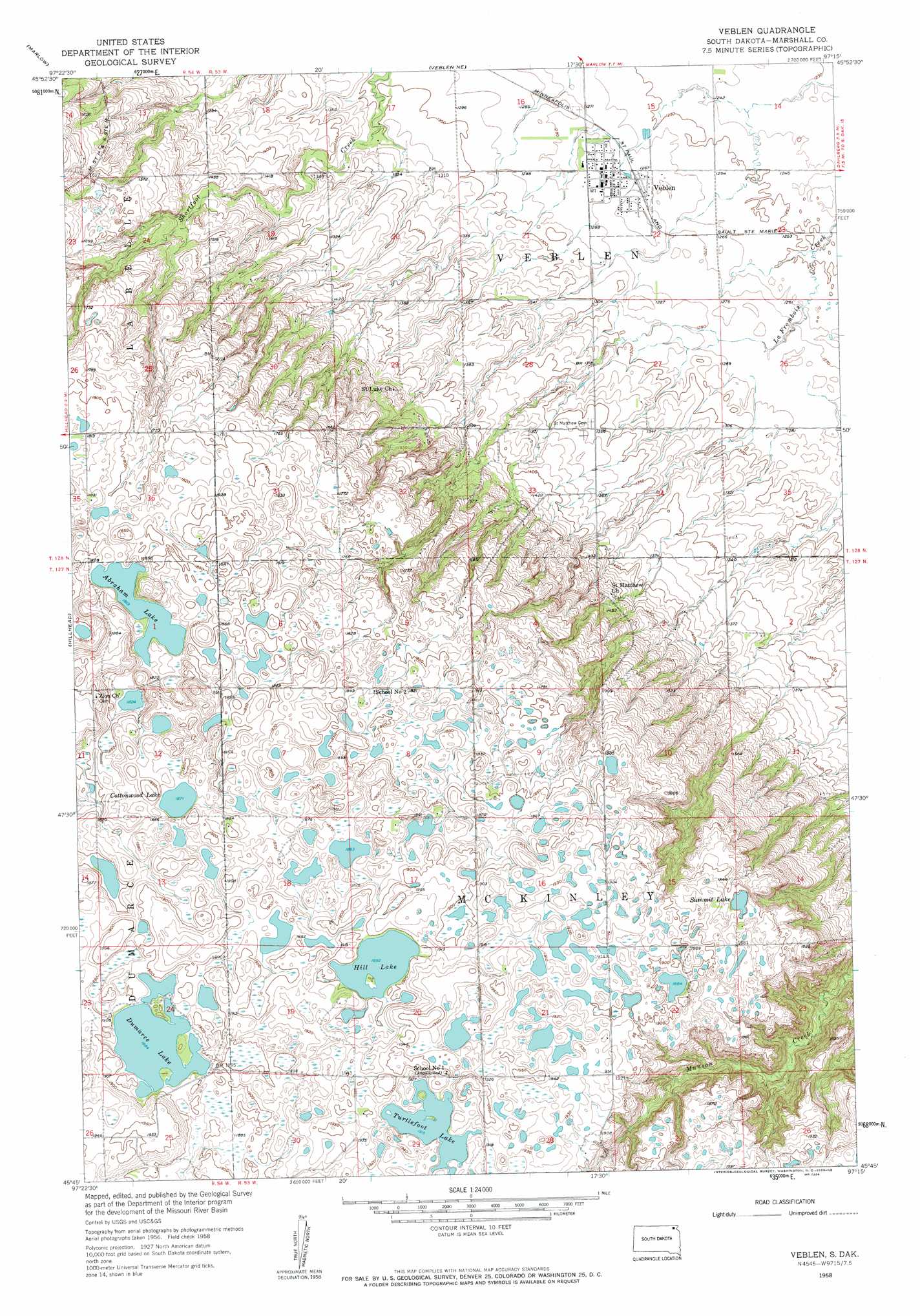
USGS Topo Quad 45097g3 - 1:24,000 scale
| Topo Map Name: | Veblen |
| USGS Topo Quad ID: | 45097g3 |
| Print Size: | ca. 21 1/4" wide x 27" high |
| Southeast Coordinates: | 45.75° N latitude / 97.25° W longitude |
| Map Center Coordinates: | 45.8125° N latitude / 97.3125° W longitude |
| U.S. State: | SD |
| Filename: | o45097g3.jpg |
| Download Map JPG Image: | Veblen topo map 1:24,000 scale |
| Map Type: | Topographic |
| Topo Series: | 7.5´ |
| Map Scale: | 1:24,000 |
| Source of Map Images: | United States Geological Survey (USGS) |
| Alternate Map Versions: |
Veblen SD 1958, updated 1959 Download PDF Buy paper map Veblen SD 2012 Download PDF Buy paper map Veblen SD 2015 Download PDF Buy paper map |
1:24,000 Topo Quads surrounding Veblen
Rutland |
Cayuga |
Geneseo |
Lidgerwood |
Swan Lake |
Havana |
Marlow |
Veblen Ne |
Claire City Nw |
Claire City Ne |
Kidder Se |
Hillhead |
Veblen |
Claire City Sw |
Claire City |
Britton 4 Ne |
Lake City |
South Red Iron Lake |
Whitestone Lake |
Sisseton |
Britton 4 Se |
Eden |
Piyas Lake |
Drywood Lakes |
Goodwill |
> Back to 45097e1 at 1:100,000 scale
> Back to 45096a1 at 1:250,000 scale
> Back to U.S. Topo Maps home
Veblen topo map: Gazetteer
Veblen: Lakes
Abraham Lake elevation 554m 1817′Cottonwood Lake elevation 571m 1873′
Dumarce Lake elevation 574m 1883′
Hill Lake elevation 577m 1893′
Summit Lake elevation 563m 1847′
Turtlefoot Lake elevation 584m 1916′
Veblen: Populated Places
Veblen elevation 390m 1279′Veblen digital topo map on disk
Buy this Veblen topo map showing relief, roads, GPS coordinates and other geographical features, as a high-resolution digital map file on DVD:
Eastern North Dakota & Eastern South Dakota
Buy digital topo maps: Eastern North Dakota & Eastern South Dakota