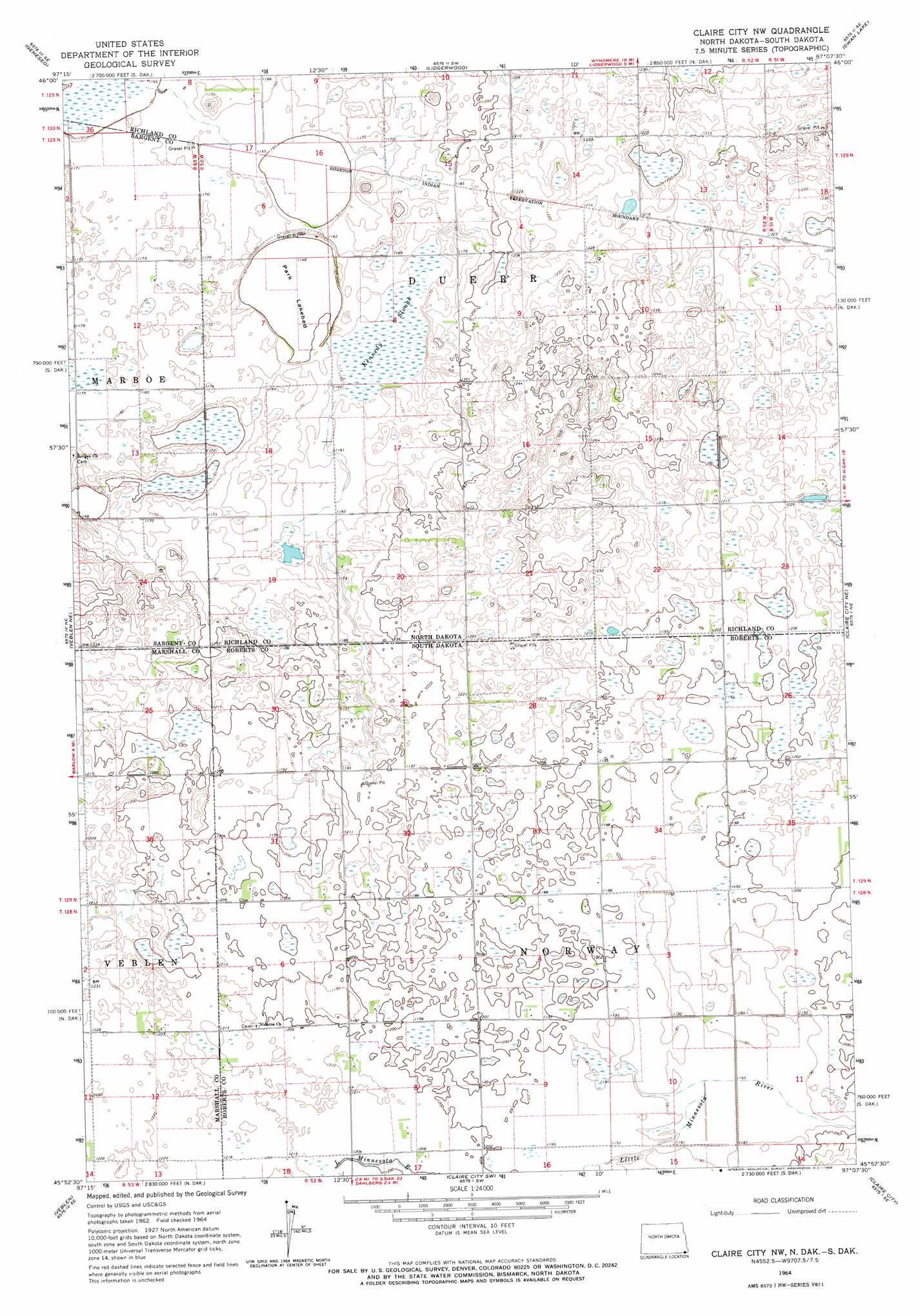
Claire City Nw Topo Map South Dakota
To zoom in, hover over the map of Claire City Nw
USGS Topo Quad 45097h2 - 1:24,000 scale
| Topo Map Name: | Claire City Nw |
| USGS Topo Quad ID: | 45097h2 |
| Print Size: | ca. 21 1/4" wide x 27" high |
| Southeast Coordinates: | 45.875° N latitude / 97.125° W longitude |
| Map Center Coordinates: | 45.9375° N latitude / 97.1875° W longitude |
| U.S. States: | SD, ND |
| Filename: | o45097h2.jpg |
| Download Map JPG Image: | Claire City Nw topo map 1:24,000 scale |
| Map Type: | Topographic |
| Topo Series: | 7.5´ |
| Map Scale: | 1:24,000 |
| Source of Map Images: | United States Geological Survey (USGS) |
| Alternate Map Versions: |
Claire City NW ND 1964, updated 1966 Download PDF Buy paper map Claire City NW ND 2011 Download PDF Buy paper map Claire City NW ND 2014 Download PDF Buy paper map |
1:24,000 Topo Quads surrounding Claire City Nw
Cayuga Nw |
Hamlin |
Kreiser Lake |
Moselle |
Mantador |
Cayuga |
Geneseo |
Lidgerwood |
Swan Lake |
Hankinson |
Marlow |
Veblen Ne |
Claire City Nw |
Claire City Ne |
New Effington Nw |
Hillhead |
Veblen |
Claire City Sw |
Claire City |
New Effington |
Lake City |
South Red Iron Lake |
Whitestone Lake |
Sisseton |
Peever Nw |
> Back to 45097e1 at 1:100,000 scale
> Back to 45096a1 at 1:250,000 scale
> Back to U.S. Topo Maps home
Claire City Nw topo map: Gazetteer
Claire City Nw: Flats
Park Lakebed elevation 348m 1141′Claire City Nw: Guts
Kennedy Slough elevation 353m 1158′Claire City Nw digital topo map on disk
Buy this Claire City Nw topo map showing relief, roads, GPS coordinates and other geographical features, as a high-resolution digital map file on DVD:
Eastern North Dakota & Eastern South Dakota
Buy digital topo maps: Eastern North Dakota & Eastern South Dakota