Twin Butte Topo Map South Dakota
To zoom in, hover over the map of Twin Butte
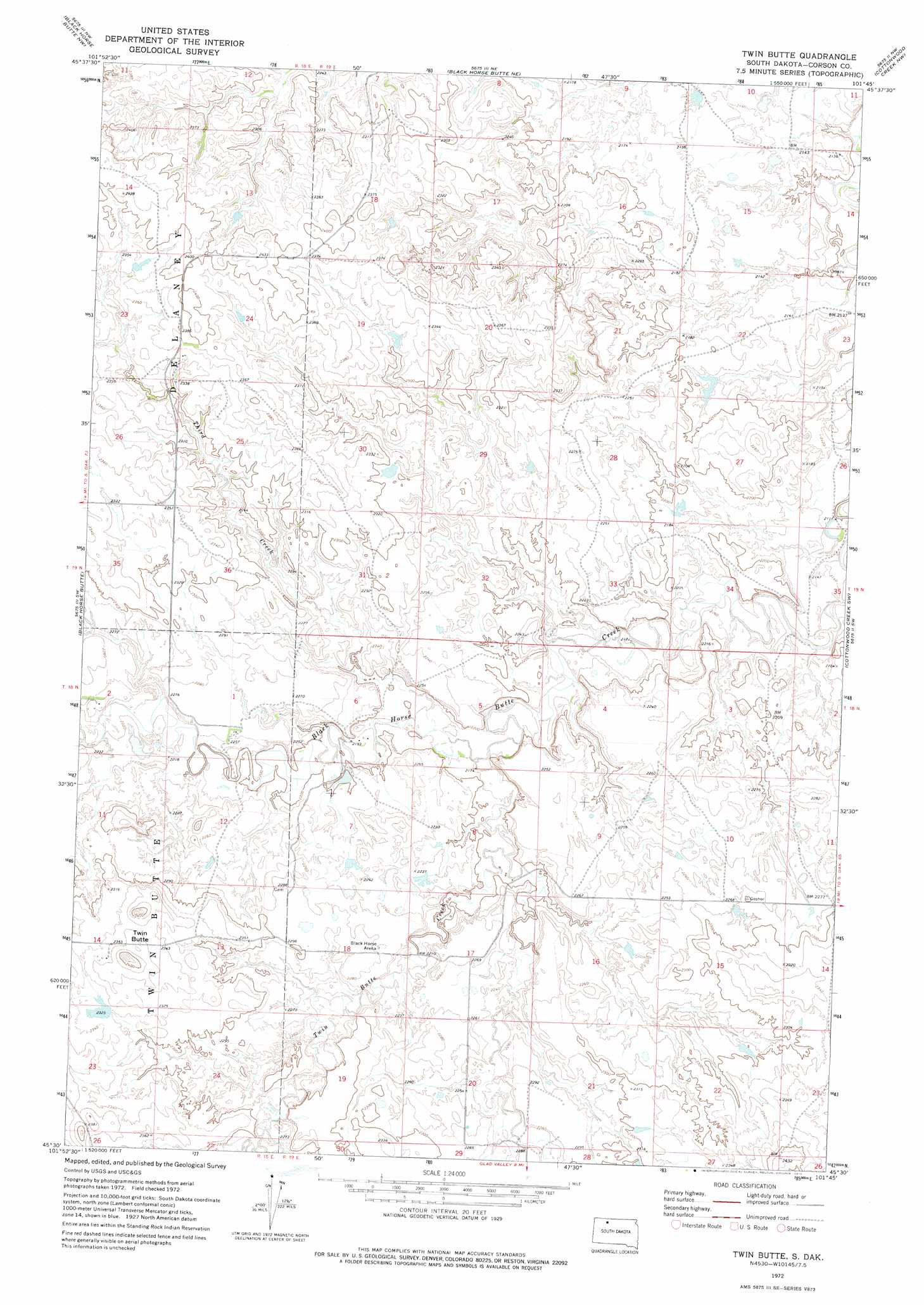
USGS Topo Quad 45101e7 - 1:24,000 scale
| Topo Map Name: | Twin Butte |
| USGS Topo Quad ID: | 45101e7 |
| Print Size: | ca. 21 1/4" wide x 27" high |
| Southeast Coordinates: | 45.5° N latitude / 101.75° W longitude |
| Map Center Coordinates: | 45.5625° N latitude / 101.8125° W longitude |
| U.S. State: | SD |
| Filename: | o45101e7.jpg |
| Download Map JPG Image: | Twin Butte topo map 1:24,000 scale |
| Map Type: | Topographic |
| Topo Series: | 7.5´ |
| Map Scale: | 1:24,000 |
| Source of Map Images: | United States Geological Survey (USGS) |
| Alternate Map Versions: |
Twin Butte SD 1972, updated 1975 Download PDF Buy paper map Twin Butte SD 1998, updated 2001 Download PDF Buy paper map Twin Butte SD 2012 Download PDF Buy paper map Twin Butte SD 2015 Download PDF Buy paper map |
| FStopo: | US Forest Service topo Twin Butte is available: Download FStopo PDF Download FStopo TIF |
1:24,000 Topo Quads surrounding Twin Butte
Lemmon Lake |
Thunder Hawk Sw |
Thunder Hawk Se |
Skull Butte |
Morristown Se |
Meadow Ne |
Black Horse Butte Nw |
Black Horse Butte Ne |
Cottonwood Creek Nw |
Cottonwood Creek Ne |
Meadow Se |
Black Horse Butte |
Twin Butte |
Cottonwood Creek Sw |
Cottonwood Creek Se |
Coal Springs |
Glad Valley Nw |
Glad Valley |
Irish Creek Nw |
Irish Creek Ne |
Coal Springs Se |
Glad Valley Sw |
Glad Valley Se |
Irish Creek Sw |
Irish Creek Se |
> Back to 45101e1 at 1:100,000 scale
> Back to 45100a1 at 1:250,000 scale
> Back to U.S. Topo Maps home
Twin Butte topo map: Gazetteer
Twin Butte: Airports
Shambo Ranch Landing Field elevation 686m 2250′Twin Butte: Streams
East Fork East Twin Butte Creek elevation 665m 2181′Third Creek elevation 663m 2175′
Twin Butte Creek elevation 659m 2162′
Twin Butte: Summits
Twin Butte elevation 745m 2444′Twin Butte digital topo map on disk
Buy this Twin Butte topo map showing relief, roads, GPS coordinates and other geographical features, as a high-resolution digital map file on DVD:
Eastern North Dakota & Eastern South Dakota
Buy digital topo maps: Eastern North Dakota & Eastern South Dakota