Alderdale Topo Map Oregon
To zoom in, hover over the map of Alderdale
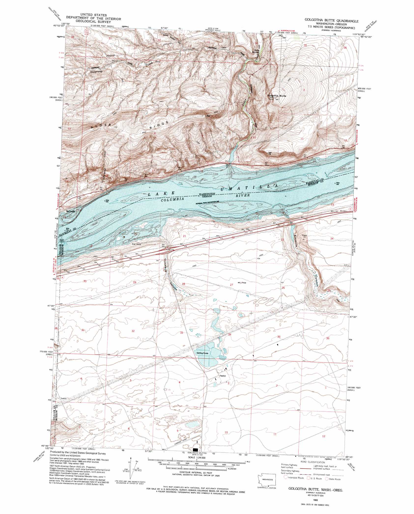
USGS Topo Quad 45119g8 - 1:24,000 scale
| Topo Map Name: | Alderdale |
| USGS Topo Quad ID: | 45119g8 |
| Print Size: | ca. 21 1/4" wide x 27" high |
| Southeast Coordinates: | 45.75° N latitude / 119.875° W longitude |
| Map Center Coordinates: | 45.8125° N latitude / 119.9375° W longitude |
| U.S. States: | OR, WA |
| Filename: | o45119g8.jpg |
| Download Map JPG Image: | Alderdale topo map 1:24,000 scale |
| Map Type: | Topographic |
| Topo Series: | 7.5´ |
| Map Scale: | 1:24,000 |
| Source of Map Images: | United States Geological Survey (USGS) |
| Alternate Map Versions: |
Alderdale WA 1962, updated 1963 Download PDF Buy paper map Alderdale WA 1962, updated 1978 Download PDF Buy paper map Alderdale WA 1970, updated 1972 Download PDF Buy paper map Golgotha Butte WA 1993, updated 1993 Download PDF Buy paper map Golgotha Butte WA 2011 Download PDF Buy paper map Golgotha Butte WA 2013 Download PDF Buy paper map |
1:24,000 Topo Quads surrounding Alderdale
Bluelight |
Tule Prong |
Prosser Sw |
Prosser Se |
Lenzie Ranch |
Crider Valley |
Douty Canyon |
Phinny Hill |
Canoe Ridge |
Blalock Island |
Wood Gulch |
Heppner Junction |
Alderdale |
Crow Butte |
Boardman |
Arlington |
Horn Butte |
Dalreed Butte |
Ella |
Well Spring |
Shutler Flat |
Hickland Butte |
Cecil |
Ione North |
Strawberry Canyon Sw |
> Back to 45119e1 at 1:100,000 scale
> Back to 45118a1 at 1:250,000 scale
> Back to U.S. Topo Maps home
Alderdale topo map: Gazetteer
Alderdale: Airports
Simtag Farms Airstrip elevation 169m 554′Alderdale: Parks
Quesna County Park elevation 82m 269′Alderdale: Populated Places
Alderdale elevation 91m 298′McCredie elevation 96m 314′
Alderdale: Ridges
Alder Ridge elevation 407m 1335′Alderdale: Springs
Sally Spring elevation 129m 423′Alderdale: Streams
Alder Creek elevation 84m 275′Cottonwood Creek elevation 82m 269′
Sixprong Creek elevation 121m 396′
Alderdale: Summits
Golgotha Butte elevation 321m 1053′Alderdale: Valleys
Sixmile Canyon elevation 82m 269′Threemile Canyon elevation 87m 285′
Alderdale digital topo map on disk
Buy this Alderdale topo map showing relief, roads, GPS coordinates and other geographical features, as a high-resolution digital map file on DVD: