Strasburg Topo Map North Dakota
To zoom in, hover over the map of Strasburg
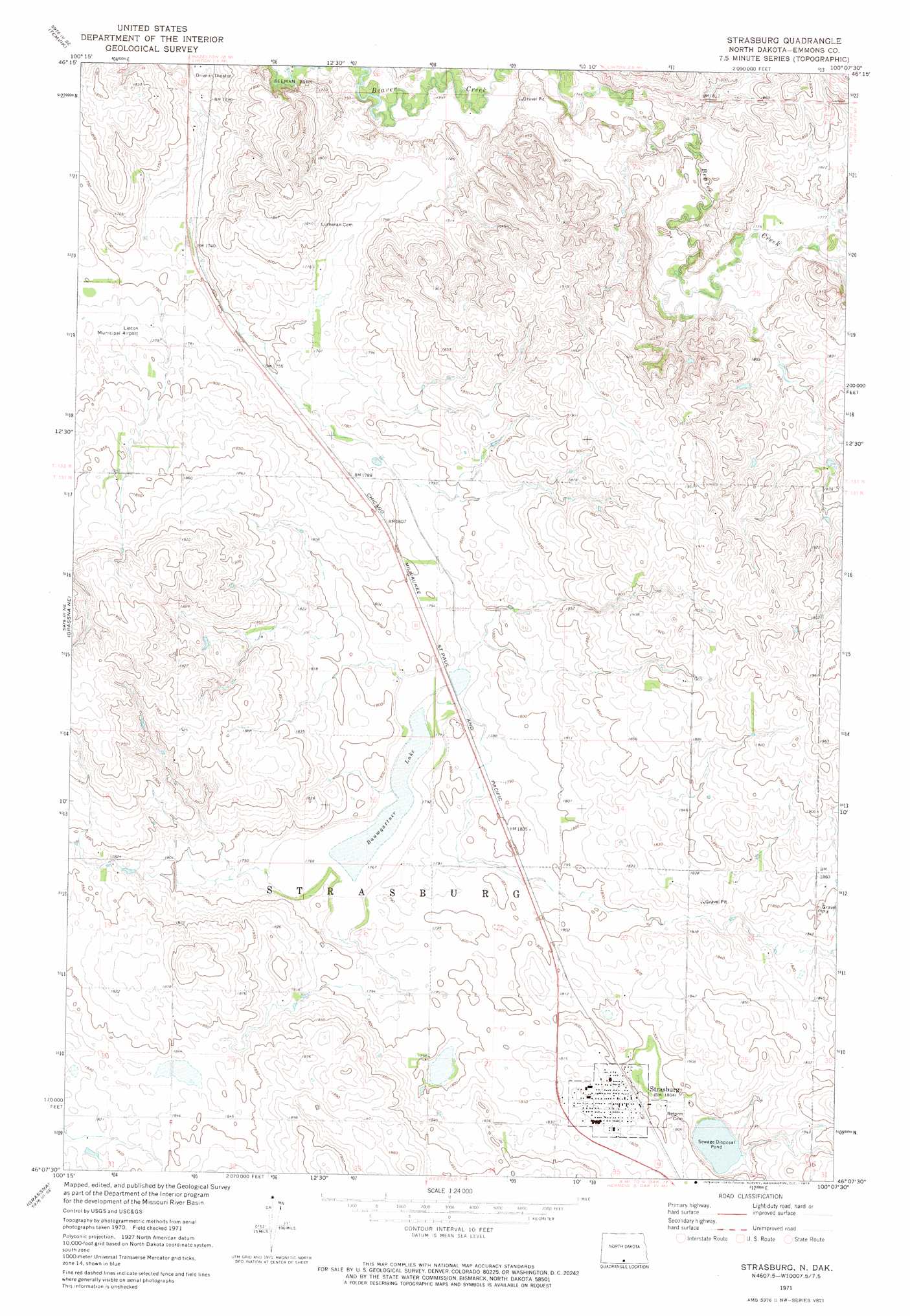
USGS Topo Quad 46100b2 - 1:24,000 scale
| Topo Map Name: | Strasburg |
| USGS Topo Quad ID: | 46100b2 |
| Print Size: | ca. 21 1/4" wide x 27" high |
| Southeast Coordinates: | 46.125° N latitude / 100.125° W longitude |
| Map Center Coordinates: | 46.1875° N latitude / 100.1875° W longitude |
| U.S. State: | ND |
| Filename: | O46100B2.jpg |
| Download Map JPG Image: | Strasburg topo map 1:24,000 scale |
| Map Type: | Topographic |
| Topo Series: | 7.5´ |
| Map Scale: | 1:24,000 |
| Source of Map Images: | United States Geological Survey (USGS) |
| Alternate Map Versions: |
Strasburg ND 1971, updated 1973 Download PDF Buy paper map Strasburg ND 2011 Download PDF Buy paper map Strasburg ND 2014 Download PDF Buy paper map |
1:24,000 Topo Quads surrounding Strasburg
Hazelton Nw |
Hazelton |
Appert Lake |
Linton Ne |
Schell Buttes Nw |
Hazelton Sw |
Temvik |
Linton |
Rohrich Dam |
Schell Buttes Sw |
Grassna Nw |
Grassna Ne |
Strasburg |
Senger Lake North |
Weisser Dam West |
Kiefer Buttes |
Grassna |
Westfield |
Senger Lake South |
Hague |
Pollock Nw |
Pollock |
Herreid Nw |
Herreid Ne |
Zeeland Nw |
> Back to 46100a1 at 1:100,000 scale
> Back to 46100a1 at 1:250,000 scale
> Back to U.S. Topo Maps home
Strasburg topo map: Gazetteer
Strasburg: Airports
Linton Municipal Airport elevation 554m 1817′Strasburg: Lakes
Baumgartner Lake elevation 539m 1768′Strasburg: Parks
Seeman Park elevation 523m 1715′Strasburg: Populated Places
Strasburg elevation 552m 1811′Strasburg digital topo map on disk
Buy this Strasburg topo map showing relief, roads, GPS coordinates and other geographical features, as a high-resolution digital map file on DVD:
Eastern North Dakota & Eastern South Dakota
Buy digital topo maps: Eastern North Dakota & Eastern South Dakota