Crown Butte Lake Topo Map North Dakota
To zoom in, hover over the map of Crown Butte Lake
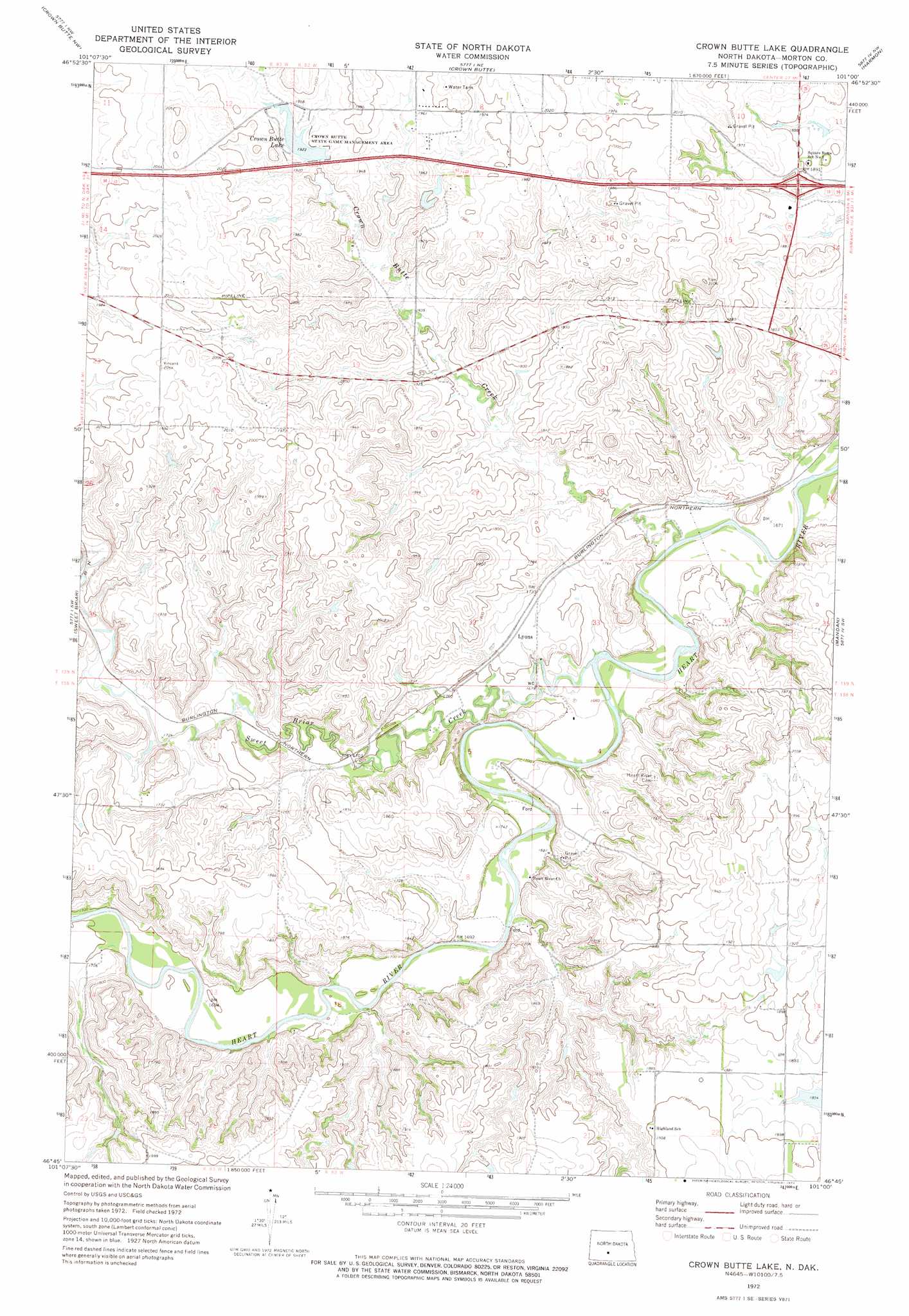
USGS Topo Quad 46101g1 - 1:24,000 scale
| Topo Map Name: | Crown Butte Lake |
| USGS Topo Quad ID: | 46101g1 |
| Print Size: | ca. 21 1/4" wide x 27" high |
| Southeast Coordinates: | 46.75° N latitude / 101° W longitude |
| Map Center Coordinates: | 46.8125° N latitude / 101.0625° W longitude |
| U.S. State: | ND |
| Filename: | O46101G1.jpg |
| Download Map JPG Image: | Crown Butte Lake topo map 1:24,000 scale |
| Map Type: | Topographic |
| Topo Series: | 7.5´ |
| Map Scale: | 1:24,000 |
| Source of Map Images: | United States Geological Survey (USGS) |
| Alternate Map Versions: |
Crown Butte Lake ND 1972, updated 1974 Download PDF Buy paper map Crown Butte Lake ND 2011 Download PDF Buy paper map Crown Butte Lake ND 2014 Download PDF Buy paper map |
1:24,000 Topo Quads surrounding Crown Butte Lake
Center |
Nelson Lake |
Fort Clark Se |
Price |
Wilton Se |
New Salem Ne |
Crown Butte Nw |
Crown Butte |
Harmon |
Burnt Butte |
Judson |
Sweet Briar |
Crown Butte Lake |
Mandan |
Bismarck |
Green Ridge |
Fish Creek Lane |
Fallon Ne |
Lynwood |
Schmidt |
Otter Creek East |
Nygren Dam |
Fallon |
Saint Anthony |
The Hogback |
> Back to 46101e1 at 1:100,000 scale
> Back to 46100a1 at 1:250,000 scale
> Back to U.S. Topo Maps home
Crown Butte Lake topo map: Gazetteer
Crown Butte Lake: Dams
Boehm Dam elevation 578m 1896′Crown Butte Dam elevation 583m 1912′
Crown Butte Lake: Parks
Crown Butte State Game Management Area elevation 586m 1922′Crown Butte Lake: Populated Places
Lyons elevation 527m 1729′Crown Butte Lake: Reservoirs
Crown Butte Lake elevation 586m 1922′Crown Butte Lake: Streams
Crown Butte Creek elevation 504m 1653′Sweetbriar Creek elevation 506m 1660′
Crown Butte Lake digital topo map on disk
Buy this Crown Butte Lake topo map showing relief, roads, GPS coordinates and other geographical features, as a high-resolution digital map file on DVD:
Eastern North Dakota & Eastern South Dakota
Buy digital topo maps: Eastern North Dakota & Eastern South Dakota