Plum Butte Ne Topo Map North Dakota
To zoom in, hover over the map of Plum Butte Ne
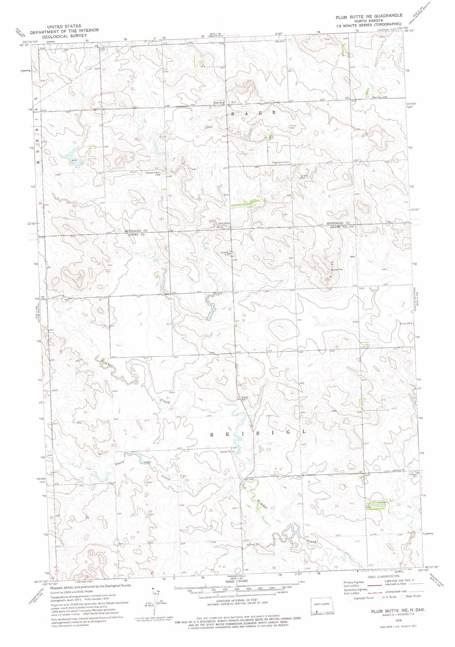
USGS Topo Quad 46102b1 - 1:24,000 scale
| Topo Map Name: | Plum Butte Ne |
| USGS Topo Quad ID: | 46102b1 |
| Print Size: | ca. 21 1/4" wide x 27" high |
| Southeast Coordinates: | 46.125° N latitude / 102° W longitude |
| Map Center Coordinates: | 46.1875° N latitude / 102.0625° W longitude |
| U.S. State: | ND |
| Filename: | O46102B1.jpg |
| Download Map JPG Image: | Plum Butte Ne topo map 1:24,000 scale |
| Map Type: | Topographic |
| Topo Series: | 7.5´ |
| Map Scale: | 1:24,000 |
| Source of Map Images: | United States Geological Survey (USGS) |
| Alternate Map Versions: |
Plum Butte NE ND 1974, updated 1978 Download PDF Buy paper map Plum Butte NE ND 2011 Download PDF Buy paper map Plum Butte NE ND 2014 Download PDF Buy paper map |
1:24,000 Topo Quads surrounding Plum Butte Ne
Mott North |
Burt Nw |
North Star Butte |
New Leipzig North |
Elgin |
Mott South |
Burt |
Bentley |
New Leipzig South |
Sheep Creek Dam |
Long Butte |
Plum Butte |
Plum Butte Ne |
Coffin Buttes |
Pretty Rock Butte |
Barths Butte |
Cedar Butte |
Nason Hill |
Round Top |
Pretty Rock Butte Se |
White Butte |
Lemmon |
Lemmon Ne |
Thunder Hawk |
Keldron |
> Back to 46102a1 at 1:100,000 scale
> Back to 46102a1 at 1:250,000 scale
> Back to U.S. Topo Maps home
Plum Butte Ne topo map: Gazetteer
Plum Butte Ne: Dams
Brown Dam elevation 756m 2480′Plum Butte Ne: Streams
Sheep Creek elevation 720m 2362′Plum Butte Ne digital topo map on disk
Buy this Plum Butte Ne topo map showing relief, roads, GPS coordinates and other geographical features, as a high-resolution digital map file on DVD:
Eastern Montana & Western North Dakota
Buy digital topo maps: Eastern Montana & Western North Dakota