Sunnyside Topo Map Washington
To zoom in, hover over the map of Sunnyside
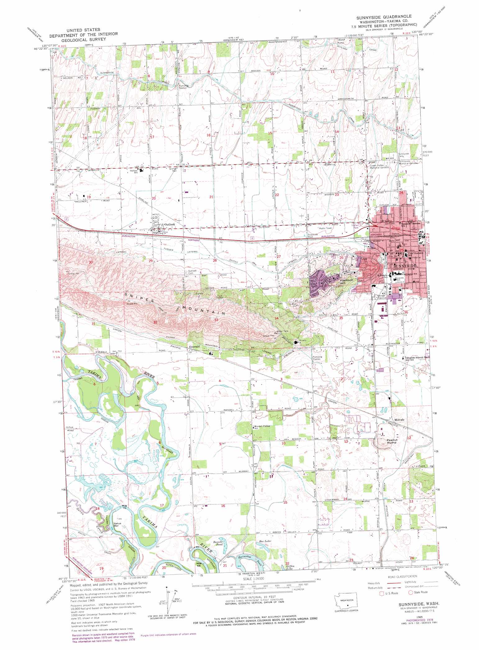
USGS Topo Quad 46120c1 - 1:24,000 scale
| Topo Map Name: | Sunnyside |
| USGS Topo Quad ID: | 46120c1 |
| Print Size: | ca. 21 1/4" wide x 27" high |
| Southeast Coordinates: | 46.25° N latitude / 120° W longitude |
| Map Center Coordinates: | 46.3125° N latitude / 120.0625° W longitude |
| U.S. State: | WA |
| Filename: | o46120c1.jpg |
| Download Map JPG Image: | Sunnyside topo map 1:24,000 scale |
| Map Type: | Topographic |
| Topo Series: | 7.5´ |
| Map Scale: | 1:24,000 |
| Source of Map Images: | United States Geological Survey (USGS) |
| Alternate Map Versions: |
Sunnyside WA 1965, updated 1967 Download PDF Buy paper map Sunnyside WA 2011 Download PDF Buy paper map Sunnyside WA 2013 Download PDF Buy paper map |
1:24,000 Topo Quads surrounding Sunnyside
Elephant Mountain |
Black Rock Spring Sw |
Black Rock Spring |
Cairn Hope Peak |
Emerson Nipple |
Toppenish |
Granger Nw |
Granger Ne |
Sulphur Spring |
Maiden Spring |
Hembre Mountain |
Granger |
Sunnyside |
Grandview |
Sagebrush Ridge |
Poisel Butte |
Bluelight Nw |
Mabton West |
Mabton East |
Prosser |
Poisel Butte Se |
Bluelight |
Tule Prong |
Prosser Sw |
Prosser Se |
> Back to 46120a1 at 1:100,000 scale
> Back to 46120a1 at 1:250,000 scale
> Back to U.S. Topo Maps home
Sunnyside topo map: Gazetteer
Sunnyside: Bars
Satus Bar elevation 201m 659′Sunnyside: Canals
Outlook Canal elevation 283m 928′Snipes Mountain Lateral elevation 229m 751′
Sulphur Creek Wasteway elevation 209m 685′
Turner Lateral elevation 240m 787′
Sunnyside: Lakes
Bos Lake elevation 204m 669′Bounds Pond elevation 201m 659′
Horseshoe Pond elevation 199m 652′
Sunnyside: Parks
Toppenish National Wildlife Refuge elevation 204m 669′Sunnyside: Populated Places
Emerald elevation 220m 721′Midvale elevation 211m 692′
Outlook elevation 239m 784′
Sunnyside elevation 227m 744′
Sunnyside: Streams
Satus Creek elevation 199m 652′Sunnyside: Summits
Harrison Hill elevation 301m 987′Peanut Hump elevation 240m 787′
Snipes Mountain elevation 396m 1299′
Sunnyside digital topo map on disk
Buy this Sunnyside topo map showing relief, roads, GPS coordinates and other geographical features, as a high-resolution digital map file on DVD: