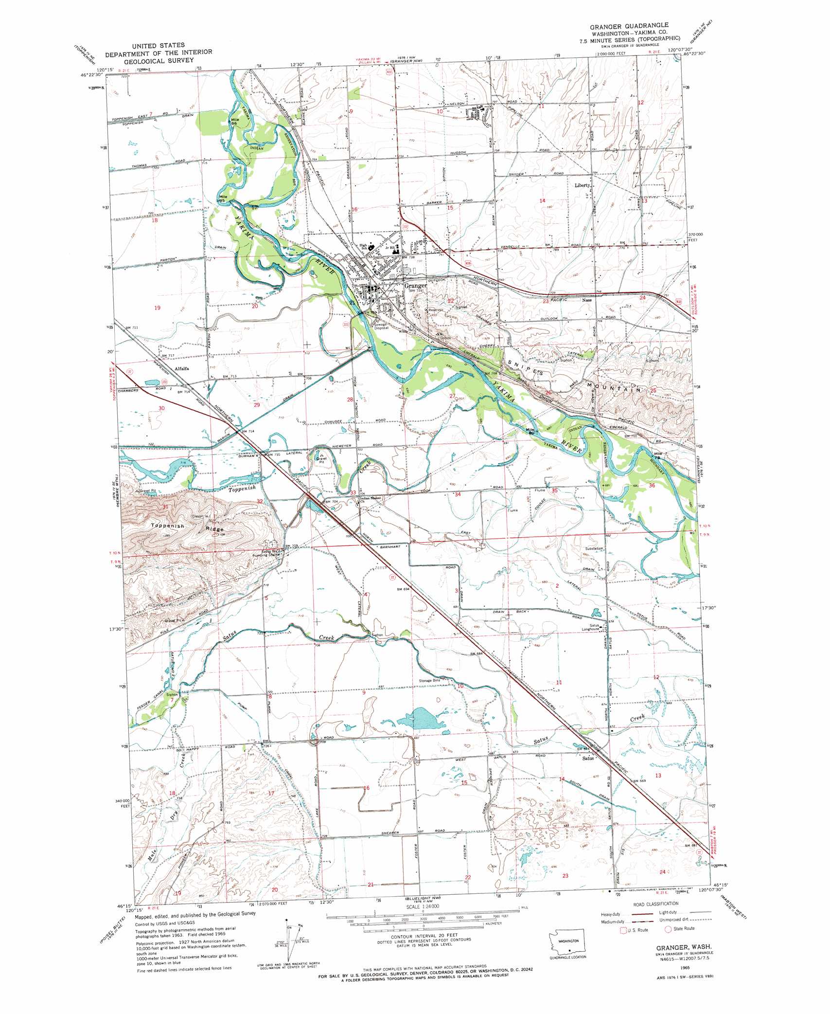
Granger Topo Map Washington
To zoom in, hover over the map of Granger
USGS Topo Quad 46120c2 - 1:24,000 scale
| Topo Map Name: | Granger |
| USGS Topo Quad ID: | 46120c2 |
| Print Size: | ca. 21 1/4" wide x 27" high |
| Southeast Coordinates: | 46.25° N latitude / 120.125° W longitude |
| Map Center Coordinates: | 46.3125° N latitude / 120.1875° W longitude |
| U.S. State: | WA |
| Filename: | o46120c2.jpg |
| Download Map JPG Image: | Granger topo map 1:24,000 scale |
| Map Type: | Topographic |
| Topo Series: | 7.5´ |
| Map Scale: | 1:24,000 |
| Source of Map Images: | United States Geological Survey (USGS) |
| Alternate Map Versions: |
Granger WA 1965, updated 1967 Download PDF Buy paper map Granger WA 2011 Download PDF Buy paper map Granger WA 2013 Download PDF Buy paper map |
1:24,000 Topo Quads surrounding Granger
Yakima East |
Elephant Mountain |
Black Rock Spring Sw |
Black Rock Spring |
Cairn Hope Peak |
Wapato |
Toppenish |
Granger Nw |
Granger Ne |
Sulphur Spring |
Toppenish Sw |
Hembre Mountain |
Granger |
Sunnyside |
Grandview |
Poisel Butte Nw |
Poisel Butte |
Bluelight Nw |
Mabton West |
Mabton East |
Poisel Butte Sw |
Poisel Butte Se |
Bluelight |
Tule Prong |
Prosser Sw |
> Back to 46120a1 at 1:100,000 scale
> Back to 46120a1 at 1:250,000 scale
> Back to U.S. Topo Maps home
Granger topo map: Gazetteer
Granger: Canals
Coulee Drain elevation 208m 682′Durham Lateral elevation 216m 708′
East Lateral elevation 211m 692′
Foster Drain elevation 212m 695′
Granger Drain elevation 253m 830′
North Barnhart Road Draw elevation 211m 692′
North Drain elevation 206m 675′
Parton Drain elevation 217m 711′
South Drain elevation 204m 669′
Granger: Crossings
Granger Interchange elevation 223m 731′Granger: Parks
Hisey Park elevation 213m 698′Granger: Populated Places
Alfalfa elevation 218m 715′Granger elevation 223m 731′
Liberty elevation 242m 793′
Nass elevation 226m 741′
Satus elevation 205m 672′
Granger: Streams
Mule Dry Creek elevation 221m 725′Toppenish Creek elevation 208m 682′
Granger digital topo map on disk
Buy this Granger topo map showing relief, roads, GPS coordinates and other geographical features, as a high-resolution digital map file on DVD: