Toutle Mountain Topo Map Washington
To zoom in, hover over the map of Toutle Mountain
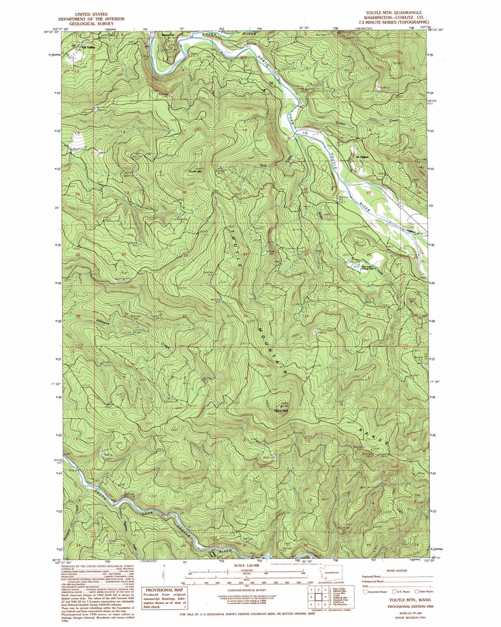
USGS Topo Quad 46122c5 - 1:24,000 scale
| Topo Map Name: | Toutle Mountain |
| USGS Topo Quad ID: | 46122c5 |
| Print Size: | ca. 21 1/4" wide x 27" high |
| Southeast Coordinates: | 46.25° N latitude / 122.5° W longitude |
| Map Center Coordinates: | 46.3125° N latitude / 122.5625° W longitude |
| U.S. State: | WA |
| Filename: | o46122c5.jpg |
| Download Map JPG Image: | Toutle Mountain topo map 1:24,000 scale |
| Map Type: | Topographic |
| Topo Series: | 7.5´ |
| Map Scale: | 1:24,000 |
| Source of Map Images: | United States Geological Survey (USGS) |
| Alternate Map Versions: |
Toutle Mtn WA 1984, updated 1985 Download PDF Buy paper map Toutle Mtn. WA 1984, updated 1994 Download PDF Buy paper map Toutle Mountain WA 2011 Download PDF Buy paper map Toutle Mountain WA 2013 Download PDF Buy paper map |
1:24,000 Topo Quads surrounding Toutle Mountain
Jackson Prairie |
Onalaska |
Mayfield Lake |
Mossyrock |
Morton |
Toledo |
Eden Valley |
Hatchet Mountain |
Coyote Mountain |
Winters Mountain |
Silver Lake |
Toutle |
Toutle Mountain |
Huffstadt Mountain |
Elk Rock |
Mount Brynion |
Hemlock Pass |
Wolf Point |
Elk Mountain |
Goat Mountain |
Kalama |
Woolford Creek |
Georges Peak |
Lakeview Peak |
Cougar |
> Back to 46122a1 at 1:100,000 scale
> Back to 46122a1 at 1:250,000 scale
> Back to U.S. Topo Maps home
Toutle Mountain topo map: Gazetteer
Toutle Mountain: Parks
Al Raught Park elevation 275m 902′Hoffstadt Creek Park elevation 297m 974′
Toutle Mountain: Populated Places
Kid Valley elevation 236m 774′Saint Helens elevation 293m 961′
Toutle Mountain: Ranges
Toutle Mountain Range elevation 832m 2729′Toutle Mountain: Streams
Alder Creek elevation 269m 882′Bear Creek elevation 297m 974′
Big Wolf Creek elevation 244m 800′
Eighteen Creek elevation 209m 685′
Green River elevation 225m 738′
Hoffstadt Creek elevation 298m 977′
Pullen Creek elevation 288m 944′
Stitz Creek elevation 290m 951′
Thirteen Creek elevation 201m 659′
Twenty Creek elevation 241m 790′
Toutle Mountain: Summits
Signal Peak elevation 1004m 3293′Toutle Mountain elevation 747m 2450′
Toutle Mountain digital topo map on disk
Buy this Toutle Mountain topo map showing relief, roads, GPS coordinates and other geographical features, as a high-resolution digital map file on DVD: