Logan Hill Topo Map Washington
To zoom in, hover over the map of Logan Hill
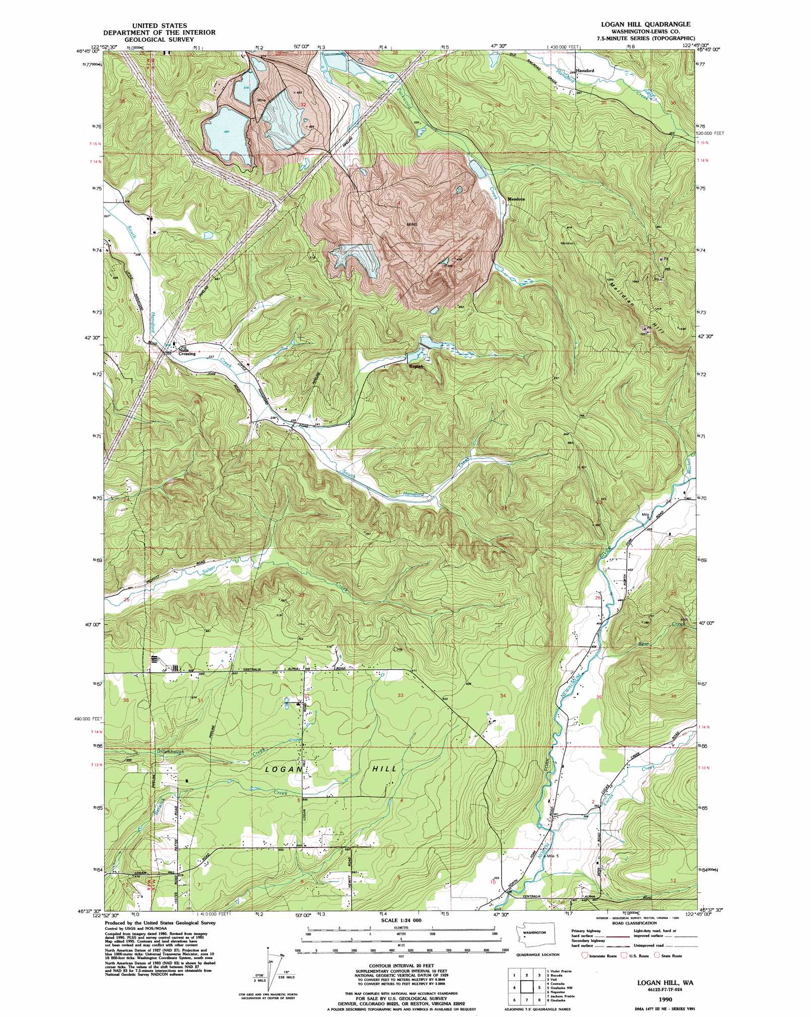
USGS Topo Quad 46122f7 - 1:24,000 scale
| Topo Map Name: | Logan Hill |
| USGS Topo Quad ID: | 46122f7 |
| Print Size: | ca. 21 1/4" wide x 27" high |
| Southeast Coordinates: | 46.625° N latitude / 122.75° W longitude |
| Map Center Coordinates: | 46.6875° N latitude / 122.8125° W longitude |
| U.S. State: | WA |
| Filename: | o46122f7.jpg |
| Download Map JPG Image: | Logan Hill topo map 1:24,000 scale |
| Map Type: | Topographic |
| Topo Series: | 7.5´ |
| Map Scale: | 1:24,000 |
| Source of Map Images: | United States Geological Survey (USGS) |
| Alternate Map Versions: |
Logan Hill WA 1984, updated 1985 Download PDF Buy paper map Logan Hill WA 1990, updated 1995 Download PDF Buy paper map Logan Hill WA 2011 Download PDF Buy paper map Logan Hill WA 2013 Download PDF Buy paper map |
1:24,000 Topo Quads surrounding Logan Hill
Little Rock |
Maytown |
East Olympia |
Tenalquot Prarie |
Mckenna |
Rochester |
Violet Prairie |
Bucoda |
Vail |
Lake Lawrence |
Adna |
Centralia |
Logan Hill |
Onalaska Nw |
Bernier Creek |
Curtis |
Napavine |
Jackson Prairie |
Onalaska |
Mayfield Lake |
Wildwood |
Winlock |
Toledo |
Eden Valley |
Hatchet Mountain |
> Back to 46122e1 at 1:100,000 scale
> Back to 46122a1 at 1:250,000 scale
> Back to U.S. Topo Maps home
Logan Hill topo map: Gazetteer
Logan Hill: Dams
Dam Number 1-A elevation 76m 249′Dam Number 3B elevation 129m 423′
Dam Number Eight elevation 86m 282′
Dam Number Five elevation 75m 246′
Dam Number Four elevation 82m 269′
Dam Number Seven elevation 92m 301′
Dam Number Three elevation 85m 278′
Dam Number Two elevation 85m 278′
Logan Hill: Populated Places
Kopiah elevation 92m 301′Nulls Crossing elevation 68m 223′
Logan Hill: Reservoirs
Pond Number 1-A elevation 76m 249′Pond Number Eight elevation 86m 282′
Pond Number Five elevation 75m 246′
Pond Number Four elevation 82m 269′
Pond Number Seven elevation 92m 301′
Pond Number Three elevation 85m 278′
Pond Number Two elevation 85m 278′
Logan Hill: Streams
Bear Creek elevation 121m 396′Lucas Creek elevation 105m 344′
Mitchell Creek elevation 142m 465′
Logan Hill: Summits
Logan Hill elevation 204m 669′Meridian Hill elevation 433m 1420′
Logan Hill digital topo map on disk
Buy this Logan Hill topo map showing relief, roads, GPS coordinates and other geographical features, as a high-resolution digital map file on DVD: