Frenchville Topo Map Maine
To zoom in, hover over the map of Frenchville
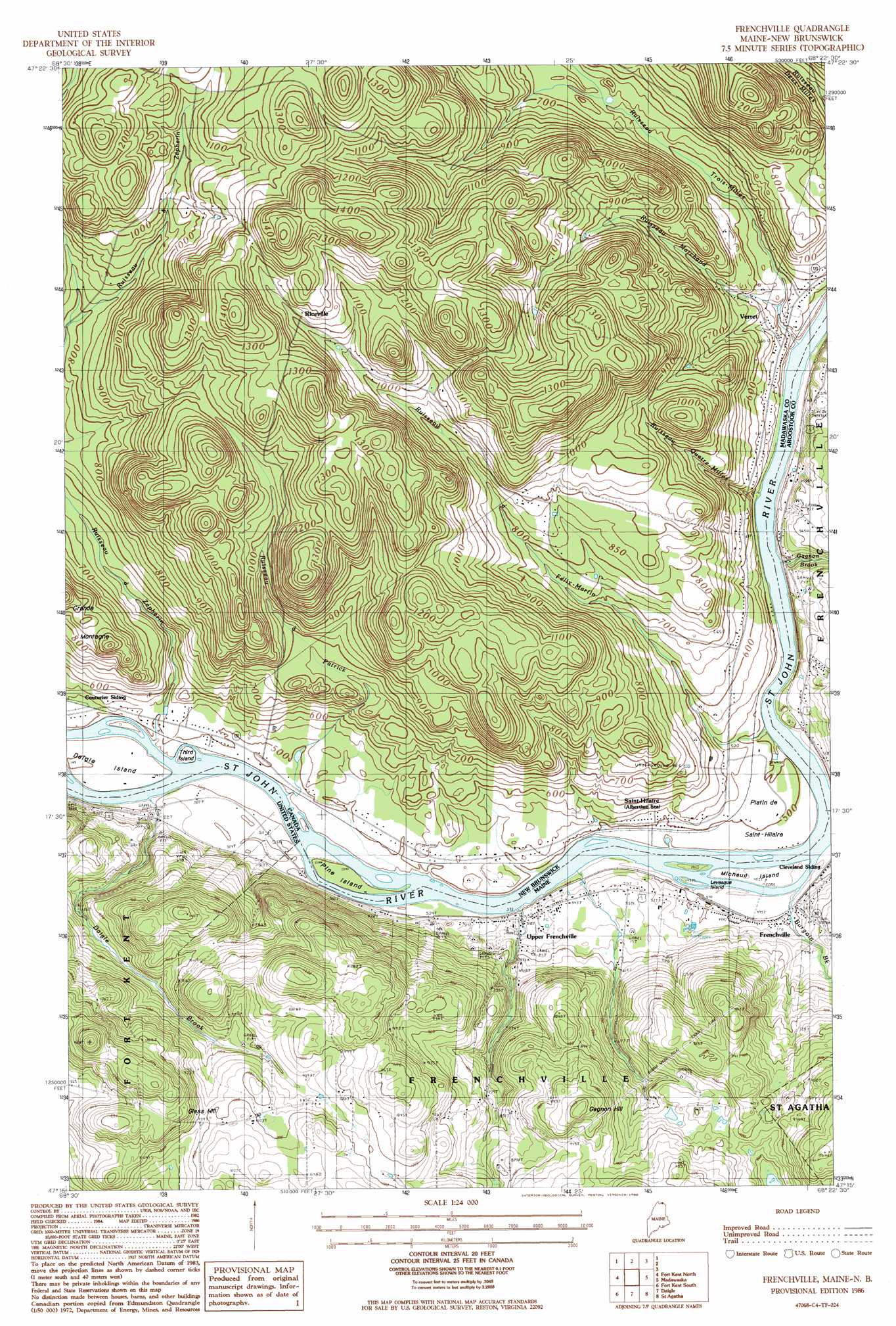
USGS Topo Quad 47068c4 - 1:24,000 scale
| Topo Map Name: | Frenchville |
| USGS Topo Quad ID: | 47068c4 |
| Print Size: | ca. 21 1/4" wide x 27" high |
| Southeast Coordinates: | 47.25° N latitude / 68.375° W longitude |
| Map Center Coordinates: | 47.3125° N latitude / 68.4375° W longitude |
| U.S. State: | ME |
| Filename: | o47068c4.jpg |
| Download Map JPG Image: | Frenchville topo map 1:24,000 scale |
| Map Type: | Topographic |
| Topo Series: | 7.5´ |
| Map Scale: | 1:24,000 |
| Source of Map Images: | United States Geological Survey (USGS) |
| Alternate Map Versions: |
Frenchville SW ME 1975, updated 1981 Download PDF Buy paper map Frenchville ME 1986, updated 1986 Download PDF Buy paper map Frenchville ME 2011 Download PDF Buy paper map Frenchville ME 2014 Download PDF Buy paper map |
1:24,000 Topo Quads surrounding Frenchville
Fort Kent North |
Frenchville |
Madawaska |
Grand Isle |
|
Wheelock |
Fort Kent South |
Daigle |
Saint Agatha |
Paulette Brook |
Wallacrass Lakes |
Eagle Lake |
Square Lake West |
Square Lake East |
Stockholm |
> Back to 47068a1 at 1:100,000 scale
> Back to 47068a1 at 1:250,000 scale
> Back to U.S. Topo Maps home
Frenchville topo map: Gazetteer
Frenchville: Islands
Levesque Island elevation 141m 462′Michaud Island elevation 151m 495′
Frenchville: Populated Places
Frenchville elevation 155m 508′Upper Frenchville elevation 158m 518′
Frenchville: Post Offices
Frenchville Post Office elevation 154m 505′Upper Frenchville Post Office elevation 161m 528′
Frenchville: Streams
Burgoin Brook elevation 146m 479′Daigle Brook elevation 148m 485′
Dickey Brook elevation 144m 472′
Gagnon Brook elevation 148m 485′
Frenchville: Summits
Gagnon Hill elevation 344m 1128′Glass Hill elevation 354m 1161′
Frenchville digital topo map on disk
Buy this Frenchville topo map showing relief, roads, GPS coordinates and other geographical features, as a high-resolution digital map file on DVD:
Maine, New Hampshire, Rhode Island & Eastern Massachusetts
Buy digital topo maps: Maine, New Hampshire, Rhode Island & Eastern Massachusetts