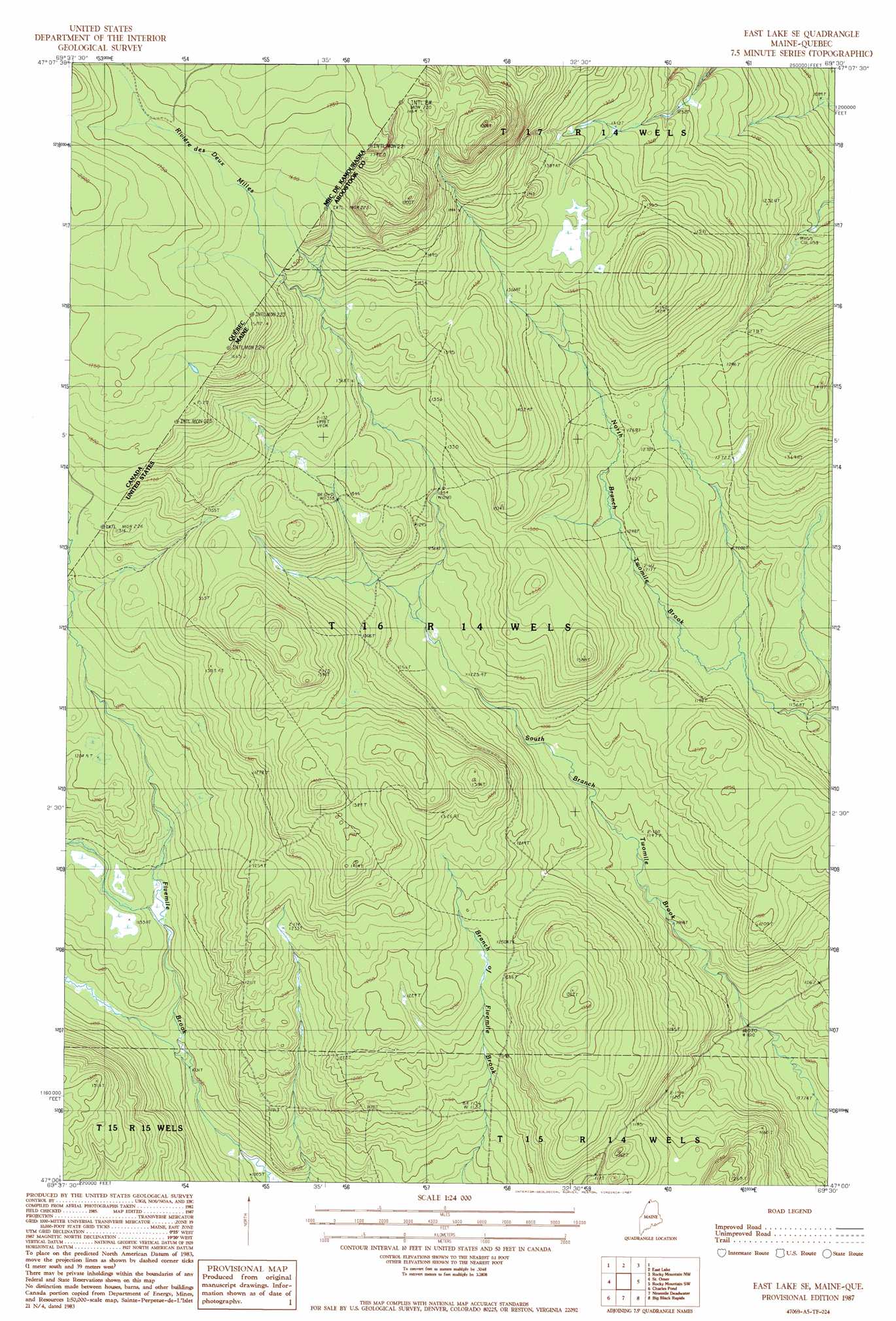
East Lake Se Topo Map Maine
To zoom in, hover over the map of East Lake Se
USGS Topo Quad 47069a5 - 1:24,000 scale
| Topo Map Name: | East Lake Se |
| USGS Topo Quad ID: | 47069a5 |
| Print Size: | ca. 21 1/4" wide x 27" high |
| Southeast Coordinates: | 47° N latitude / 69.5° W longitude |
| Map Center Coordinates: | 47.0625° N latitude / 69.5625° W longitude |
| U.S. State: | ME |
| Filename: | o47069a5.jpg |
| Download Map JPG Image: | East Lake Se topo map 1:24,000 scale |
| Map Type: | Topographic |
| Topo Series: | 7.5´ |
| Map Scale: | 1:24,000 |
| Source of Map Images: | United States Geological Survey (USGS) |
| Alternate Map Versions: |
East Lake SE ME 1976, updated 1983 Download PDF Buy paper map East Lake SE ME 1976, updated 1984 Download PDF Buy paper map East Lake SE ME 1987, updated 1987 Download PDF Buy paper map East Lake SE ME 2011 Download PDF Buy paper map East Lake SE ME 2014 Download PDF Buy paper map |
1:24,000 Topo Quads surrounding East Lake Se
Morrison Brook |
Rocky Brook |
|||
East Lake |
Rocky Mountain Nw |
Rocky Mountain |
||
Saint Omer |
East Lake Se |
Rocky Mountain Sw |
Schoolhouse Rapids |
|
Saint Pamphile |
Charles Pond |
Ninemile Deadwater |
Big Black Rapids |
Mckinnon Brook |
Depot Lake |
Houlton Pond |
Seven Islands |
Blue Brook |
Round Pond |
> Back to 47069a1 at 1:100,000 scale
> Back to 47068a1 at 1:250,000 scale
> Back to U.S. Topo Maps home
No gazetteer data is available for the East Lake Se topo map sheet.
East Lake Se digital topo map on disk
Buy this East Lake Se topo map showing relief, roads, GPS coordinates and other geographical features, as a high-resolution digital map file on DVD:
Maine, New Hampshire, Rhode Island & Eastern Massachusetts
Buy digital topo maps: Maine, New Hampshire, Rhode Island & Eastern Massachusetts