Rocky Mountain Topo Map Maine
To zoom in, hover over the map of Rocky Mountain
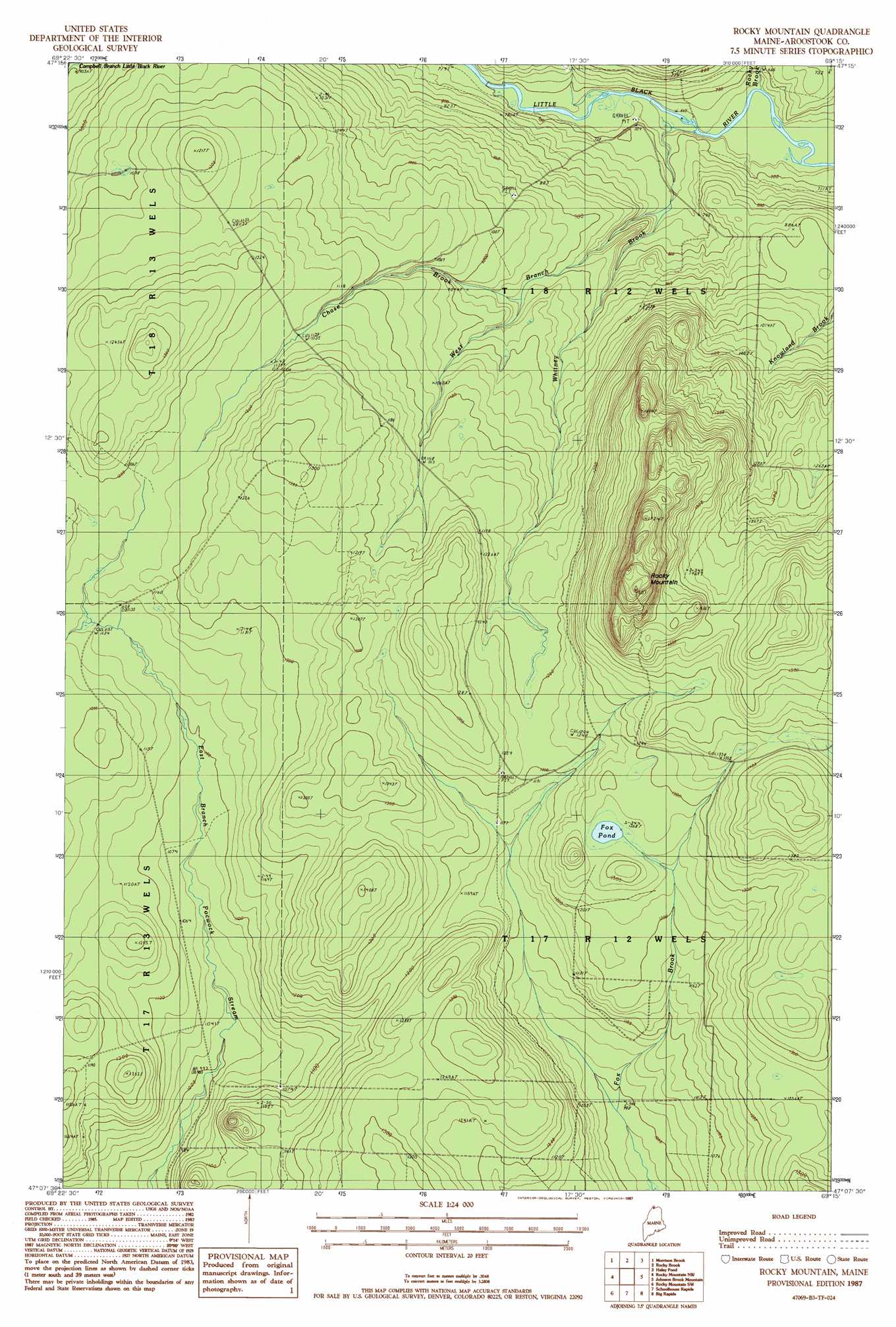
USGS Topo Quad 47069b3 - 1:24,000 scale
| Topo Map Name: | Rocky Mountain |
| USGS Topo Quad ID: | 47069b3 |
| Print Size: | ca. 21 1/4" wide x 27" high |
| Southeast Coordinates: | 47.125° N latitude / 69.25° W longitude |
| Map Center Coordinates: | 47.1875° N latitude / 69.3125° W longitude |
| U.S. State: | ME |
| Filename: | o47069b3.jpg |
| Download Map JPG Image: | Rocky Mountain topo map 1:24,000 scale |
| Map Type: | Topographic |
| Topo Series: | 7.5´ |
| Map Scale: | 1:24,000 |
| Source of Map Images: | United States Geological Survey (USGS) |
| Alternate Map Versions: |
Rocky Mountain ME 1987, updated 1987 Download PDF Buy paper map Rocky Mountain ME 2011 Download PDF Buy paper map Rocky Mountain ME 2014 Download PDF Buy paper map |
1:24,000 Topo Quads surrounding Rocky Mountain
Saint Eleuthere |
Estcourt |
Landry |
||
Morrison Brook |
Rocky Brook |
Hafey Pond |
Beau Lake |
|
East Lake |
Rocky Mountain Nw |
Rocky Mountain |
Johnson Brook Mountain |
Falls Brook Lake |
East Lake Se |
Rocky Mountain Sw |
Schoolhouse Rapids |
Big Rapids |
Allagash |
Ninemile Deadwater |
Big Black Rapids |
Mckinnon Brook |
Allagash Falls |
Mckeen Lake |
> Back to 47069a1 at 1:100,000 scale
> Back to 47068a1 at 1:250,000 scale
> Back to U.S. Topo Maps home
Rocky Mountain topo map: Gazetteer
Rocky Mountain: Lakes
Fox Pond elevation 388m 1272′Rocky Mountain: Streams
Chase Brook elevation 222m 728′Rocky Brook elevation 199m 652′
West Branch Chase Brook elevation 223m 731′
Whitney Brook elevation 201m 659′
Rocky Mountain: Summits
Rocky Mountain elevation 612m 2007′Rocky Mountain digital topo map on disk
Buy this Rocky Mountain topo map showing relief, roads, GPS coordinates and other geographical features, as a high-resolution digital map file on DVD:
Maine, New Hampshire, Rhode Island & Eastern Massachusetts
Buy digital topo maps: Maine, New Hampshire, Rhode Island & Eastern Massachusetts