Schoolhouse Rapids Topo Map Maine
To zoom in, hover over the map of Schoolhouse Rapids
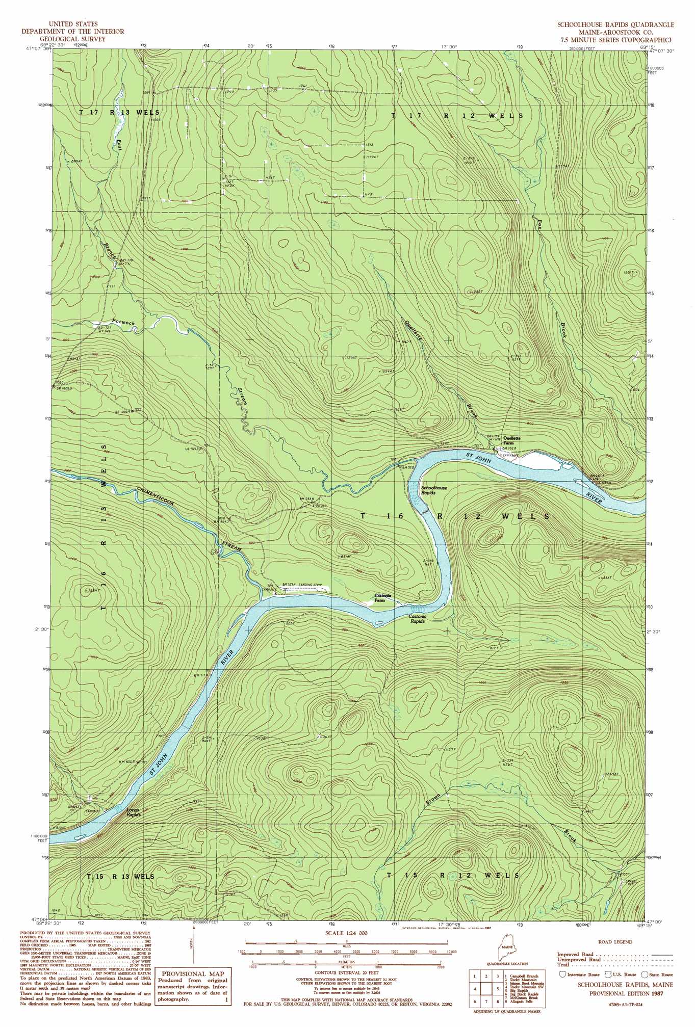
USGS Topo Quad 47069a3 - 1:24,000 scale
| Topo Map Name: | Schoolhouse Rapids |
| USGS Topo Quad ID: | 47069a3 |
| Print Size: | ca. 21 1/4" wide x 27" high |
| Southeast Coordinates: | 47° N latitude / 69.25° W longitude |
| Map Center Coordinates: | 47.0625° N latitude / 69.3125° W longitude |
| U.S. State: | ME |
| Filename: | o47069a3.jpg |
| Download Map JPG Image: | Schoolhouse Rapids topo map 1:24,000 scale |
| Map Type: | Topographic |
| Topo Series: | 7.5´ |
| Map Scale: | 1:24,000 |
| Source of Map Images: | United States Geological Survey (USGS) |
| Alternate Map Versions: |
Schoolhouse Rapids ME 1987, updated 1987 Download PDF Buy paper map Schoolhouse Rapids ME 2011 Download PDF Buy paper map Schoolhouse Rapids ME 2014 Download PDF Buy paper map |
1:24,000 Topo Quads surrounding Schoolhouse Rapids
Morrison Brook |
Rocky Brook |
Hafey Pond |
Beau Lake |
|
East Lake |
Rocky Mountain Nw |
Rocky Mountain |
Johnson Brook Mountain |
Falls Brook Lake |
East Lake Se |
Rocky Mountain Sw |
Schoolhouse Rapids |
Big Rapids |
Allagash |
Ninemile Deadwater |
Big Black Rapids |
Mckinnon Brook |
Allagash Falls |
Mckeen Lake |
Seven Islands |
Blue Brook |
Round Pond |
Five Finger Brook |
Big Brook Lake |
> Back to 47069a1 at 1:100,000 scale
> Back to 47068a1 at 1:250,000 scale
> Back to U.S. Topo Maps home
Schoolhouse Rapids topo map: Gazetteer
Schoolhouse Rapids: Rapids
Longs Rapids elevation 221m 725′Schoolhouse Rapids elevation 213m 698′
Schoolhouse Rapids: Streams
Chimenticook Stream elevation 217m 711′East Branch Pocwock Stream elevation 225m 738′
Ouellette Brook elevation 210m 688′
Pocwock Stream elevation 212m 695′
Schoolhouse Rapids digital topo map on disk
Buy this Schoolhouse Rapids topo map showing relief, roads, GPS coordinates and other geographical features, as a high-resolution digital map file on DVD:
Maine, New Hampshire, Rhode Island & Eastern Massachusetts
Buy digital topo maps: Maine, New Hampshire, Rhode Island & Eastern Massachusetts