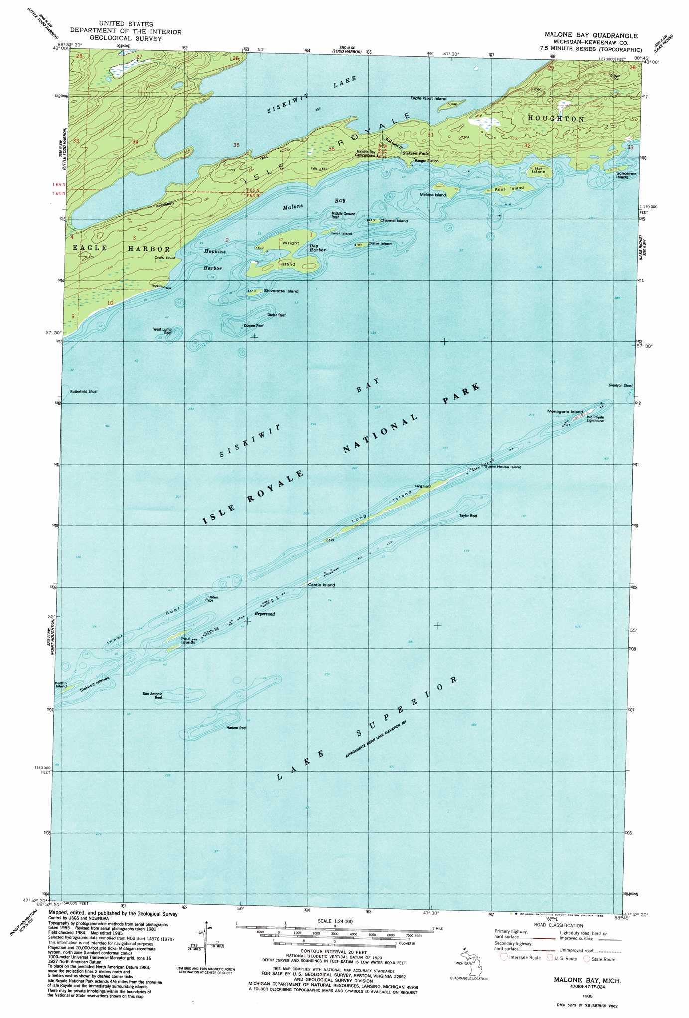
Malone Bay Topo Map Michigan
To zoom in, hover over the map of Malone Bay
USGS Topo Quad 47088h7 - 1:24,000 scale
| Topo Map Name: | Malone Bay |
| USGS Topo Quad ID: | 47088h7 |
| Print Size: | ca. 21 1/4" wide x 27" high |
| Southeast Coordinates: | 47.875° N latitude / 88.75° W longitude |
| Map Center Coordinates: | 47.9375° N latitude / 88.8125° W longitude |
| U.S. State: | MI |
| Filename: | o47088h7.jpg |
| Download Map JPG Image: | Malone Bay topo map 1:24,000 scale |
| Map Type: | Topographic |
| Topo Series: | 7.5´ |
| Map Scale: | 1:24,000 |
| Source of Map Images: | United States Geological Survey (USGS) |
| Alternate Map Versions: |
Malone Bay MI 1985, updated 1986 Download PDF Buy paper map Malone Bay MI 2011 Download PDF Buy paper map Malone Bay MI 2014 Download PDF Buy paper map Malone Bay MI 2017 Download PDF Buy paper map |
1:24,000 Topo Quads surrounding Malone Bay
Belle Harbor |
||||
Todd Harbor |
McCargoe Cove |
Mott Island |
||
Sugar Mountain |
Point Houghton |
Malone Bay |
Lake Richie |
|
Feldtmann Ridge |
Point Houghton |
|||
> Back to 47088e1 at 1:100,000 scale
> Back to 47088a1 at 1:250,000 scale
> Back to U.S. Topo Maps home
Malone Bay topo map: Gazetteer
Malone Bay: Bars
Doden Reef elevation 183m 600′Domen Reef elevation 183m 600′
Harlem Reef elevation 183m 600′
Inner Reef elevation 183m 600′
Middle Ground Reef elevation 183m 600′
San Antonio Reef elevation 183m 600′
Taylor Reef elevation 183m 600′
West Lump Reef elevation 183m 600′
Malone Bay: Bays
Hopkins Harbor elevation 183m 600′Malone Bay elevation 183m 600′
Malone Bay: Capes
Crow Point elevation 188m 616′Malone Bay: Channels
Bryersund elevation 183m 600′Malone Bay: Falls
Siskiwit Falls elevation 186m 610′Malone Bay: Harbors
Dog Harbor elevation 183m 600′Malone Bay: Islands
Castle Island elevation 185m 606′Channel Island elevation 185m 606′
Eagle Nest Island elevation 205m 672′
Hat Island elevation 189m 620′
Inner Island elevation 185m 606′
Long Island elevation 189m 620′
Malone Island elevation 189m 620′
Menagerie Island elevation 189m 620′
Outer Island elevation 185m 606′
Paul Islands elevation 185m 606′
Redfin Island elevation 183m 600′
Ross Island elevation 189m 620′
Schooner Island elevation 189m 620′
Shiverette Island elevation 185m 606′
Siskiwit Islands elevation 183m 600′
Stone House Island elevation 183m 600′
Wright Island elevation 183m 600′
Malone Bay: Post Offices
Isle Royale Natinal Park Post Office (historical) elevation 189m 620′Malone Bay: Streams
Siskiwit River elevation 183m 600′Malone Bay: Trails
Ishpeming Trail elevation 204m 669′Malone Bay digital topo map on disk
Buy this Malone Bay topo map showing relief, roads, GPS coordinates and other geographical features, as a high-resolution digital map file on DVD: