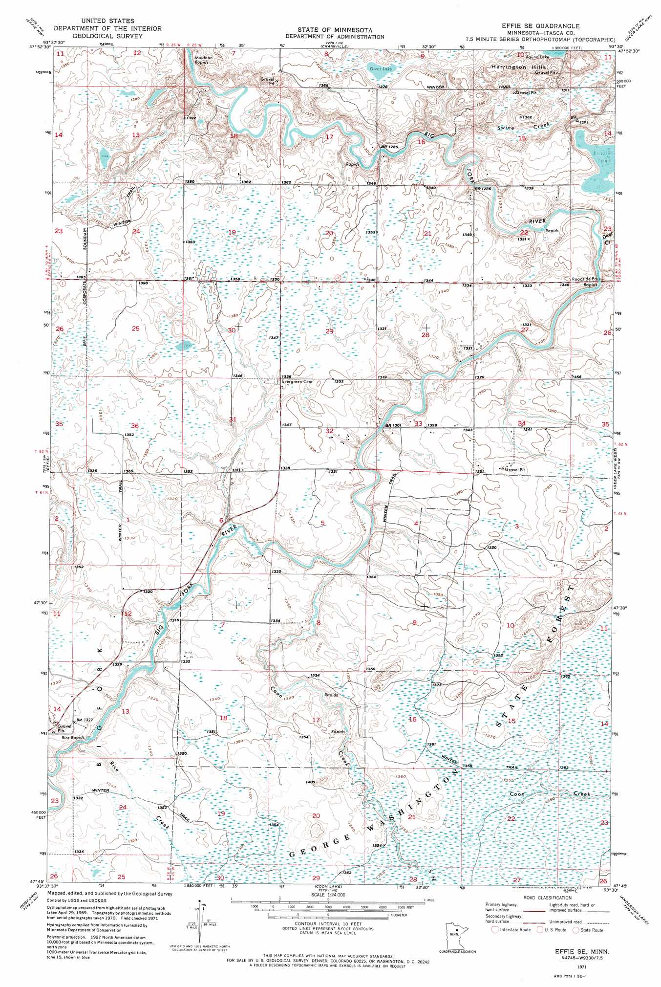
Effie Se Topo Map Minnesota
To zoom in, hover over the map of Effie Se
USGS Topo Quad 47093g5 - 1:24,000 scale
| Topo Map Name: | Effie Se |
| USGS Topo Quad ID: | 47093g5 |
| Print Size: | ca. 21 1/4" wide x 27" high |
| Southeast Coordinates: | 47.75° N latitude / 93.5° W longitude |
| Map Center Coordinates: | 47.8125° N latitude / 93.5625° W longitude |
| U.S. State: | MN |
| Filename: | o47093g5.jpg |
| Download Map JPG Image: | Effie Se topo map 1:24,000 scale |
| Map Type: | Topographic |
| Topo Series: | 7.5´ |
| Map Scale: | 1:24,000 |
| Source of Map Images: | United States Geological Survey (USGS) |
| Alternate Map Versions: |
Effie SE MN 1971, updated 1973 Download PDF Buy paper map Effie SE MN 2010 Download PDF Buy paper map Effie SE MN 2013 Download PDF Buy paper map Effie SE MN 2016 Download PDF Buy paper map |
1:24,000 Topo Quads surrounding Effie Se
Big Falls Se |
Johnson Landing |
Johnson Landing Se |
Nett Lake River Sw |
Nett Lake River Se |
Wildwood Ne |
Effie Nw |
Craigville |
Deer Lake Nw |
Deer Lake Ne |
Wildwood Se |
Effie |
Effie Se |
Deer Lake West |
Deer Lake East |
Spring Lake |
Bigfork |
Coon Lake |
Anderson Lake |
Horsehead Lake |
Jessie Lake |
Marcell |
Clubhouse Lake |
Balsam Lake |
Hartley Lake |
> Back to 47093e1 at 1:100,000 scale
> Back to 47092a1 at 1:250,000 scale
> Back to U.S. Topo Maps home
Effie Se topo map: Gazetteer
Effie Se: Lakes
Grass Lake elevation 416m 1364′Effie Se: Parks
Big Fork River Wayside Park elevation 399m 1309′Effie Se: Ranges
Harrington Hills elevation 427m 1400′Effie Se: Rapids
Rice Rapids elevation 396m 1299′Effie Se: Streams
Coon Creek elevation 395m 1295′Deer Creek elevation 393m 1289′
Rice Creek elevation 397m 1302′
South Fork Coon Creek elevation 413m 1354′
Swine Creek elevation 391m 1282′
Effie Se digital topo map on disk
Buy this Effie Se topo map showing relief, roads, GPS coordinates and other geographical features, as a high-resolution digital map file on DVD: