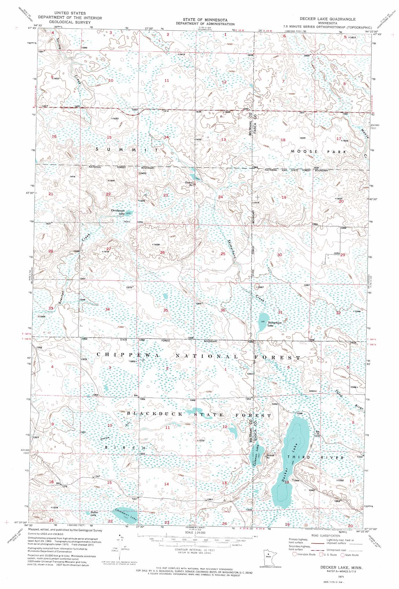
Decker Lake Topo Map Minnesota
To zoom in, hover over the map of Decker Lake
USGS Topo Quad 47094f4 - 1:24,000 scale
| Topo Map Name: | Decker Lake |
| USGS Topo Quad ID: | 47094f4 |
| Print Size: | ca. 21 1/4" wide x 27" high |
| Southeast Coordinates: | 47.625° N latitude / 94.375° W longitude |
| Map Center Coordinates: | 47.6875° N latitude / 94.4375° W longitude |
| U.S. State: | MN |
| Filename: | p47094f4.jpg |
| Download Map JPG Image: | Decker Lake topo map 1:24,000 scale |
| Map Type: | Orthophoto |
| Topo Series: | 7.5´ |
| Map Scale: | 1:24,000 |
| Source of Map Images: | United States Geological Survey (USGS) |
| Alternate Map Versions: |
Decker Lake MN 1971, updated 1974 Download PDF Buy paper map Decker Lake MN 1996, updated 1998 Download PDF Buy paper map Decker Lake MN 2011 Download PDF Buy paper map Decker Lake MN 2013 Download PDF Buy paper map Decker Lake MN 2016 Download PDF Buy paper map |
| FStopo: | US Forest Service topo Decker Lake is available: Download FStopo PDF Download FStopo TIF |
1:24,000 Topo Quads surrounding Decker Lake
Saum |
Saum Ne |
Kelliher |
Northome North |
Mizpah |
O'Brien Lookout Tower |
Borden Lake |
Funkley |
Northome South |
Elmwood Island |
Tenstrike |
Blackduck |
Decker Lake |
Alvwood |
Squaw Lake |
Turtle River Lake |
Pimushe Lake |
Gimmer Lake |
Dixon Lake |
Pigeon Dam Lake |
Andrusia Lake |
Cass Lake |
Pennington |
Raven Lake |
Bena Nw |
> Back to 47094e1 at 1:100,000 scale
> Back to 47094a1 at 1:250,000 scale
> Back to U.S. Topo Maps home
Decker Lake topo map: Gazetteer
Decker Lake: Forests
Blackduck State Forest elevation 416m 1364′Decker Lake: Lakes
Chinaman Lake elevation 413m 1354′Christenson Lake elevation 418m 1371′
Coleman Lake elevation 409m 1341′
Decker Lake elevation 403m 1322′
Dollar Lake elevation 414m 1358′
Skimerhorn Lake elevation 406m 1332′
Decker Lake: Streams
Skimerhorn Creek elevation 406m 1332′Decker Lake digital topo map on disk
Buy this Decker Lake topo map showing relief, roads, GPS coordinates and other geographical features, as a high-resolution digital map file on DVD: