Tenstrike Topo Map Minnesota
To zoom in, hover over the map of Tenstrike
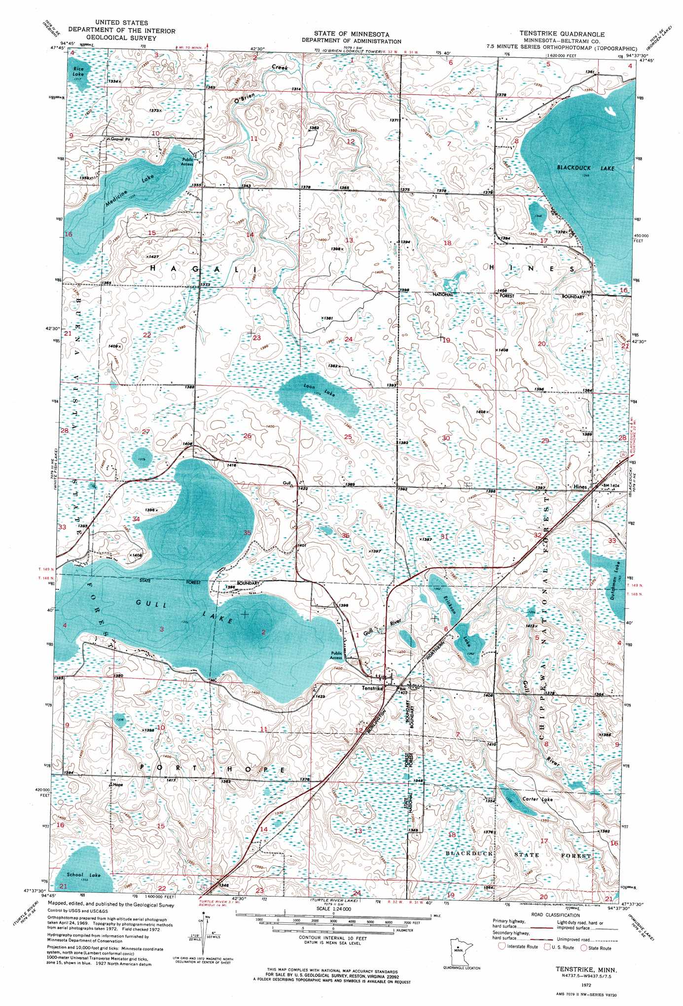
USGS Topo Quad 47094f6 - 1:24,000 scale
| Topo Map Name: | Tenstrike |
| USGS Topo Quad ID: | 47094f6 |
| Print Size: | ca. 21 1/4" wide x 27" high |
| Southeast Coordinates: | 47.625° N latitude / 94.625° W longitude |
| Map Center Coordinates: | 47.6875° N latitude / 94.6875° W longitude |
| U.S. State: | MN |
| Filename: | p47094f6.jpg |
| Download Map JPG Image: | Tenstrike topo map 1:24,000 scale |
| Map Type: | Orthophoto |
| Topo Series: | 7.5´ |
| Map Scale: | 1:24,000 |
| Source of Map Images: | United States Geological Survey (USGS) |
| Alternate Map Versions: |
Tenstrike MN 1972, updated 1974 Download PDF Buy paper map Tenstrike MN 1996, updated 1998 Download PDF Buy paper map Tenstrike MN 2011 Download PDF Buy paper map Tenstrike MN 2013 Download PDF Buy paper map Tenstrike MN 2016 Download PDF Buy paper map |
| FStopo: | US Forest Service topo Tenstrike is available: Download FStopo PDF Download FStopo TIF |
1:24,000 Topo Quads surrounding Tenstrike
Redby Ne |
Saum |
Saum Ne |
Kelliher |
|
Redby |
Nebish |
O'Brien Lookout Tower |
Borden Lake |
Funkley |
Puposky Lake |
White Fish Lake |
Tenstrike |
Blackduck |
Decker Lake |
Peterson Lake |
Turtle River |
Turtle River Lake |
Pimushe Lake |
Gimmer Lake |
Bemidji West |
Bemidji East |
Andrusia Lake |
Cass Lake |
Pennington |
> Back to 47094e1 at 1:100,000 scale
> Back to 47094a1 at 1:250,000 scale
> Back to U.S. Topo Maps home
Tenstrike topo map: Gazetteer
Tenstrike: Lakes
Carter Lake elevation 411m 1348′Erickson Lake elevation 415m 1361′
Gull Lake elevation 420m 1377′
Loon Lake elevation 419m 1374′
Medicine Lake elevation 408m 1338′
Rice Lake elevation 402m 1318′
School Lake elevation 412m 1351′
Tenstrike: Populated Places
Hines elevation 429m 1407′North Seventy-One Mobile Home Park elevation 420m 1377′
Tenstrike elevation 435m 1427′
Tenstrike: Post Offices
Hines Post Office elevation 429m 1407′Tenstrike Post Office elevation 435m 1427′
Tenstrike: Trails
Carter Lake Trail elevation 418m 1371′Tenstrike digital topo map on disk
Buy this Tenstrike topo map showing relief, roads, GPS coordinates and other geographical features, as a high-resolution digital map file on DVD: