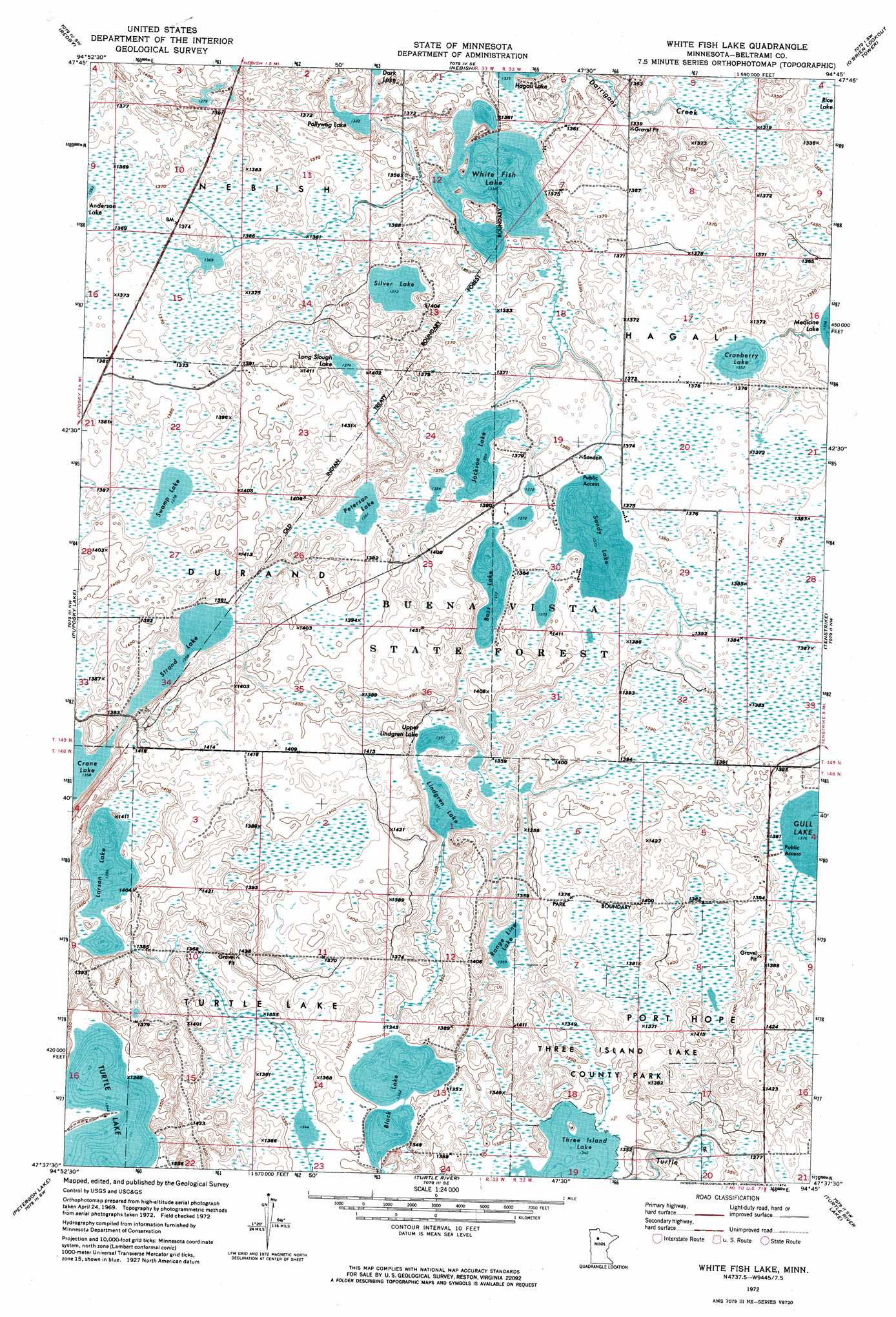
White Fish Lake Topo Map Minnesota
To zoom in, hover over the map of White Fish Lake
USGS Topo Quad 47094f7 - 1:24,000 scale
| Topo Map Name: | White Fish Lake |
| USGS Topo Quad ID: | 47094f7 |
| Print Size: | ca. 21 1/4" wide x 27" high |
| Southeast Coordinates: | 47.625° N latitude / 94.75° W longitude |
| Map Center Coordinates: | 47.6875° N latitude / 94.8125° W longitude |
| U.S. State: | MN |
| Filename: | p47094f7.jpg |
| Download Map JPG Image: | White Fish Lake topo map 1:24,000 scale |
| Map Type: | Orthophoto |
| Topo Series: | 7.5´ |
| Map Scale: | 1:24,000 |
| Source of Map Images: | United States Geological Survey (USGS) |
| Alternate Map Versions: |
White Fish Lake MN 1972, updated 1974 Download PDF Buy paper map White Fish Lake MN 2010 Download PDF Buy paper map White Fish Lake MN 2013 Download PDF Buy paper map White Fish Lake MN 2016 Download PDF Buy paper map |
1:24,000 Topo Quads surrounding White Fish Lake
Redby Ne |
Saum |
Saum Ne |
||
Red Lake |
Redby |
Nebish |
O'Brien Lookout Tower |
Borden Lake |
Aure |
Puposky Lake |
White Fish Lake |
Tenstrike |
Blackduck |
Wilton |
Peterson Lake |
Turtle River |
Turtle River Lake |
Pimushe Lake |
Grant Lake |
Bemidji West |
Bemidji East |
Andrusia Lake |
Cass Lake |
> Back to 47094e1 at 1:100,000 scale
> Back to 47094a1 at 1:250,000 scale
> Back to U.S. Topo Maps home
White Fish Lake topo map: Gazetteer
White Fish Lake: Lakes
Bass Lake elevation 419m 1374′Black Lake elevation 409m 1341′
Cranberry Lake elevation 412m 1351′
Jackson Lake elevation 413m 1354′
Larson Lake elevation 422m 1384′
Lindgren Lake elevation 412m 1351′
Long Slough Lake elevation 421m 1381′
Peterson Lake elevation 415m 1361′
Pollywog Lake elevation 404m 1325′
Range Line Lake elevation 415m 1361′
Sandy Lake elevation 418m 1371′
Silver Lake elevation 419m 1374′
Strand Lake elevation 415m 1361′
Swamp Lake elevation 420m 1377′
Upper Lindgren Lake elevation 412m 1351′
White Fish Lake elevation 408m 1338′
White Fish Lake: Parks
Three Island Lake County Park elevation 412m 1351′White Fish Lake digital topo map on disk
Buy this White Fish Lake topo map showing relief, roads, GPS coordinates and other geographical features, as a high-resolution digital map file on DVD: