Tuttle Topo Map North Dakota
To zoom in, hover over the map of Tuttle
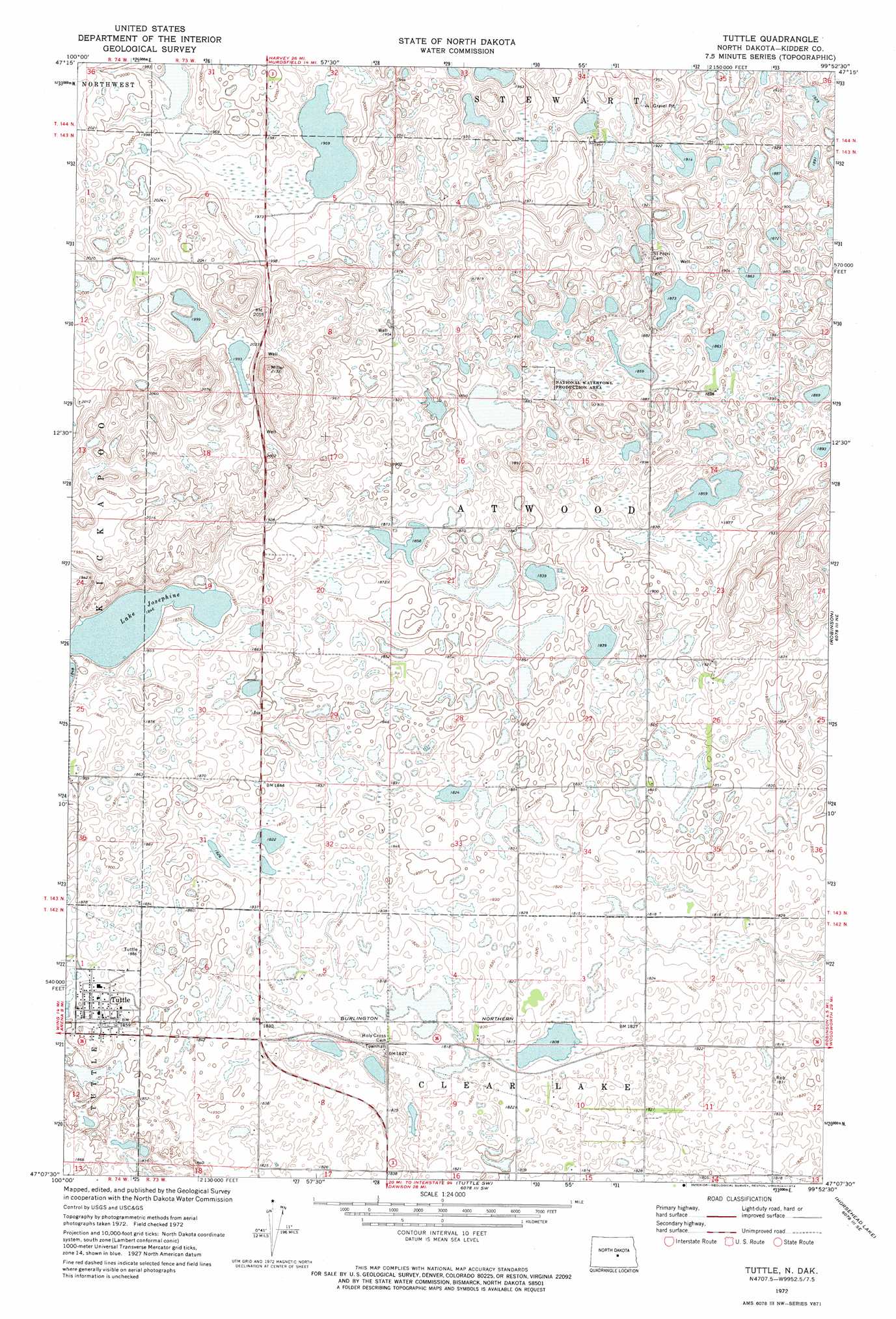
USGS Topo Quad 47099b8 - 1:24,000 scale
| Topo Map Name: | Tuttle |
| USGS Topo Quad ID: | 47099b8 |
| Print Size: | ca. 21 1/4" wide x 27" high |
| Southeast Coordinates: | 47.125° N latitude / 99.875° W longitude |
| Map Center Coordinates: | 47.1875° N latitude / 99.9375° W longitude |
| U.S. State: | ND |
| Filename: | O47099B8.jpg |
| Download Map JPG Image: | Tuttle topo map 1:24,000 scale |
| Map Type: | Topographic |
| Topo Series: | 7.5´ |
| Map Scale: | 1:24,000 |
| Source of Map Images: | United States Geological Survey (USGS) |
| Alternate Map Versions: |
Tuttle ND 1972, updated 1974 Download PDF Buy paper map Tuttle ND 2011 Download PDF Buy paper map Tuttle ND 2014 Download PDF Buy paper map |
1:24,000 Topo Quads surrounding Tuttle
Goodrich West |
Goodrich East |
Hurdsfield |
Chaseley |
Bowden |
Goodrich Sw |
Woodhouse Lake |
Senior Lake |
Willow Lake |
Wagon Wheel Hill |
Arena |
Lake Helen |
Tuttle |
Robinson |
Des Moines Lake |
Harriet Lake |
Harriet Lake Se |
Tuttle Sw |
Horsehead Lake |
Kunkel Lake |
Clear Lake |
Stony Slough |
Steele Nw |
Steele Ne |
Tappen North |
> Back to 47099a1 at 1:100,000 scale
> Back to 47098a1 at 1:250,000 scale
> Back to U.S. Topo Maps home
Tuttle topo map: Gazetteer
Tuttle: Dams
Atwood Dam elevation 563m 1847′Tuttle: Populated Places
Tuttle elevation 567m 1860′Tuttle digital topo map on disk
Buy this Tuttle topo map showing relief, roads, GPS coordinates and other geographical features, as a high-resolution digital map file on DVD:
Eastern North Dakota & Eastern South Dakota
Buy digital topo maps: Eastern North Dakota & Eastern South Dakota