Stanton Topo Map North Dakota
To zoom in, hover over the map of Stanton
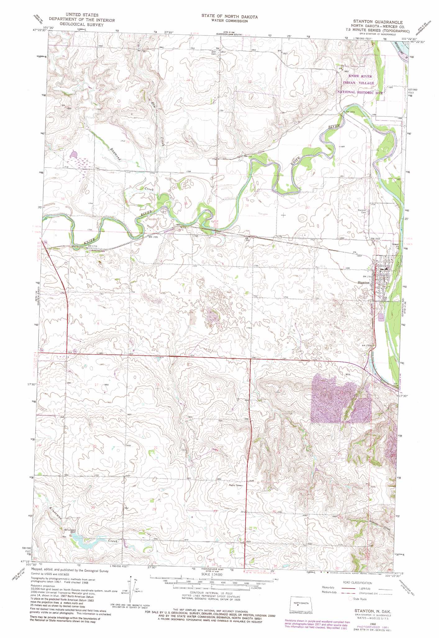
USGS Topo Quad 47101c4 - 1:24,000 scale
| Topo Map Name: | Stanton |
| USGS Topo Quad ID: | 47101c4 |
| Print Size: | ca. 21 1/4" wide x 27" high |
| Southeast Coordinates: | 47.25° N latitude / 101.375° W longitude |
| Map Center Coordinates: | 47.3125° N latitude / 101.4375° W longitude |
| U.S. State: | ND |
| Filename: | O47101C4.jpg |
| Download Map JPG Image: | Stanton topo map 1:24,000 scale |
| Map Type: | Topographic |
| Topo Series: | 7.5´ |
| Map Scale: | 1:24,000 |
| Source of Map Images: | United States Geological Survey (USGS) |
| Alternate Map Versions: |
Stanton ND 1968, updated 1969 Download PDF Buy paper map Stanton ND 1968, updated 1981 Download PDF Buy paper map Stanton ND 2011 Download PDF Buy paper map Stanton ND 2014 Download PDF Buy paper map |
1:24,000 Topo Quads surrounding Stanton
Emmet Sw |
Emmet Se |
Garrison Dam North |
Riverdale North |
Coleharbor |
Hazen Nw |
Hazen Ne |
Garrison Dam South |
Riverdale South |
Underwood |
Hazen West |
Hazen East |
Stanton |
Stanton Se |
Washburn Sw |
Red Butte Nw |
Red Butte |
Hannover Nw |
Hannover Ne |
Fort Clark |
Red Butte Sw |
Otter Creek |
Hannover |
Center |
Nelson Lake |
> Back to 47101a1 at 1:100,000 scale
> Back to 47100a1 at 1:250,000 scale
> Back to U.S. Topo Maps home
Stanton topo map: Gazetteer
Stanton: Dams
Arrowhead Dam elevation 581m 1906′Stanton: Parks
Knife River Indian Villages National Historic Site elevation 509m 1669′Stanton: Populated Places
Stanton elevation 519m 1702′Stanton: Streams
Elm Creek elevation 516m 1692′Raymond Creek elevation 514m 1686′
Stanton digital topo map on disk
Buy this Stanton topo map showing relief, roads, GPS coordinates and other geographical features, as a high-resolution digital map file on DVD:
Eastern North Dakota & Eastern South Dakota
Buy digital topo maps: Eastern North Dakota & Eastern South Dakota