Barker Canyon Topo Map Washington
To zoom in, hover over the map of Barker Canyon
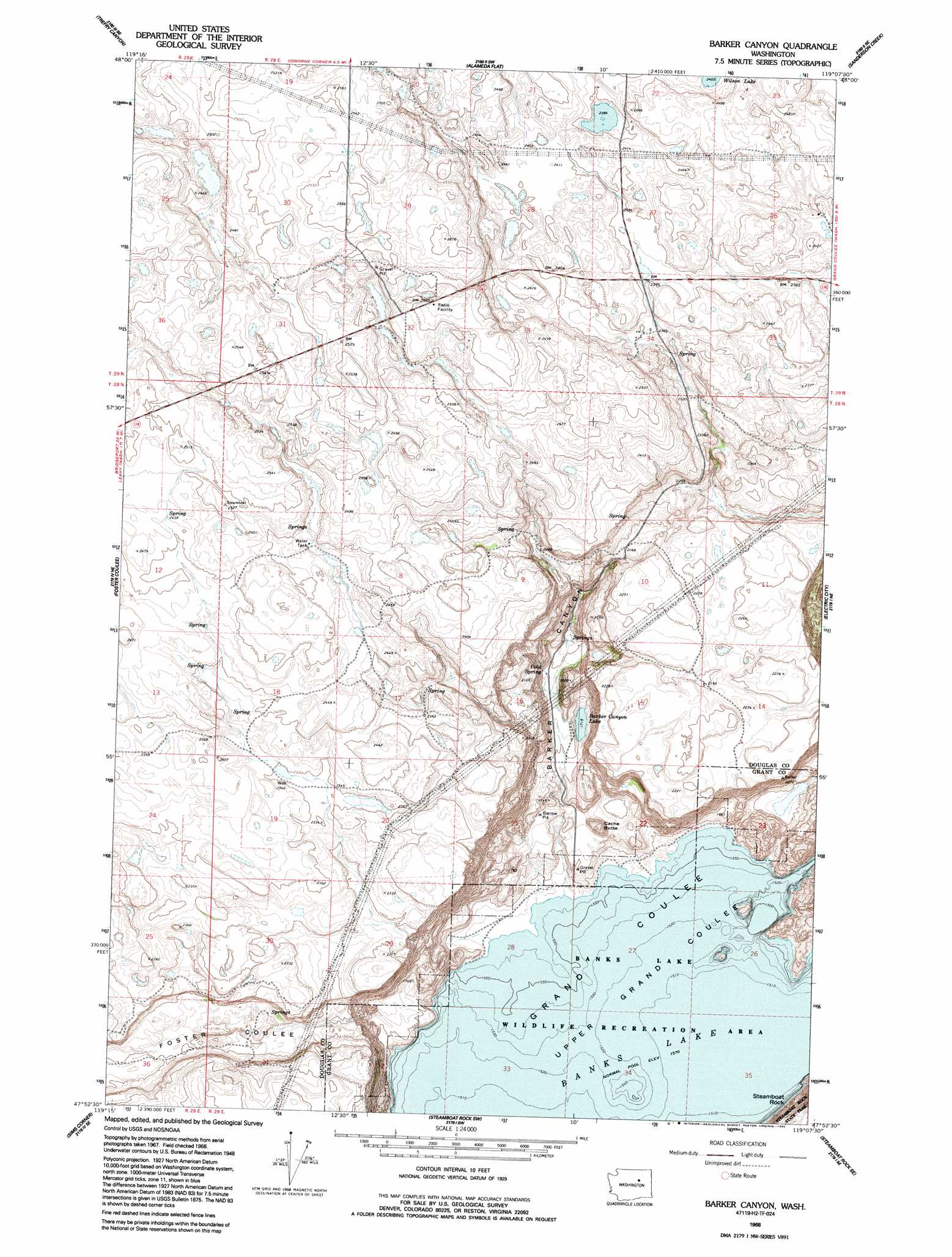
USGS Topo Quad 47119h2 - 1:24,000 scale
| Topo Map Name: | Barker Canyon |
| USGS Topo Quad ID: | 47119h2 |
| Print Size: | ca. 21 1/4" wide x 27" high |
| Southeast Coordinates: | 47.875° N latitude / 119.125° W longitude |
| Map Center Coordinates: | 47.9375° N latitude / 119.1875° W longitude |
| U.S. State: | WA |
| Filename: | o47119h2.jpg |
| Download Map JPG Image: | Barker Canyon topo map 1:24,000 scale |
| Map Type: | Topographic |
| Topo Series: | 7.5´ |
| Map Scale: | 1:24,000 |
| Source of Map Images: | United States Geological Survey (USGS) |
| Alternate Map Versions: |
Barker Canyon WA 1968, updated 1971 Download PDF Buy paper map Barker Canyon WA 1968, updated 1992 Download PDF Buy paper map Barker Canyon WA 2011 Download PDF Buy paper map Barker Canyon WA 2014 Download PDF Buy paper map |
1:24,000 Topo Quads surrounding Barker Canyon
Joe Lake |
Boot Mountain |
Hopkins Canyon |
Armstrong Creek |
Nespelem |
Stubblefield Point |
Trefry Canyon |
Alameda Flat |
Sanderson Creek |
Belvedere |
Leahy |
Foster Coulee |
Barker Canyon |
Electric City |
Grand Coulee Dam |
Barnes Butte |
Sims Corner |
Steamboat Rock West |
Steamboat Rock East |
Jack Woods Butte |
Saint Andrews |
Mold |
Hartline Nw |
Hartline |
Almira |
> Back to 47119e1 at 1:100,000 scale
> Back to 47118a1 at 1:250,000 scale
> Back to U.S. Topo Maps home
Barker Canyon topo map: Gazetteer
Barker Canyon: Lakes
Barker Canyon Lake elevation 527m 1729′Barker Canyon: Summits
Barker Butte elevation 687m 2253′Cache Butte elevation 548m 1797′
Steamboat Butte elevation 771m 2529′
Barker Canyon: Valleys
Barker Canyon elevation 480m 1574′Barker Canyon digital topo map on disk
Buy this Barker Canyon topo map showing relief, roads, GPS coordinates and other geographical features, as a high-resolution digital map file on DVD: