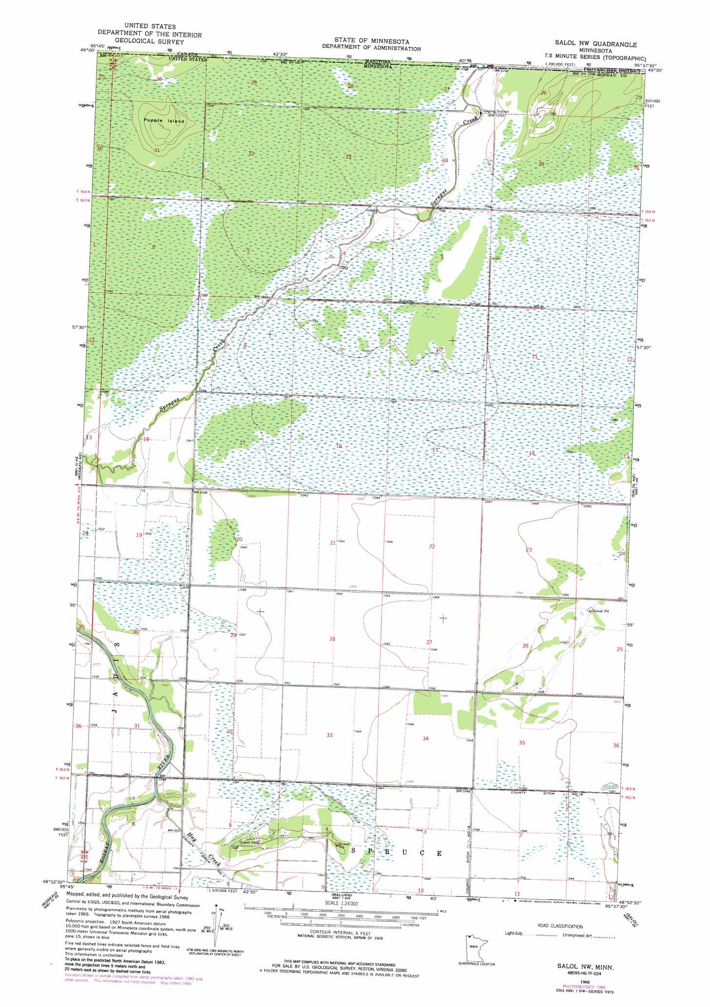
Salol Nw Topo Map Minnesota
To zoom in, hover over the map of Salol Nw
USGS Topo Quad 48095h6 - 1:24,000 scale
| Topo Map Name: | Salol Nw |
| USGS Topo Quad ID: | 48095h6 |
| Print Size: | ca. 21 1/4" wide x 27" high |
| Southeast Coordinates: | 48.875° N latitude / 95.625° W longitude |
| Map Center Coordinates: | 48.9375° N latitude / 95.6875° W longitude |
| U.S. State: | MN |
| Filename: | o48095h6.jpg |
| Download Map JPG Image: | Salol Nw topo map 1:24,000 scale |
| Map Type: | Topographic |
| Topo Series: | 7.5´ |
| Map Scale: | 1:24,000 |
| Source of Map Images: | United States Geological Survey (USGS) |
| Alternate Map Versions: |
Salol NW MN 1966, updated 1968 Download PDF Buy paper map Salol NW MN 1966, updated 1984 Download PDF Buy paper map Salol NW MN 2010 Download PDF Buy paper map Salol NW MN 2013 Download PDF Buy paper map Salol NW MN 2016 Download PDF Buy paper map |
1:24,000 Topo Quads surrounding Salol Nw
Pinecreek |
Roseau Ne |
Salol Nw |
Salol Ne |
Warroad Nw |
Fox |
Roseau |
Malung |
Salol |
Warroad Sw |
Thief Lake Nw |
Thief Lake Ne |
Wannaska |
Wannaska Ne |
Mulligan Lake Nw |
> Back to 48095e1 at 1:100,000 scale
> Back to 48094a1 at 1:250,000 scale
> Back to U.S. Topo Maps home
Salol Nw topo map: Gazetteer
Salol Nw: Forests
Lost River State Forest elevation 323m 1059′Salol Nw: Islands
Popple Island elevation 327m 1072′Salol Nw: Streams
Hay Creek elevation 315m 1033′Salol Nw digital topo map on disk
Buy this Salol Nw topo map showing relief, roads, GPS coordinates and other geographical features, as a high-resolution digital map file on DVD: