Williston East Topo Map North Dakota
To zoom in, hover over the map of Williston East
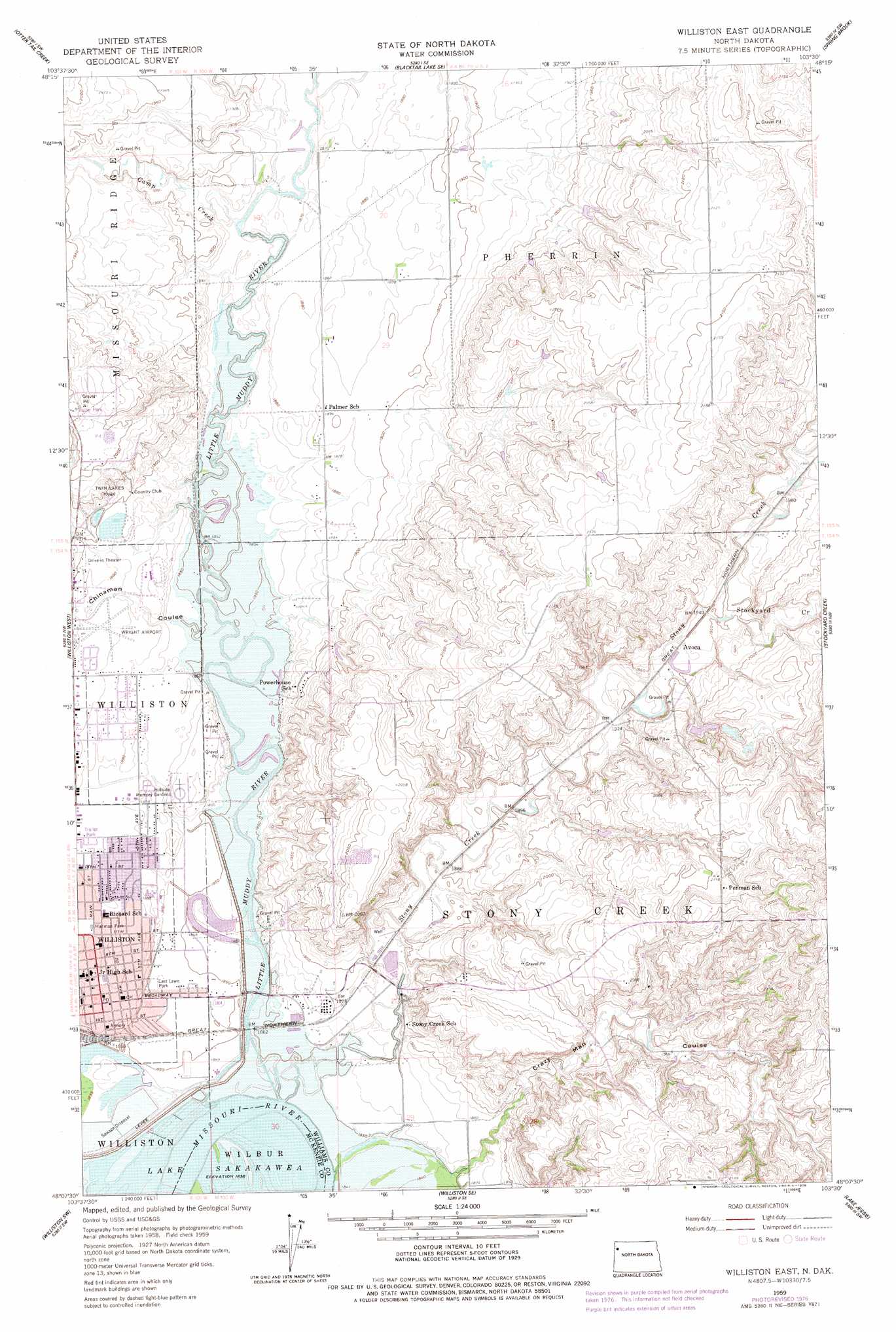
USGS Topo Quad 48103b5 - 1:24,000 scale
| Topo Map Name: | Williston East |
| USGS Topo Quad ID: | 48103b5 |
| Print Size: | ca. 21 1/4" wide x 27" high |
| Southeast Coordinates: | 48.125° N latitude / 103.5° W longitude |
| Map Center Coordinates: | 48.1875° N latitude / 103.5625° W longitude |
| U.S. State: | ND |
| Filename: | O48103B5.jpg |
| Download Map JPG Image: | Williston East topo map 1:24,000 scale |
| Map Type: | Topographic |
| Topo Series: | 7.5´ |
| Map Scale: | 1:24,000 |
| Source of Map Images: | United States Geological Survey (USGS) |
| Alternate Map Versions: |
Williston East ND 1959, updated 1960 Download PDF Buy paper map Williston East ND 1959, updated 1978 Download PDF Buy paper map Williston East ND 2011 Download PDF Buy paper map Williston East ND 2014 Download PDF Buy paper map |
1:24,000 Topo Quads surrounding Williston East
Bonetraill |
Blacktail Lake |
Twin Lakes |
Epping Nw |
Epping Ne |
Bonetraill Se |
Otter Tail Creek |
Blacktail Lake Se |
Spring Brook |
Epping |
Trenton Ne |
Williston West |
Williston East |
Stockyard Creek |
Gamache Creek |
Trenton |
Williston Sw |
Williston Se |
Lake Jessie |
Chris Creek |
Cartwright Ne |
Camp Creek West |
Camp Creek East |
Watford City Nw |
Watford City Ne |
> Back to 48103a1 at 1:100,000 scale
> Back to 48102a1 at 1:250,000 scale
> Back to U.S. Topo Maps home
Williston East topo map: Gazetteer
Williston East: Airports
Wright Field elevation 575m 1886′Williston East: Parks
East Lawn Park elevation 567m 1860′Harmon Park elevation 574m 1883′
Twin Lakes Park elevation 591m 1938′
Williston East: Populated Places
Avoca elevation 592m 1942′Williston elevation 572m 1876′
Williston East: Streams
Camp Creek elevation 567m 1860′Little Muddy River elevation 560m 1837′
Stockyard Creek elevation 591m 1938′
Stony Creek elevation 562m 1843′
Williston East: Valleys
Chinaman Coulee elevation 562m 1843′Crazy Man Coulee elevation 564m 1850′
Williston East digital topo map on disk
Buy this Williston East topo map showing relief, roads, GPS coordinates and other geographical features, as a high-resolution digital map file on DVD:
Eastern Montana & Western North Dakota
Buy digital topo maps: Eastern Montana & Western North Dakota