Bonetraill Se Topo Map North Dakota
To zoom in, hover over the map of Bonetraill Se
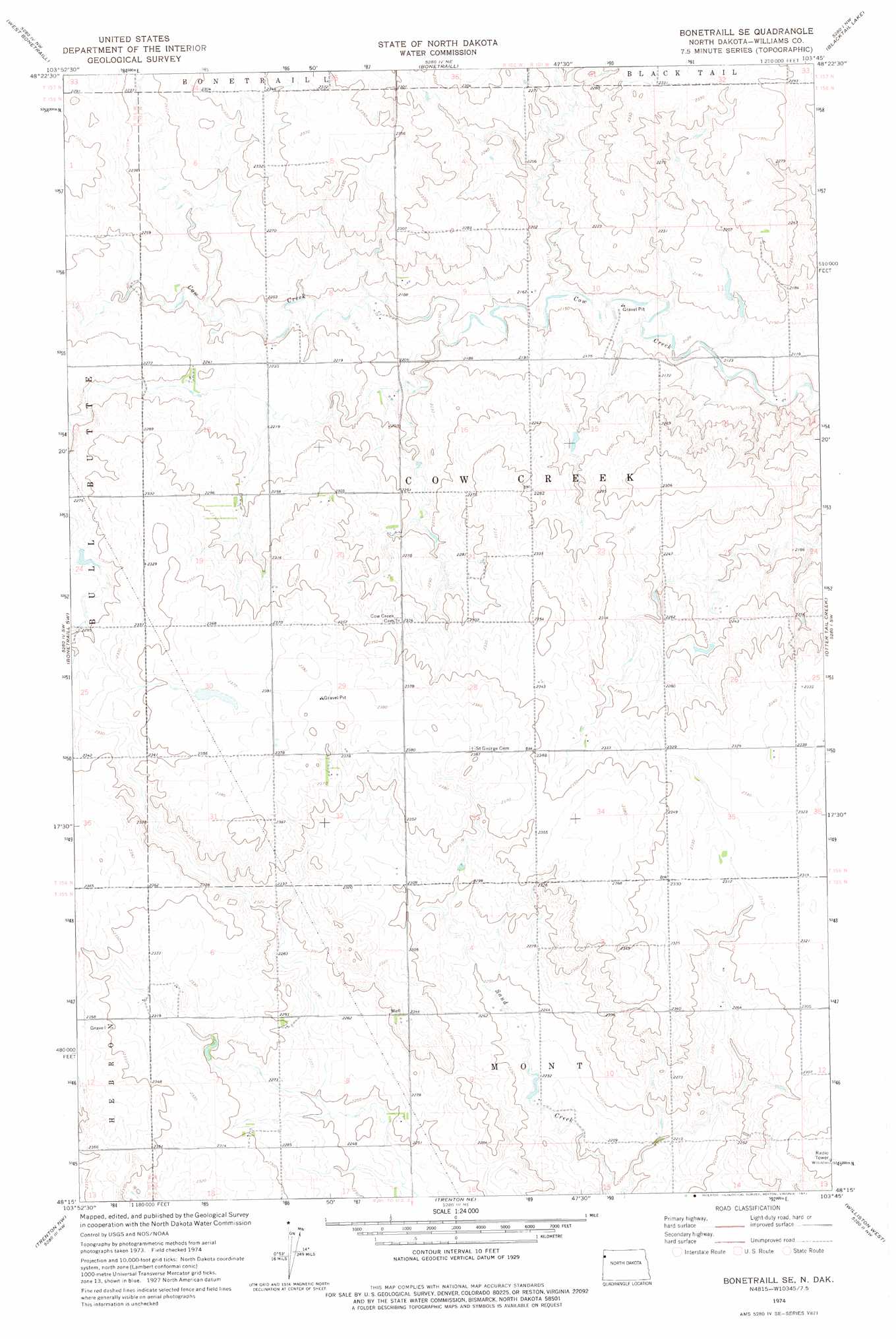
USGS Topo Quad 48103c7 - 1:24,000 scale
| Topo Map Name: | Bonetraill Se |
| USGS Topo Quad ID: | 48103c7 |
| Print Size: | ca. 21 1/4" wide x 27" high |
| Southeast Coordinates: | 48.25° N latitude / 103.75° W longitude |
| Map Center Coordinates: | 48.3125° N latitude / 103.8125° W longitude |
| U.S. State: | ND |
| Filename: | O48103C7.jpg |
| Download Map JPG Image: | Bonetraill Se topo map 1:24,000 scale |
| Map Type: | Topographic |
| Topo Series: | 7.5´ |
| Map Scale: | 1:24,000 |
| Source of Map Images: | United States Geological Survey (USGS) |
| Alternate Map Versions: |
Bonetraill SE ND 1974, updated 1977 Download PDF Buy paper map Bonetraill SE ND 2011 Download PDF Buy paper map Bonetraill SE ND 2014 Download PDF Buy paper map |
1:24,000 Topo Quads surrounding Bonetraill Se
Brush Lake |
Grenora |
Hanks |
Zahl |
Appam |
Brush Mountain |
West Bonetraill |
Bonetraill |
Blacktail Lake |
Twin Lakes |
Bull Butte |
Bonetraill Sw |
Bonetraill Se |
Otter Tail Creek |
Blacktail Lake Se |
Red Bank Creek |
Trenton Nw |
Trenton Ne |
Williston West |
Williston East |
Bainville Se |
Trenton Sw |
Trenton |
Williston Sw |
Williston Se |
> Back to 48103a1 at 1:100,000 scale
> Back to 48102a1 at 1:250,000 scale
> Back to U.S. Topo Maps home
No gazetteer data is available for the Bonetraill Se topo map sheet.
Bonetraill Se digital topo map on disk
Buy this Bonetraill Se topo map showing relief, roads, GPS coordinates and other geographical features, as a high-resolution digital map file on DVD:
Eastern Montana & Western North Dakota
Buy digital topo maps: Eastern Montana & Western North Dakota