Laundry Hill Topo Map Montana
To zoom in, hover over the map of Laundry Hill
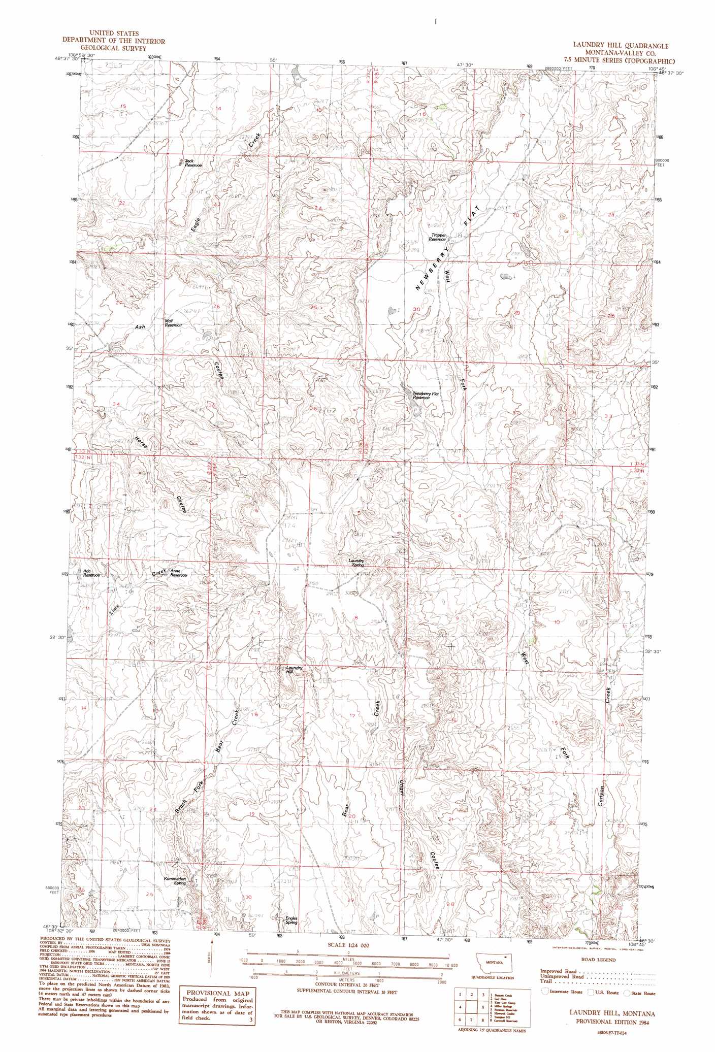
USGS Topo Quad 48106e7 - 1:24,000 scale
| Topo Map Name: | Laundry Hill |
| USGS Topo Quad ID: | 48106e7 |
| Print Size: | ca. 21 1/4" wide x 27" high |
| Southeast Coordinates: | 48.5° N latitude / 106.75° W longitude |
| Map Center Coordinates: | 48.5625° N latitude / 106.8125° W longitude |
| U.S. State: | MT |
| Filename: | o48106e7.jpg |
| Download Map JPG Image: | Laundry Hill topo map 1:24,000 scale |
| Map Type: | Topographic |
| Topo Series: | 7.5´ |
| Map Scale: | 1:24,000 |
| Source of Map Images: | United States Geological Survey (USGS) |
| Alternate Map Versions: |
Laundry Hill MT 1984, updated 1984 Download PDF Buy paper map Laundry Hill MT 2011 Download PDF Buy paper map Laundry Hill MT 2014 Download PDF Buy paper map |
1:24,000 Topo Quads surrounding Laundry Hill
Snake Creek School |
Antelope Pass |
Last Chance Res. |
Dodge Reservoir |
O'Juel Lake |
Papoose Hills |
Burnett Creek |
Gay Dam |
Kerr Cow Camp |
Wards Dam |
Jones Coulee |
Miller Springs |
Laundry Hill |
Forsman Reservoir |
Dry Fork Creek |
Hinsdale |
Ellsworth Coulee |
Tampico Ne |
Cornwell Reservoir |
Chapman Coulee Ne |
Hinsdale Se |
Vandalia |
Tampico |
Chapman Coulee |
Hawk Coulee |
> Back to 48106e1 at 1:100,000 scale
> Back to 48106a1 at 1:250,000 scale
> Back to U.S. Topo Maps home
Laundry Hill topo map: Gazetteer
Laundry Hill: Dams
Vr 64 Dam elevation 806m 2644′Laundry Hill: Flats
Newberry Flat elevation 866m 2841′Laundry Hill: Reservoirs
Ada Reservoir elevation 806m 2644′Anna Reservoir elevation 826m 2709′
Jack Reservoir elevation 793m 2601′
Mail Reservoir elevation 800m 2624′
Newberry Flat Reservoir elevation 845m 2772′
Trapper Reservoir elevation 861m 2824′
Laundry Hill: Springs
Engles Spring elevation 826m 2709′Kummerfort Spring elevation 826m 2709′
Laundry Spring elevation 894m 2933′
Laundry Hill: Streams
West Fork Canyon Creek elevation 787m 2582′Laundry Hill: Summits
Laundry Hill elevation 906m 2972′Laundry Hill digital topo map on disk
Buy this Laundry Hill topo map showing relief, roads, GPS coordinates and other geographical features, as a high-resolution digital map file on DVD:
Eastern Montana & Western North Dakota
Buy digital topo maps: Eastern Montana & Western North Dakota