Last Chance Res. Topo Map Montana
To zoom in, hover over the map of Last Chance Res.
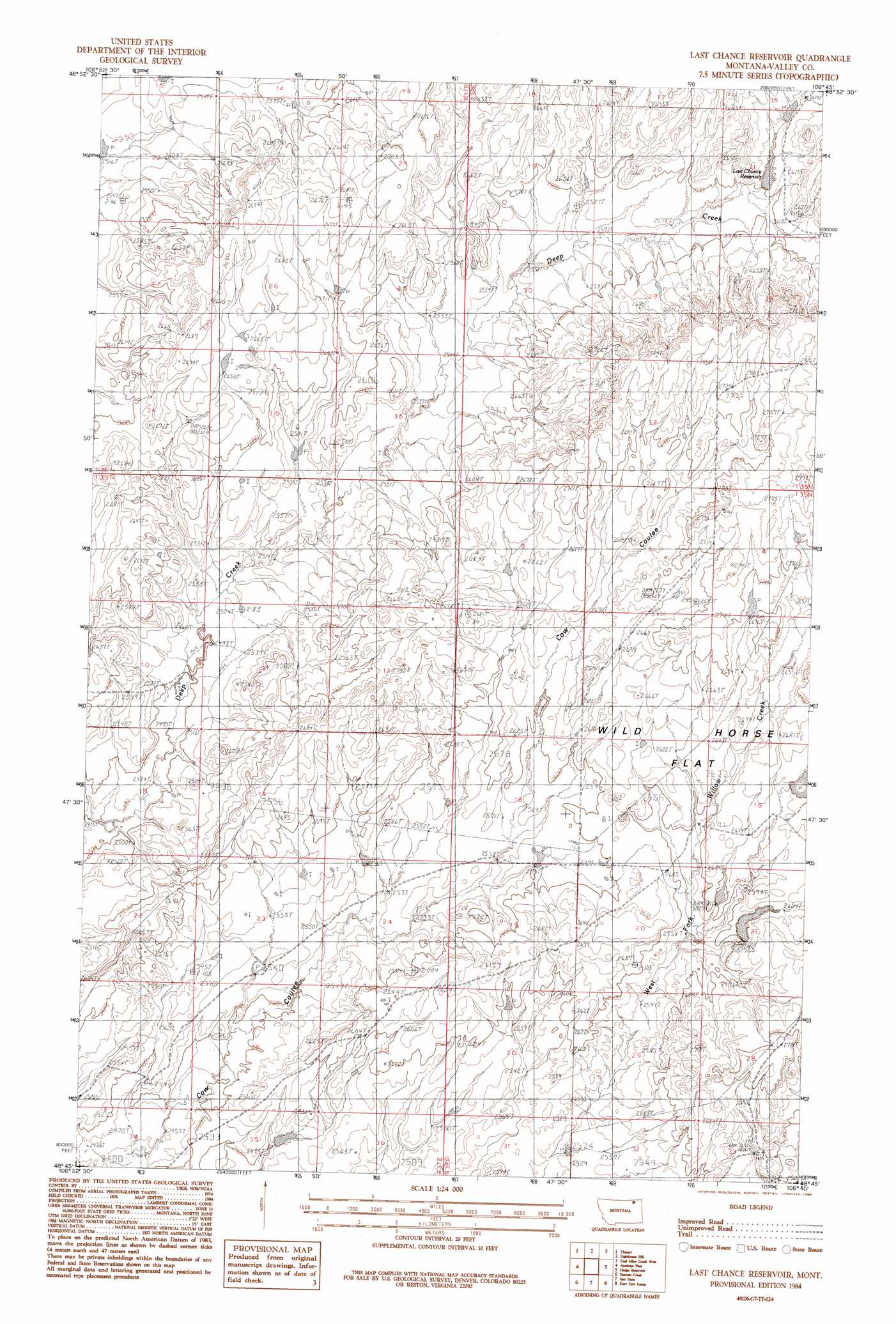
USGS Topo Quad 48106g7 - 1:24,000 scale
| Topo Map Name: | Last Chance Res. |
| USGS Topo Quad ID: | 48106g7 |
| Print Size: | ca. 21 1/4" wide x 27" high |
| Southeast Coordinates: | 48.75° N latitude / 106.75° W longitude |
| Map Center Coordinates: | 48.8125° N latitude / 106.8125° W longitude |
| U.S. State: | MT |
| Filename: | o48106g7.jpg |
| Download Map JPG Image: | Last Chance Res. topo map 1:24,000 scale |
| Map Type: | Topographic |
| Topo Series: | 7.5´ |
| Map Scale: | 1:24,000 |
| Source of Map Images: | United States Geological Survey (USGS) |
| Alternate Map Versions: |
Last Chance Reservoir MT 1984, updated 1984 Download PDF Buy paper map Last Chance Reservoir MT 2011 Download PDF Buy paper map Last Chance Reservoir MT 2014 Download PDF Buy paper map |
1:24,000 Topo Quads surrounding Last Chance Res.
Black Calf Reservoir |
Thoeny |
Lighthouse Hill |
Coal Mine Creek West |
Coal Mine Creek East |
Snake Creek School |
Antelope Pass |
Last Chance Res. |
Dodge Reservoir |
O'Juel Lake |
Papoose Hills |
Burnett Creek |
Gay Dam |
Kerr Cow Camp |
Wards Dam |
Jones Coulee |
Miller Springs |
Laundry Hill |
Forsman Reservoir |
Dry Fork Creek |
> Back to 48106e1 at 1:100,000 scale
> Back to 48106a1 at 1:250,000 scale
> Back to U.S. Topo Maps home
Last Chance Res. topo map: Gazetteer
Last Chance Res.: Dams
Etchart Dam elevation 802m 2631′Last Chance Res.: Flats
Wild Horse Flat elevation 809m 2654′Last Chance Res.: Post Offices
Tobison Post Office (historical) elevation 808m 2650′Last Chance Res.: Reservoirs
Last Chance Reservoir elevation 793m 2601′Last Chance Res. digital topo map on disk
Buy this Last Chance Res. topo map showing relief, roads, GPS coordinates and other geographical features, as a high-resolution digital map file on DVD:
Eastern Montana & Western North Dakota
Buy digital topo maps: Eastern Montana & Western North Dakota