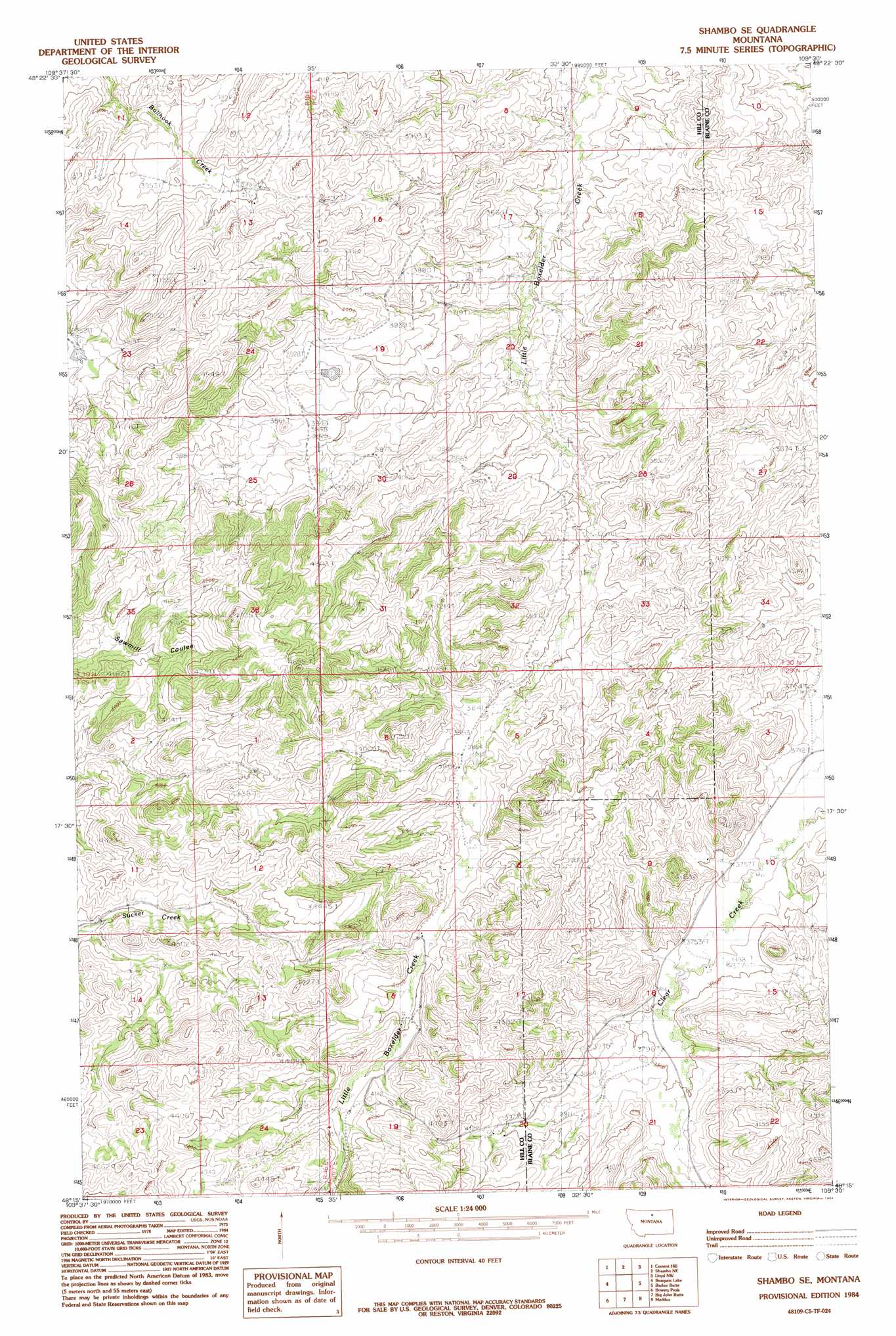
Shambo Se Topo Map Montana
To zoom in, hover over the map of Shambo Se
USGS Topo Quad 48109c5 - 1:24,000 scale
| Topo Map Name: | Shambo Se |
| USGS Topo Quad ID: | 48109c5 |
| Print Size: | ca. 21 1/4" wide x 27" high |
| Southeast Coordinates: | 48.25° N latitude / 109.5° W longitude |
| Map Center Coordinates: | 48.3125° N latitude / 109.5625° W longitude |
| U.S. State: | MT |
| Filename: | o48109c5.jpg |
| Download Map JPG Image: | Shambo Se topo map 1:24,000 scale |
| Map Type: | Topographic |
| Topo Series: | 7.5´ |
| Map Scale: | 1:24,000 |
| Source of Map Images: | United States Geological Survey (USGS) |
| Alternate Map Versions: |
Shambo SE MT 1984, updated 1984 Download PDF Buy paper map Shambo SE MT 2011 Download PDF Buy paper map Shambo SE MT 2014 Download PDF Buy paper map |
1:24,000 Topo Quads surrounding Shambo Se
Herron Park |
Havre |
Havre Se |
Lohman |
Lohman Se |
Laredo Ne |
Cement Hill |
Shambo Ne |
Lloyd Nw |
Sayer Butte |
Rocky Boy |
Bearpaw Lake |
Shambo Se |
Barber Butte |
Lloyd |
Centennial Mountain |
Bowery Peak |
Big John Butte |
Maddux |
Corrigan Mountain |
Ryan Butte |
Tiger Butte |
Warrick |
Blue Stone Peak |
Williamson Butte |
> Back to 48109a1 at 1:100,000 scale
> Back to 48108a1 at 1:250,000 scale
> Back to U.S. Topo Maps home
Shambo Se topo map: Gazetteer
Shambo Se: Streams
Upper Rocky Hock Creek elevation 1177m 3861′Shambo Se: Valleys
Henrys Basin Coulee elevation 1097m 3599′War Bonnet Coulee elevation 1096m 3595′
Shambo Se digital topo map on disk
Buy this Shambo Se topo map showing relief, roads, GPS coordinates and other geographical features, as a high-resolution digital map file on DVD: