Joplin Topo Map Missouri
To zoom in, hover over the map of Joplin
USGS Topo Map 37094a1 - 1:100,000 scale
| Topo Map Name: | Joplin |
| USGS Topo Quad ID: | 37094a1 |
| Print Size: | ca. 39" wide x 24" high |
| Southeast Coordinates: | 37° N latitude / 94° W longitude |
| Map Center Coordinates: | 37.25° N latitude / 94.5° W longitude |
| U.S. States: | MO, KS |
| Filename: | 37094a1.jpg |
| Download Map JPG Image: | Joplin topo map 1:100,000 scale |
| Map Type: | Topographic |
| Topo Series: | 30´x60´ |
| Map Scale: | 1:100,000 |
| Source of Map Images: | United States Geological Survey (USGS) |
| Alternate Map Versions: |
Joplin MO 1986, updated 1986 Download PDF Buy paper map Joplin MO 1991, updated 1991 Download PDF Buy paper map |
1:100,000 Topos surrounding Joplin
Chanute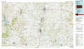 |
Nevada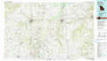 |
Bolivar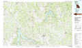 |
Coffeyville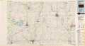 |
Joplin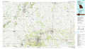 |
Springfield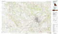 |
Bartlesville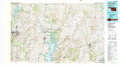 |
Neosho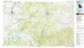 |
Table Rock Lake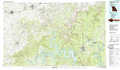 |
> Back to 37094a1 at 1:250,000 scale
> Back to U.S. Topo Maps home
1:24,000 Topo Quads covered by the spatial extent of this 100k map (Joplin)
|
Grindstone Creek 
|
Radley 
|
Pittsburg 
|
Mindenmines 
|
Nashville 
|
Lamar South 
|
Kenoma 
|
Golden City 
|
|
West Mineral 
|
Cherokee 
|
Kirkwood 
|
Asbury 
|
Neck City 
|
Jasper 
|
Maple Grove 
|
Dudenville 
|
|
Hallowell 
|
Columbus 
|
Crestline 
|
Carl Junction 
|
Webb City 
|
Carthage 
|
Avilla 
|
La Russell 
|
|
Melrose 
|
Neutral 
|
Baxter Springs 
|
Joplin West 
|
Joplin East 
|
Fidelity 
|
Reeds 
|
Sarcoxie 
|
