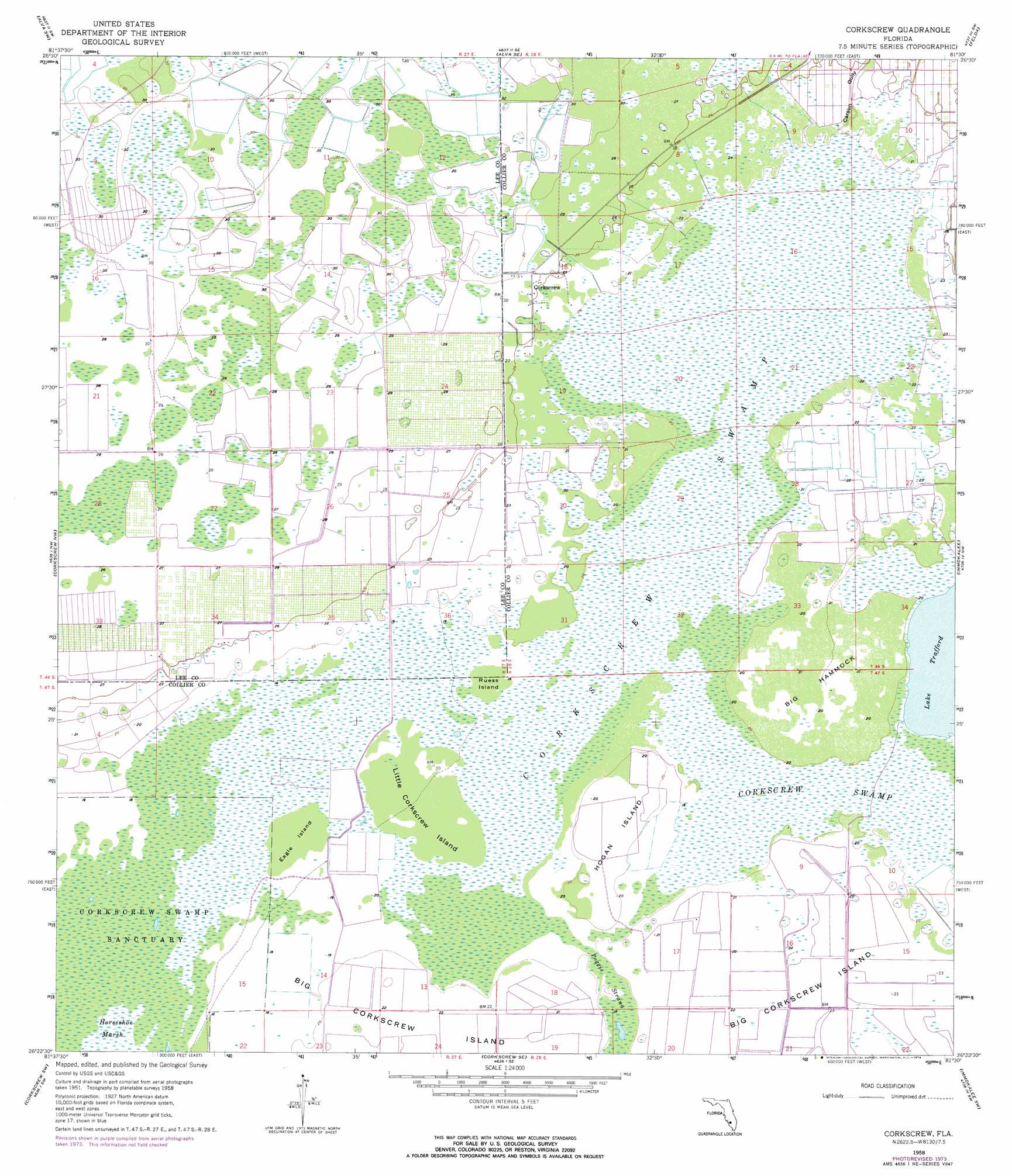
Corkscrew Topo Map Florida
To zoom in, hover over the map of Corkscrew
USGS Topo Quad 26081d5 - 1:24,000 scale
| Topo Map Name: | Corkscrew |
| USGS Topo Quad ID: | 26081d5 |
| Print Size: | ca. 21 1/4" wide x 27" high |
| Southeast Coordinates: | 26.375° N latitude / 81.5° W longitude |
| Map Center Coordinates: | 26.4375° N latitude / 81.5625° W longitude |
| U.S. State: | FL |
| Filename: | O26081D5.jpg |
| Download Map JPG Image: | Corkscrew topo map 1:24,000 scale |
| Map Type: | Topographic |
| Topo Series: | 7.5´ |
| Map Scale: | 1:24,000 |
| Source of Map Images: | United States Geological Survey (USGS) |
| Alternate Map Versions: |
Corkscrew FL 1958, updated 1959 Download PDF Buy paper map Corkscrew FL 1958, updated 1966 Download PDF Buy paper map Corkscrew FL 1958, updated 1974 Download PDF Buy paper map Corkscrew FL 2012 Download PDF Buy paper map Corkscrew FL 2015 Download PDF Buy paper map |
1:24,000 Topo Quads surrounding Corkscrew
Fort Myers |
Olga |
Alva |
Sears |
Felda Ne |
Fort Myers Se |
Alva Sw |
Alva Se |
Felda |
Felda Se |
Estero |
Corkscrew Nw |
Corkscrew |
Immokalee |
Immokalee Ne |
Bonita Springs |
Corkscrew Sw |
Corkscrew Se |
Immokalee Sw |
Sunniland |
Naples North |
Belle Meade Nw |
Belle Meade Ne |
Catherine Island |
Miles City |
> Back to 26081a1 at 1:100,000 scale
> Back to 26080a1 at 1:250,000 scale
> Back to U.S. Topo Maps home
Corkscrew topo map: Gazetteer
Corkscrew: Airports
Corkscrew Trace Airport elevation 8m 26′Corkscrew: Islands
Eagle Island elevation 6m 19′Hogan Island elevation 6m 19′
Little Corkscrew Island elevation 6m 19′
Ruess Island elevation 6m 19′
Corkscrew: Lakes
Big Hammock elevation 6m 19′Corkscrew: Parks
Corkscrew Swamp Sanctuary elevation 5m 16′Corkscrew: Populated Places
Corkscrew elevation 8m 26′Corkscrew: Streams
Carson Gully elevation 6m 19′Corkscrew: Swamps
Corkscrew Swamp elevation 6m 19′Poggie Strand elevation 6m 19′
Corkscrew digital topo map on disk
Buy this Corkscrew topo map showing relief, roads, GPS coordinates and other geographical features, as a high-resolution digital map file on DVD: