Fellsmere 4 Se Topo Map Florida
To zoom in, hover over the map of Fellsmere 4 Se
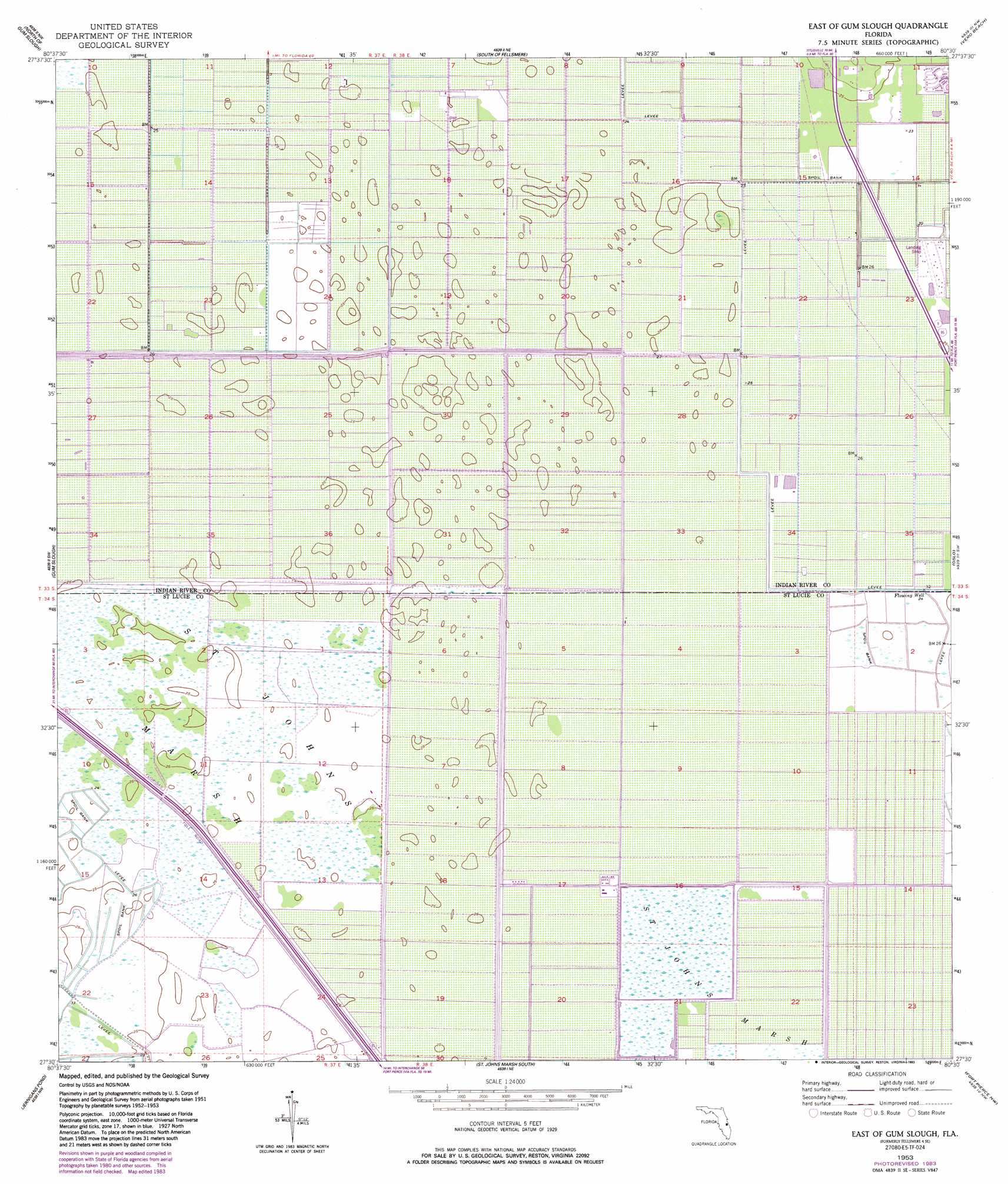
USGS Topo Quad 27080e5 - 1:24,000 scale
| Topo Map Name: | Fellsmere 4 Se |
| USGS Topo Quad ID: | 27080e5 |
| Print Size: | ca. 21 1/4" wide x 27" high |
| Southeast Coordinates: | 27.5° N latitude / 80.5° W longitude |
| Map Center Coordinates: | 27.5625° N latitude / 80.5625° W longitude |
| U.S. State: | FL |
| Filename: | O27080E5.jpg |
| Download Map JPG Image: | Fellsmere 4 Se topo map 1:24,000 scale |
| Map Type: | Topographic |
| Topo Series: | 7.5´ |
| Map Scale: | 1:24,000 |
| Source of Map Images: | United States Geological Survey (USGS) |
| Alternate Map Versions: |
Fellsmere 4 SE FL 1953, updated 1954 Download PDF Buy paper map Fellsmere 4 SE FL 1953, updated 1965 Download PDF Buy paper map Fellsmere 4 SE FL 1953, updated 1971 Download PDF Buy paper map Fellsmere 4 SE FL 1953, updated 1983 Download PDF Buy paper map East of Gum Slough FL 1953, updated 1993 Download PDF Buy paper map East of Gum Slough FL 2012 Download PDF Buy paper map East of Gum Slough FL 2015 Download PDF Buy paper map |
1:24,000 Topo Quads surrounding Fellsmere 4 Se
Kenansville Se |
Fellsmere Sw |
Fellsmere |
Sebastian |
|
Fort Drum Ne |
Fellsmere 4 Nw |
Fellsmere 4 Ne |
Vero Beach |
Riomar |
Fort Drum |
Fellsmere 4 Sw |
Fellsmere 4 Se |
Oslo |
Indrio |
Taylor Creek Ne |
Okeechobee 1 Nw |
Okeechobee 1 Ne |
Fort Pierce Nw |
Fort Pierce |
Taylor Creek Se |
Okeechobee 1 Sw |
Okeechobee 1 Se |
Fort Pierce Sw |
Ankona |
> Back to 27080e1 at 1:100,000 scale
> Back to 27080a1 at 1:250,000 scale
> Back to U.S. Topo Maps home
Fellsmere 4 Se topo map: Gazetteer
Fellsmere 4 Se: Airports
Indian River Aerodrome elevation 6m 19′Marsh Airstrip elevation 7m 22′
Fellsmere 4 Se: Lakes
Pasco Packing Company Lake elevation 8m 26′Swords Pond elevation 7m 22′
Fellsmere 4 Se digital topo map on disk
Buy this Fellsmere 4 Se topo map showing relief, roads, GPS coordinates and other geographical features, as a high-resolution digital map file on DVD: