Fort Basinger Topo Map Florida
To zoom in, hover over the map of Fort Basinger
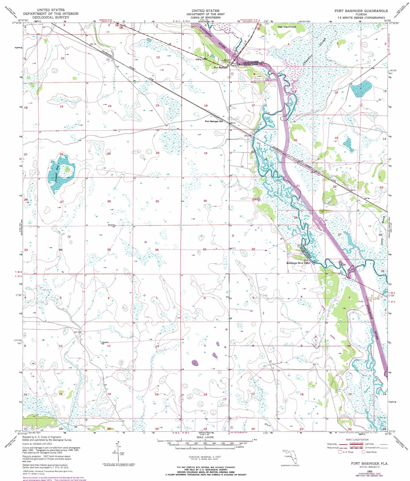
USGS Topo Quad 27081c1 - 1:24,000 scale
| Topo Map Name: | Fort Basinger |
| USGS Topo Quad ID: | 27081c1 |
| Print Size: | ca. 21 1/4" wide x 27" high |
| Southeast Coordinates: | 27.25° N latitude / 81° W longitude |
| Map Center Coordinates: | 27.3125° N latitude / 81.0625° W longitude |
| U.S. State: | FL |
| Filename: | O27081C1.jpg |
| Download Map JPG Image: | Fort Basinger topo map 1:24,000 scale |
| Map Type: | Topographic |
| Topo Series: | 7.5´ |
| Map Scale: | 1:24,000 |
| Source of Map Images: | United States Geological Survey (USGS) |
| Alternate Map Versions: |
Fort Basinger FL 1953, updated 1954 Download PDF Buy paper map Fort Basinger FL 1953, updated 1973 Download PDF Buy paper map Fort Basinger FL 2012 Download PDF Buy paper map Fort Basinger FL 2015 Download PDF Buy paper map |
1:24,000 Topo Quads surrounding Fort Basinger
Lake Arbuckle Se |
Fort Kissimmee |
Fort Kissimmee Se |
Fort Drum Sw |
Fort Drum |
Lorida |
Basinger Nw |
Basinger |
Taylor Creek Nw |
Taylor Creek Ne |
Lake Placid |
Basinger Sw |
Fort Basinger |
Taylor Creek Sw |
Taylor Creek Se |
Childs |
Brighton Nw |
Brighton |
Okeechobee Nw |
Okeechobee |
Venus |
Brighton Sw |
Brighton Se |
Okeechobee Sw |
Okeechobee Se |
> Back to 27081a1 at 1:100,000 scale
> Back to 27080a1 at 1:250,000 scale
> Back to U.S. Topo Maps home
Fort Basinger topo map: Gazetteer
Fort Basinger: Airports
River Acres Airport elevation 9m 29′Fort Basinger: Bays
Pitman Bay elevation 13m 42′Fort Basinger: Bridges
Pearce Bridge elevation 9m 29′Fort Basinger: Guts
Chandler Slough elevation 9m 29′Doughtry Cutoff elevation 7m 22′
Fort Basinger: Islands
Oak Hammock elevation 10m 32′Fort Basinger: Populated Places
Fort Basinger elevation 12m 39′Fort Basinger: Swamps
Long Cypress Slash elevation 7m 22′Fort Basinger digital topo map on disk
Buy this Fort Basinger topo map showing relief, roads, GPS coordinates and other geographical features, as a high-resolution digital map file on DVD: