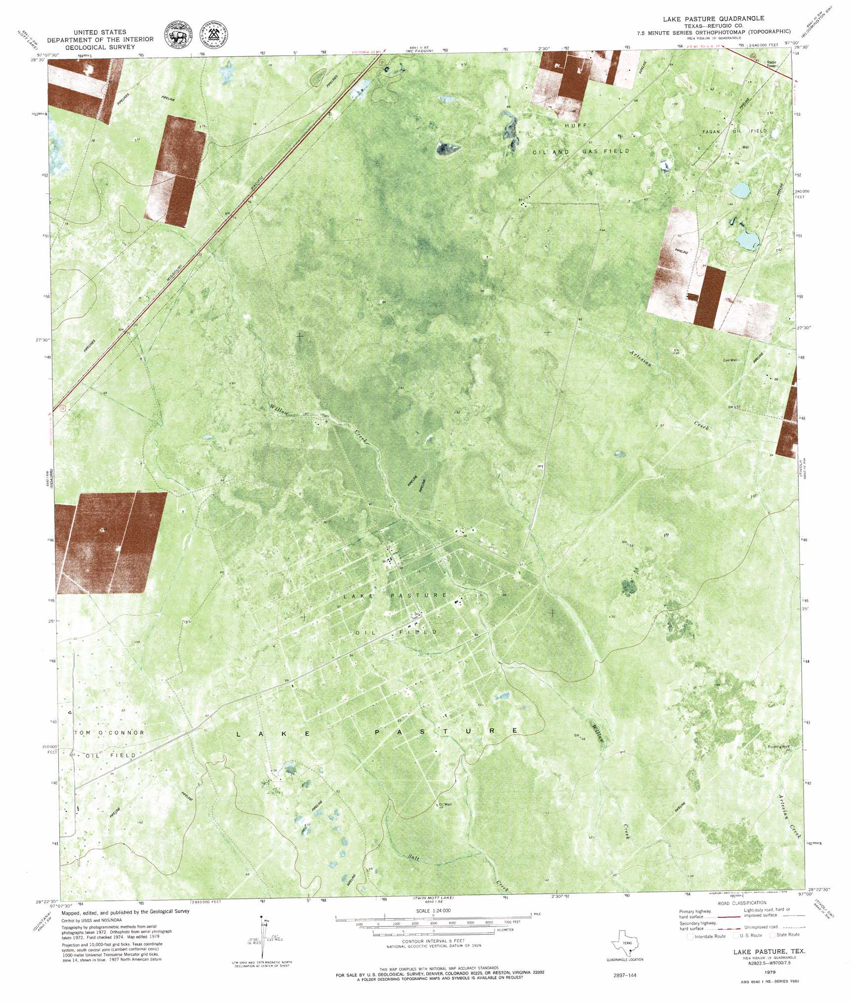
Lake Pasture Topo Map Texas
To zoom in, hover over the map of Lake Pasture
USGS Topo Quad 28097d1 - 1:24,000 scale
| Topo Map Name: | Lake Pasture |
| USGS Topo Quad ID: | 28097d1 |
| Print Size: | ca. 21 1/4" wide x 27" high |
| Southeast Coordinates: | 28.375° N latitude / 97° W longitude |
| Map Center Coordinates: | 28.4375° N latitude / 97.0625° W longitude |
| U.S. State: | TX |
| Filename: | o28097d1.jpg |
| Download Map JPG Image: | Lake Pasture topo map 1:24,000 scale |
| Map Type: | Topographic |
| Topo Series: | 7.5´ |
| Map Scale: | 1:24,000 |
| Source of Map Images: | United States Geological Survey (USGS) |
| Alternate Map Versions: |
Lake Pasture TX 1979, updated 1979 Download PDF Buy paper map Lake Pasture TX 2010 Download PDF Buy paper map Lake Pasture TX 2013 Download PDF Buy paper map Lake Pasture TX 2016 Download PDF Buy paper map |
1:24,000 Topo Quads surrounding Lake Pasture
Hensley Lake |
Fannin |
Raisin |
Bloomington |
Placedo |
Live Oak Lake |
Lott Lake |
Mcfaddin |
Bloomington Sw |
Green Lake |
Ryanville |
Vidaurri |
Lake Pasture |
Tivoli |
Austwell |
Refugio |
Quintana |
Twin Mott Lake |
Tivoli Sw |
Tivoli Se |
Woodsboro |
Mission Bay |
Lamar |
Saint Charles Bay |
Mesquite Bay |
> Back to 28097a1 at 1:100,000 scale
> Back to 28096a1 at 1:250,000 scale
> Back to U.S. Topo Maps home
Lake Pasture topo map: Gazetteer
Lake Pasture: Oilfields
Fagan Oil Field elevation 18m 59′Lake Pasture Oil Field elevation 17m 55′
Lake Pasture digital topo map on disk
Buy this Lake Pasture topo map showing relief, roads, GPS coordinates and other geographical features, as a high-resolution digital map file on DVD: