Pawnee Topo Map Texas
To zoom in, hover over the map of Pawnee
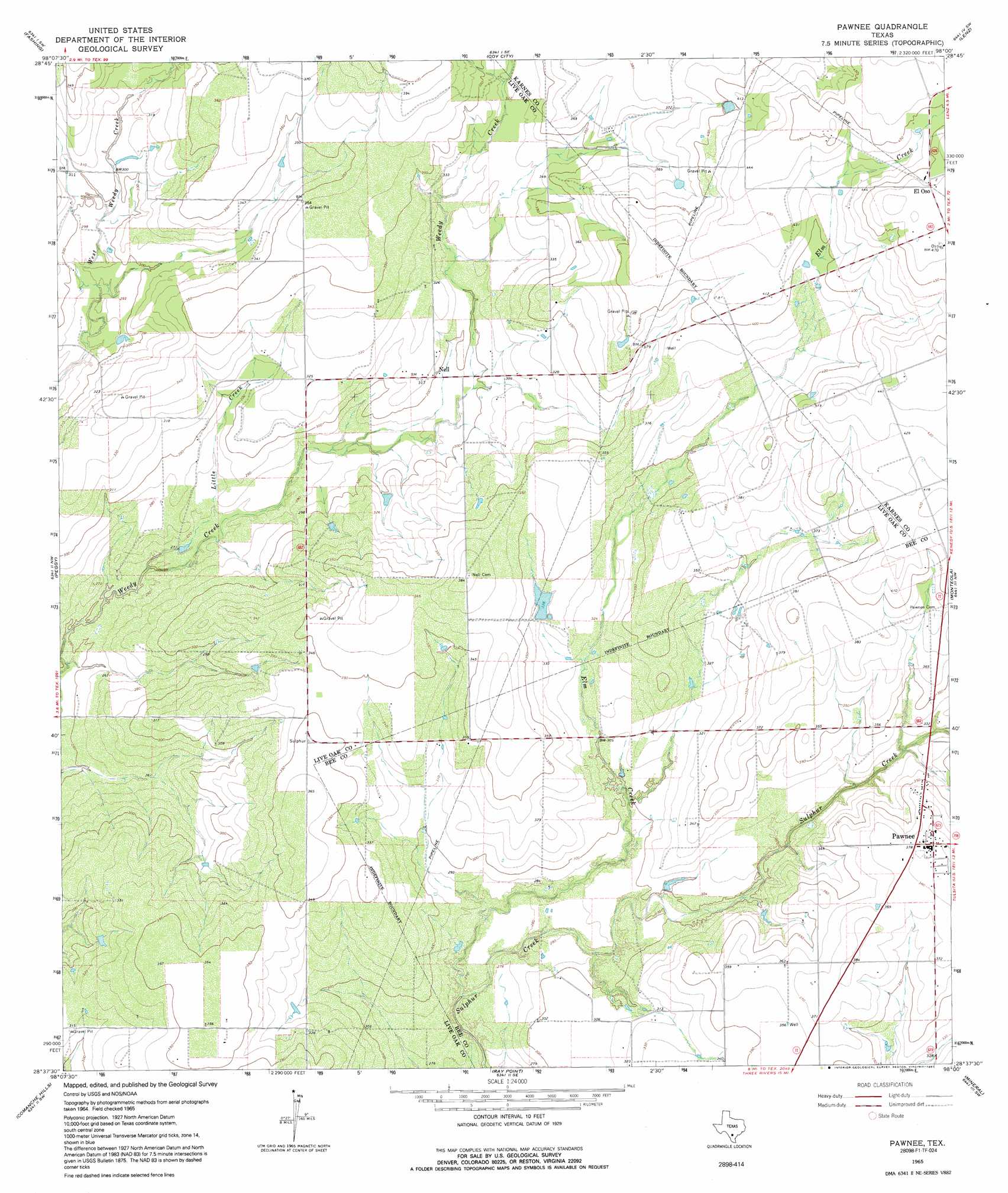
USGS Topo Quad 28098f1 - 1:24,000 scale
| Topo Map Name: | Pawnee |
| USGS Topo Quad ID: | 28098f1 |
| Print Size: | ca. 21 1/4" wide x 27" high |
| Southeast Coordinates: | 28.625° N latitude / 98° W longitude |
| Map Center Coordinates: | 28.6875° N latitude / 98.0625° W longitude |
| U.S. State: | TX |
| Filename: | o28098f1.jpg |
| Download Map JPG Image: | Pawnee topo map 1:24,000 scale |
| Map Type: | Topographic |
| Topo Series: | 7.5´ |
| Map Scale: | 1:24,000 |
| Source of Map Images: | United States Geological Survey (USGS) |
| Alternate Map Versions: |
Pawnee TX 1965, updated 1968 Download PDF Buy paper map Pawnee TX 1965, updated 1991 Download PDF Buy paper map Pawnee TX 2010 Download PDF Buy paper map Pawnee TX 2012 Download PDF Buy paper map Pawnee TX 2016 Download PDF Buy paper map |
1:24,000 Topo Quads surrounding Pawnee
Leal |
Three Oaks |
Falls City |
Karnes City |
Helena |
Mccoy |
Fashing |
Coy City |
Lenz |
Kenedy |
Whitsett |
Peggy |
Pawnee |
Monteola |
Tulsita |
Willow Hollow Tank |
Comanche Hills |
Ray Point |
Mineral |
Tuleta |
Calliham |
Three Rivers |
Oakville |
Cadiz |
Beeville West |
> Back to 28098e1 at 1:100,000 scale
> Back to 28098a1 at 1:250,000 scale
> Back to U.S. Topo Maps home
Pawnee topo map: Gazetteer
Pawnee: Dams
Arnold Lake Dam elevation 104m 341′Pawnee: Populated Places
El Oso elevation 139m 456′Nell elevation 91m 298′
Pawnee elevation 117m 383′
Pawnee: Reservoirs
Arnold Lake elevation 104m 341′Pawnee: Streams
Elm Creek elevation 78m 255′Little Creek elevation 76m 249′
Pawnee digital topo map on disk
Buy this Pawnee topo map showing relief, roads, GPS coordinates and other geographical features, as a high-resolution digital map file on DVD: