Sacatosa Tank Topo Map Texas
To zoom in, hover over the map of Sacatosa Tank
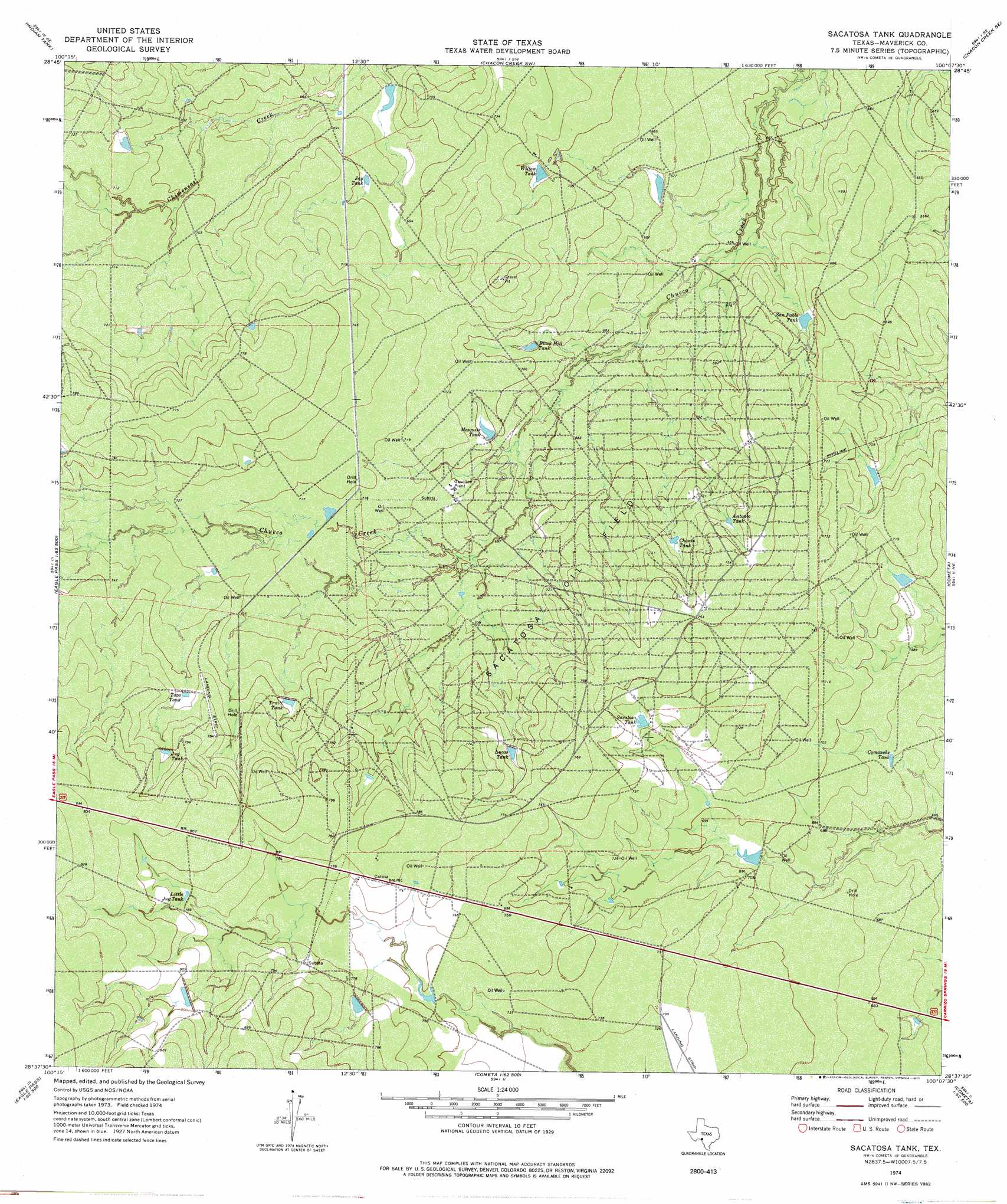
USGS Topo Quad 28100f2 - 1:24,000 scale
| Topo Map Name: | Sacatosa Tank |
| USGS Topo Quad ID: | 28100f2 |
| Print Size: | ca. 21 1/4" wide x 27" high |
| Southeast Coordinates: | 28.625° N latitude / 100.125° W longitude |
| Map Center Coordinates: | 28.6875° N latitude / 100.1875° W longitude |
| U.S. State: | TX |
| Filename: | o28100f2.jpg |
| Download Map JPG Image: | Sacatosa Tank topo map 1:24,000 scale |
| Map Type: | Topographic |
| Topo Series: | 7.5´ |
| Map Scale: | 1:24,000 |
| Source of Map Images: | United States Geological Survey (USGS) |
| Alternate Map Versions: |
Sacatosa Tank TX 1974, updated 1977 Download PDF Buy paper map Sacatosa Tank TX 2010 Download PDF Buy paper map Sacatosa Tank TX 2012 Download PDF Buy paper map Sacatosa Tank TX 2016 Download PDF Buy paper map |
1:24,000 Topo Quads surrounding Sacatosa Tank
Paloma |
Trosado Tank |
Chacon Creek Nw |
Chacon Creek Ne |
La Pryor Nw |
Deadmans Hill |
Indian Tank |
Chacon Creek Sw |
Chacon Creek Se |
Beef Hollow Creek |
Eagle Pass East |
Eagle Pass Ne |
Sacatosa Tank |
Cometa |
Carrizo Springs Nw |
Eagle Pass Sw |
El Indio |
Farias Ranch |
Cayetano Creek |
Carrizo Springs West |
Indio Creek |
Indio Tank |
Palo Blanco Tank |
Asherton Nw |
> Back to 28100e1 at 1:100,000 scale
> Back to 28100a1 at 1:250,000 scale
> Back to U.S. Topo Maps home
Sacatosa Tank topo map: Gazetteer
Sacatosa Tank: Airports
Farias Ranch Airport elevation 219m 718′Sacatosa Tank: Oilfields
Sacatosa Oil Field elevation 223m 731′Sacatosa Tank: Reservoirs
Antonio Tank elevation 224m 734′Black Hill Tank elevation 211m 692′
Chanto Tank elevation 218m 715′
Comanche Tank elevation 207m 679′
Jay Tank elevation 211m 692′
Jug Tank elevation 238m 780′
Little Jug Tank elevation 238m 780′
Lucas Tank elevation 227m 744′
Mesquite Tank elevation 213m 698′
Sacatosa Tank elevation 223m 731′
San Pablo Tank elevation 209m 685′
Taza Tank elevation 232m 761′
Truitt Tank elevation 229m 751′
Willow Tank elevation 215m 705′
Sacatosa Tank digital topo map on disk
Buy this Sacatosa Tank topo map showing relief, roads, GPS coordinates and other geographical features, as a high-resolution digital map file on DVD: