Dixie Topo Map Georgia
To zoom in, hover over the map of Dixie
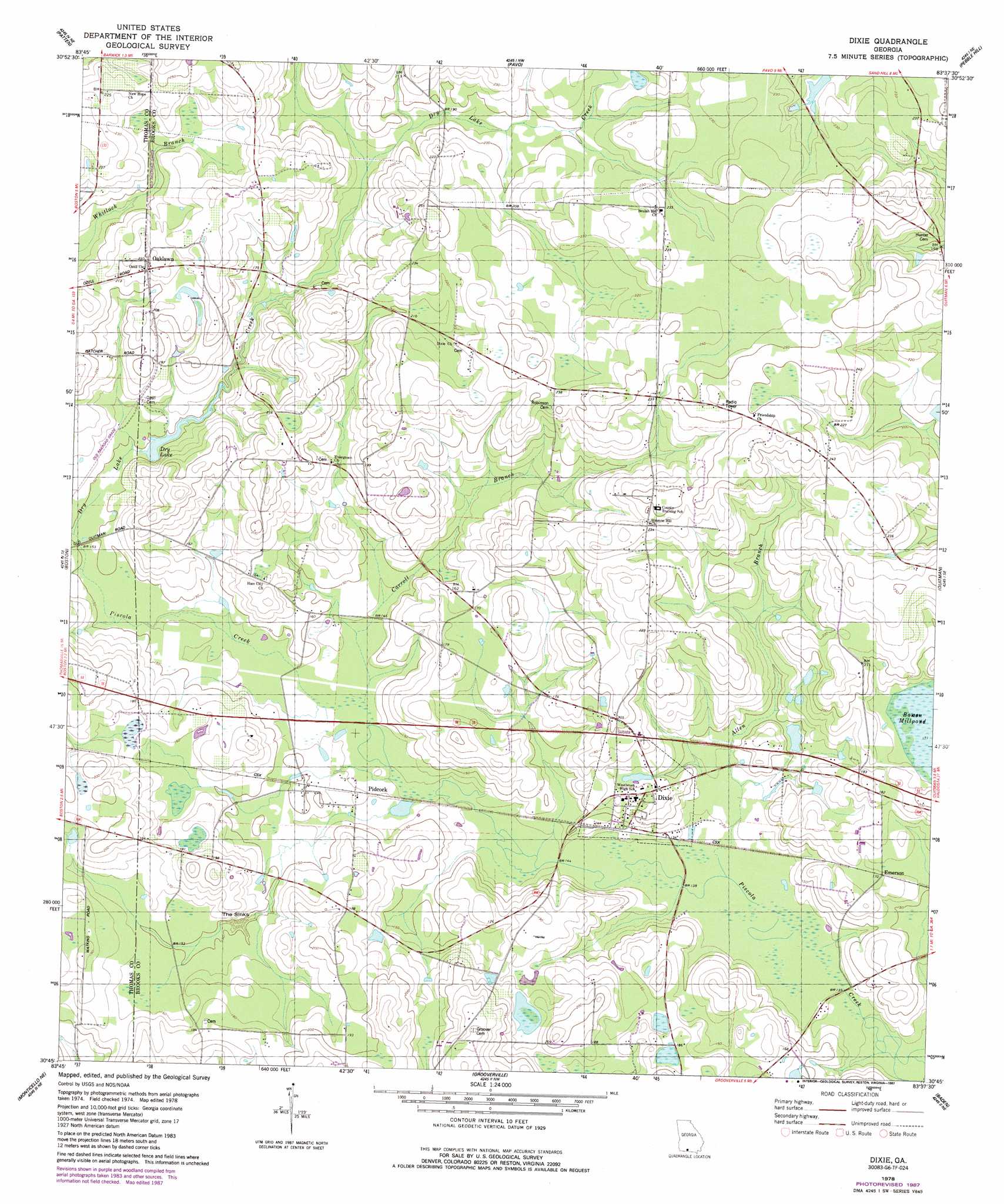
USGS Topo Quad 30083g6 - 1:24,000 scale
| Topo Map Name: | Dixie |
| USGS Topo Quad ID: | 30083g6 |
| Print Size: | ca. 21 1/4" wide x 27" high |
| Southeast Coordinates: | 30.75° N latitude / 83.625° W longitude |
| Map Center Coordinates: | 30.8125° N latitude / 83.6875° W longitude |
| U.S. State: | GA |
| Filename: | o30083g6.jpg |
| Download Map JPG Image: | Dixie topo map 1:24,000 scale |
| Map Type: | Topographic |
| Topo Series: | 7.5´ |
| Map Scale: | 1:24,000 |
| Source of Map Images: | United States Geological Survey (USGS) |
| Alternate Map Versions: |
Dixie GA 1978, updated 1978 Download PDF Buy paper map Dixie GA 1978, updated 1987 Download PDF Buy paper map Dixie GA 2011 Download PDF Buy paper map Dixie GA 2014 Download PDF Buy paper map |
1:24,000 Topo Quads surrounding Dixie
Chastain |
Coolidge |
Berlin West |
Berlin East |
Cecil |
Merrillville |
Patten |
Pavo |
Pebble Hill |
Hahira West |
Thomasville |
Boston |
Dixie |
Quitman |
Ousley |
Metcalf |
Monticello Ne |
Grooverville |
Baden |
Nankin |
Lake Miccosukee |
Monticello |
Ashville |
Hamburg |
Cherry Lake |
> Back to 30083e1 at 1:100,000 scale
> Back to 30082a1 at 1:250,000 scale
> Back to U.S. Topo Maps home
Dixie topo map: Gazetteer
Dixie: Basins
The Sinks elevation 37m 121′Dixie: Dams
Jackson Lake Dam elevation 52m 170′Dixie: Lakes
Dry Lake elevation 45m 147′Dixie: Populated Places
Dixie elevation 51m 167′Emerson elevation 49m 160′
Oaklawn elevation 70m 229′
Pidcock elevation 43m 141′
Dixie: Post Offices
Dixie Post Office elevation 42m 137′Dixie: Reservoirs
Jackson Lake elevation 52m 170′Dixie: Streams
Allen Branch elevation 39m 127′Carroll Branch elevation 42m 137′
Dry Lake Creek elevation 45m 147′
Dixie digital topo map on disk
Buy this Dixie topo map showing relief, roads, GPS coordinates and other geographical features, as a high-resolution digital map file on DVD: