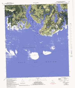
Sprague Island Topo Map Florida
To zoom in, hover over the map of Sprague Island
USGS Topo Quad 30084a2 - 1:24,000 scale
| Topo Map Name: | Sprague Island |
| USGS Topo Quad ID: | 30084a2 |
| Print Size: | ca. 21 1/4" wide x 27" high |
| Southeast Coordinates: | 30° N latitude / 84.125° W longitude |
| Map Center Coordinates: | 30.0625° N latitude / 84.1875° W longitude |
| U.S. State: | FL |
| Filename: | P30084A2.jpg |
| Download Map JPG Image: | Sprague Island topo map 1:24,000 scale |
| Map Type: | Orthophoto |
| Topo Series: | 7.5´ |
| Map Scale: | 1:24,000 |
| Source of Map Images: | United States Geological Survey (USGS) |
| Alternate Map Versions: |
Sprague Island FL 1954, updated 1956 Download PDF Buy paper map Sprague Island FL 1954, updated 1965 Download PDF Buy paper map Sprague Island FL 1954, updated 1980 Download PDF Buy paper map Sprague Island FL 1954, updated 1980 Download PDF Buy paper map Sprague Island FL 1982, updated 1984 Download PDF Buy paper map Sprague Island FL 1982, updated 1992 Download PDF Buy paper map Sprague Island FL 2012 Download PDF Buy paper map Sprague Island FL 2015 Download PDF Buy paper map |
1:24,000 Topo Quads surrounding Sprague Island
> Back to 30084a1 at 1:100,000 scale
> Back to 30084a1 at 1:250,000 scale
> Back to U.S. Topo Maps home
Sprague Island topo map: Gazetteer
Sprague Island: Bays
Big Cove elevation 0m 0′Johns Cove elevation 0m 0′
Kitchen Cove elevation 0m 0′
Little West Bayou elevation 0m 0′
Minnie Cove elevation 0m 0′
Register Bayou elevation 0m 0′
Sand Cove elevation 0m 0′
Steward Bayou elevation 1m 3′
Sprague Island: Capes
Four Mile Point elevation 0m 0′Indian Point elevation 0m 0′
Pelican Point elevation 0m 0′
Sprague Point elevation 0m 0′
Sprague Island: Channels
Big Pass elevation 0m 0′Boggy Bayou elevation 1m 3′
Haulover Creek elevation 0m 0′
Indian Pass elevation 1m 3′
Johns Creek elevation 1m 3′
Little Pass elevation 0m 0′
Stony Bayou elevation 0m 0′
Sprague Island: Flats
Bird Racks elevation 0m 0′Sprague Island: Islands
Big Pass Island elevation 1m 3′Gibbs Island elevation 1m 3′
Johns Island elevation 1m 3′
Little Pass Island elevation 0m 0′
Slough Island elevation 0m 0′
Sprague Island elevation 1m 3′
Sprague Island: Lakes
Gibbs Pond elevation 1m 3′Lighthouse Pool elevation 1m 3′
Mounds Pond elevation 1m 3′
Spectacle Pond elevation 1m 3′
Sprague Island: Parks
Saint Marks National Wildlife Refuge elevation 1m 3′Sprague Island: Reservoirs
Headquarters Pond elevation 0m 0′Mounds Pool elevation 1m 3′
Picnic Pond elevation 1m 3′
Stony Bayou Pool elevation 0m 0′
Sprague Island: Streams
Africa Bayou elevation 0m 0′Big West Bayou elevation 0m 0′
Denham Bayou elevation 0m 0′
East Goose Creek elevation 0m 0′
East River elevation 0m 0′
Flat Creek elevation 0m 0′
Four Mile Creek elevation 0m 0′
Graves Creek elevation 1m 3′
Horns Creek elevation 0m 0′
Little Denham Bayou elevation 0m 0′
Middle Creek elevation 0m 0′
Oliver Bayou elevation 1m 3′
Rock Creek elevation 0m 0′
Saint Marks River elevation 0m 0′
Shine Creek elevation 0m 0′
Sprague Island digital topo map on disk
Buy this Sprague Island topo map showing relief, roads, GPS coordinates and other geographical features, as a high-resolution digital map file on DVD:
Gulf Coast (LA, MS, AL, FL) & Southwestern Georgia
Buy digital topo maps: Gulf Coast (LA, MS, AL, FL) & Southwestern Georgia


