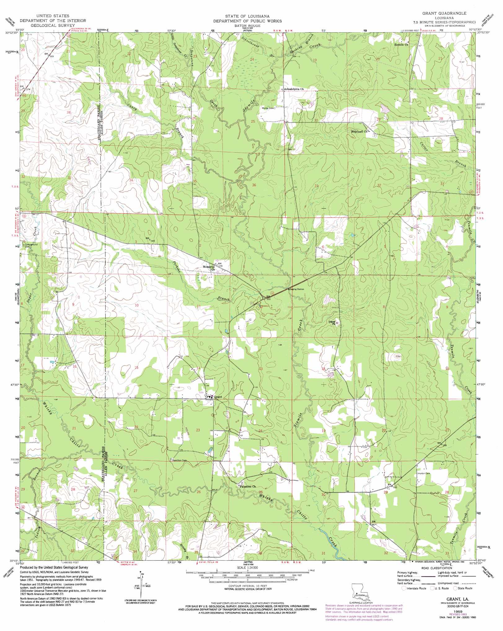
Grant Topo Map Louisiana
To zoom in, hover over the map of Grant
USGS Topo Quad 30092g8 - 1:24,000 scale
| Topo Map Name: | Grant |
| USGS Topo Quad ID: | 30092g8 |
| Print Size: | ca. 21 1/4" wide x 27" high |
| Southeast Coordinates: | 30.75° N latitude / 92.875° W longitude |
| Map Center Coordinates: | 30.8125° N latitude / 92.9375° W longitude |
| U.S. State: | LA |
| Filename: | o30092g8.jpg |
| Download Map JPG Image: | Grant topo map 1:24,000 scale |
| Map Type: | Topographic |
| Topo Series: | 7.5´ |
| Map Scale: | 1:24,000 |
| Source of Map Images: | United States Geological Survey (USGS) |
| Alternate Map Versions: |
Grant LA 1948, updated 1948 Download PDF Buy paper map Grant LA 1959, updated 1960 Download PDF Buy paper map Grant LA 1959, updated 1975 Download PDF Buy paper map Grant LA 1959, updated 1993 Download PDF Buy paper map Grant LA 2012 Download PDF Buy paper map Grant LA 2015 Download PDF Buy paper map |
1:24,000 Topo Quads surrounding Grant
Fort Polk |
Birds Creek |
Fullerton Lake |
Afeman |
Melder |
Hurricane Branch |
Sugrue |
Pitkin |
Steep Gully |
Pawnee |
Boneset Creek |
Sugartown |
Grant |
Elizabeth |
Oakdale |
Redhead Branch |
Dry Creek |
Mittie |
Pine Chapel |
Guy |
Longville |
Reeves |
Le Blanc |
Oberlin |
Soileau |
> Back to 30092e1 at 1:100,000 scale
> Back to 30092a1 at 1:250,000 scale
> Back to U.S. Topo Maps home
Grant topo map: Gazetteer
Grant: Populated Places
Grant elevation 38m 124′Reids elevation 44m 144′
Tenmile elevation 29m 95′
Grant: Post Offices
Grant Post Office elevation 39m 127′Grant: Streams
Caney Branch elevation 31m 101′Gaskins Branch elevation 34m 111′
Indian Branch elevation 29m 95′
Little Soapstone Creek elevation 35m 114′
Perkins Branch elevation 28m 91′
Schoolhouse Branch elevation 33m 108′
Sixmile Creek elevation 22m 72′
Soapstone Creek elevation 32m 104′
Sugar Creek elevation 31m 101′
Grant digital topo map on disk
Buy this Grant topo map showing relief, roads, GPS coordinates and other geographical features, as a high-resolution digital map file on DVD: