Pine Chapel Topo Map Louisiana
To zoom in, hover over the map of Pine Chapel
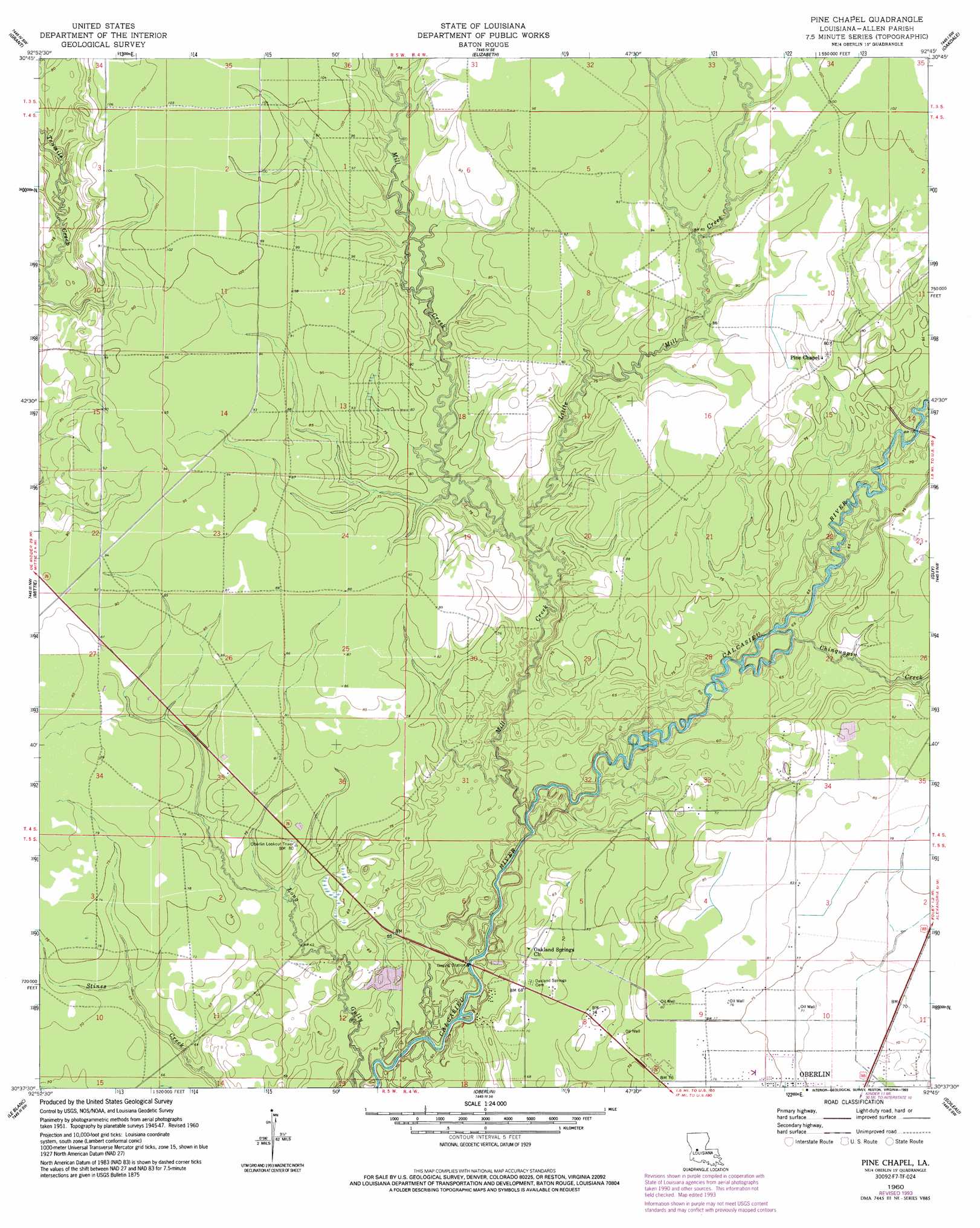
USGS Topo Quad 30092f7 - 1:24,000 scale
| Topo Map Name: | Pine Chapel |
| USGS Topo Quad ID: | 30092f7 |
| Print Size: | ca. 21 1/4" wide x 27" high |
| Southeast Coordinates: | 30.625° N latitude / 92.75° W longitude |
| Map Center Coordinates: | 30.6875° N latitude / 92.8125° W longitude |
| U.S. State: | LA |
| Filename: | o30092f7.jpg |
| Download Map JPG Image: | Pine Chapel topo map 1:24,000 scale |
| Map Type: | Topographic |
| Topo Series: | 7.5´ |
| Map Scale: | 1:24,000 |
| Source of Map Images: | United States Geological Survey (USGS) |
| Alternate Map Versions: |
Pine Chapel LA 1948, updated 1948 Download PDF Buy paper map Pine Chapel LA 1960, updated 1961 Download PDF Buy paper map Pine Chapel LA 1960, updated 1975 Download PDF Buy paper map Pine Chapel LA 1960, updated 1993 Download PDF Buy paper map Pine Chapel LA 2012 Download PDF Buy paper map Pine Chapel LA 2015 Download PDF Buy paper map |
1:24,000 Topo Quads surrounding Pine Chapel
Sugrue |
Pitkin |
Steep Gully |
Pawnee |
Glenmora |
Sugartown |
Grant |
Elizabeth |
Oakdale |
Beaver |
Dry Creek |
Mittie |
Pine Chapel |
Guy |
Bond |
Reeves |
Le Blanc |
Oberlin |
Soileau |
Duralde |
Topsy |
Indian Village |
Kinder |
Elton |
Basile |
> Back to 30092e1 at 1:100,000 scale
> Back to 30092a1 at 1:250,000 scale
> Back to U.S. Topo Maps home
Pine Chapel topo map: Gazetteer
Pine Chapel: Oilfields
East Mittie Gas Field elevation 27m 88′Northwest Oberlin Gas Field elevation 23m 75′
Pine Chapel: Streams
Chinquapin Creek elevation 19m 62′Little Mill Creek elevation 20m 65′
Mill Creek elevation 16m 52′
Pine Chapel digital topo map on disk
Buy this Pine Chapel topo map showing relief, roads, GPS coordinates and other geographical features, as a high-resolution digital map file on DVD: