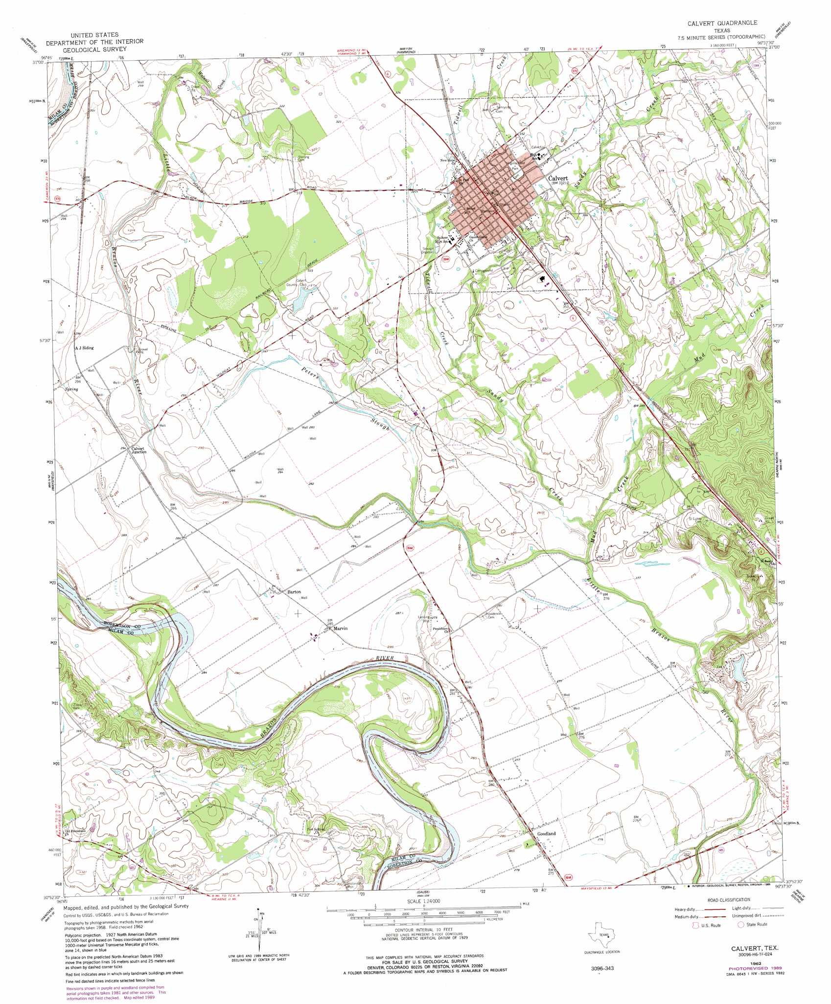
Calvert Topo Map Texas
To zoom in, hover over the map of Calvert
USGS Topo Quad 30096h6 - 1:24,000 scale
| Topo Map Name: | Calvert |
| USGS Topo Quad ID: | 30096h6 |
| Print Size: | ca. 21 1/4" wide x 27" high |
| Southeast Coordinates: | 30.875° N latitude / 96.625° W longitude |
| Map Center Coordinates: | 30.9375° N latitude / 96.6875° W longitude |
| U.S. State: | TX |
| Filename: | o30096h6.jpg |
| Download Map JPG Image: | Calvert topo map 1:24,000 scale |
| Map Type: | Topographic |
| Topo Series: | 7.5´ |
| Map Scale: | 1:24,000 |
| Source of Map Images: | United States Geological Survey (USGS) |
| Alternate Map Versions: |
Calvert TX 1962, updated 1964 Download PDF Buy paper map Calvert TX 1962, updated 1980 Download PDF Buy paper map Calvert TX 1962, updated 1989 Download PDF Buy paper map Calvert TX 2010 Download PDF Buy paper map Calvert TX 2013 Download PDF Buy paper map Calvert TX 2016 Download PDF Buy paper map |
1:24,000 Topo Quads surrounding Calvert
Cedar Springs |
Reagan |
Bremond |
Petteway |
Bald Prairie |
Rosebud |
Baileyville |
Hammond |
Owensville |
Franklin |
Ben Arnold |
Maysfield |
Calvert |
Hearne North |
Wheelock |
Cameron |
Hanover |
Gause |
Hearne South |
Dunn Creek |
Rockdale East |
Milano |
Goodwill |
Mumford |
Bryan West |
> Back to 30096e1 at 1:100,000 scale
> Back to 30096a1 at 1:250,000 scale
> Back to U.S. Topo Maps home
Calvert topo map: Gazetteer
Calvert: Airports
Putz Aero Incorporated Airport elevation 85m 278′Calvert: Guts
Peters Slough elevation 85m 278′Calvert: Parks
Virginia Field Park elevation 109m 357′Calvert: Populated Places
Barton elevation 87m 285′Calvert elevation 100m 328′
Calvert Junction elevation 89m 291′
Goodland elevation 85m 278′
Marvin elevation 87m 285′
Port Sullivan (historical) elevation 101m 331′
Calvert: Streams
Mud Creek elevation 82m 269′Sandy Creek elevation 83m 272′
Tidwell Creek elevation 88m 288′
Walnut Creek elevation 85m 278′
Calvert digital topo map on disk
Buy this Calvert topo map showing relief, roads, GPS coordinates and other geographical features, as a high-resolution digital map file on DVD: