Cave Creek School Topo Map Texas
To zoom in, hover over the map of Cave Creek School
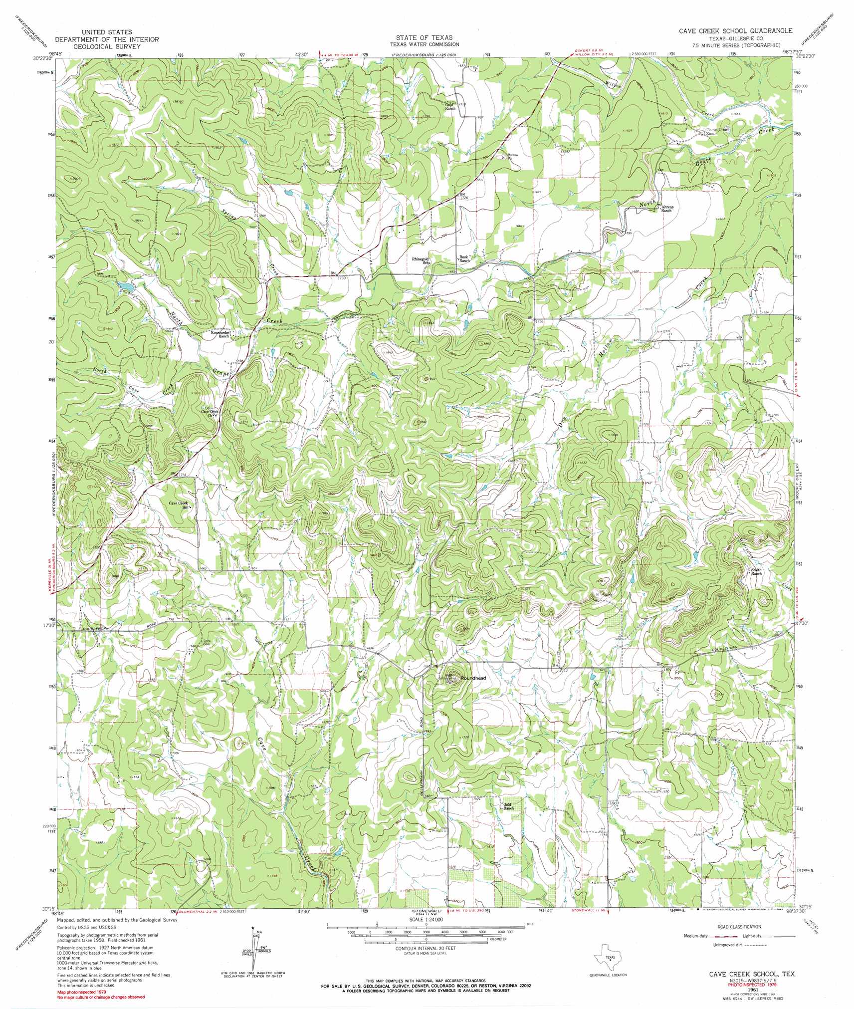
USGS Topo Quad 30098c6 - 1:24,000 scale
| Topo Map Name: | Cave Creek School |
| USGS Topo Quad ID: | 30098c6 |
| Print Size: | ca. 21 1/4" wide x 27" high |
| Southeast Coordinates: | 30.25° N latitude / 98.625° W longitude |
| Map Center Coordinates: | 30.3125° N latitude / 98.6875° W longitude |
| U.S. State: | TX |
| Filename: | o30098c6.jpg |
| Download Map JPG Image: | Cave Creek School topo map 1:24,000 scale |
| Map Type: | Topographic |
| Topo Series: | 7.5´ |
| Map Scale: | 1:24,000 |
| Source of Map Images: | United States Geological Survey (USGS) |
| Alternate Map Versions: |
Cave Creek School TX 1961, updated 1962 Download PDF Buy paper map Cave Creek School TX 1961, updated 1964 Download PDF Buy paper map Cave Creek School TX 1961, updated 1991 Download PDF Buy paper map Cave Creek School TX 2010 Download PDF Buy paper map Cave Creek School TX 2012 Download PDF Buy paper map Cave Creek School TX 2016 Download PDF Buy paper map |
1:24,000 Topo Quads surrounding Cave Creek School
House Mountain |
Enchanted Rock |
Oxford |
Click |
Dunman Mountain |
Cherry Mountain |
Crabapple |
Willow City |
Blowout |
Howell Mountain |
Fredericksburg West |
Fredericksburg East |
Cave Creek School |
Rocky Creek |
Johnson City |
Oak Crest Park |
Cain City |
Stonewall |
Hye |
Monument Hill |
Cypress Creek |
Rafter Hollow |
Whitworth Ranch |
Crabapple Creek |
Blanco |
> Back to 30098a1 at 1:100,000 scale
> Back to 30098a1 at 1:250,000 scale
> Back to U.S. Topo Maps home
Cave Creek School topo map: Gazetteer
Cave Creek School: Streams
North Cave Creek elevation 537m 1761′Spring Creek elevation 519m 1702′
Willow Creek elevation 469m 1538′
Cave Creek School: Summits
Roundhead elevation 551m 1807′Cave Creek School digital topo map on disk
Buy this Cave Creek School topo map showing relief, roads, GPS coordinates and other geographical features, as a high-resolution digital map file on DVD: