Indian Mesa Se Topo Map Texas
To zoom in, hover over the map of Indian Mesa Se
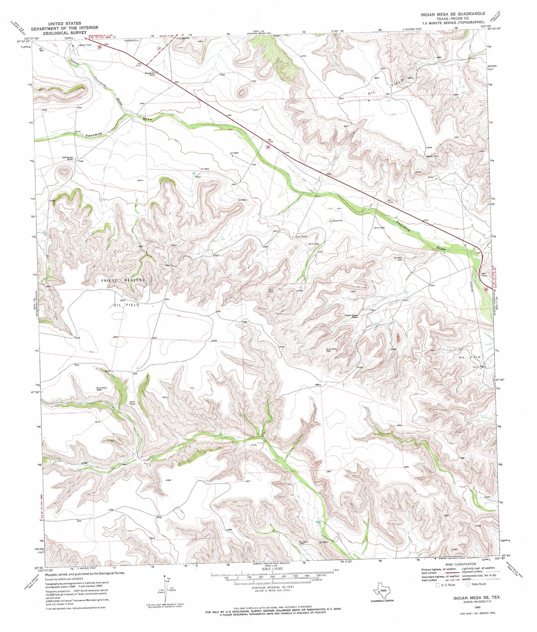
USGS Topo Quad 30102g1 - 1:24,000 scale
| Topo Map Name: | Indian Mesa Se |
| USGS Topo Quad ID: | 30102g1 |
| Print Size: | ca. 21 1/4" wide x 27" high |
| Southeast Coordinates: | 30.75° N latitude / 102° W longitude |
| Map Center Coordinates: | 30.8125° N latitude / 102.0625° W longitude |
| U.S. State: | TX |
| Filename: | o30102g1.jpg |
| Download Map JPG Image: | Indian Mesa Se topo map 1:24,000 scale |
| Map Type: | Topographic |
| Topo Series: | 7.5´ |
| Map Scale: | 1:24,000 |
| Source of Map Images: | United States Geological Survey (USGS) |
| Alternate Map Versions: |
Indian Mesa SE TX 1969, updated 1973 Download PDF Buy paper map Indian Mesa SE TX 2010 Download PDF Buy paper map Indian Mesa SE TX 2012 Download PDF Buy paper map Indian Mesa SE TX 2016 Download PDF Buy paper map |
1:24,000 Topo Quads surrounding Indian Mesa Se
Girvin Se |
Mccamey South |
Table Top Mountain |
Cedar Canyon |
Rankin Se |
Bakersfield |
Indian Mesa |
Indian Mesa Ne |
Iraan |
Twelvemile Camp |
Sherbino Mesa |
Sherbino Ranch |
Indian Mesa Se |
Divide Country |
Deer Canyon |
Hackberry Draw Ne |
Hat-A Ranch |
Smokey Mountain Ranch |
Sheffield Nw |
Sheffield |
Hackberry Draw Se |
Seventeen Ranch |
Mitchell Draw |
Horsehead Canyon |
Sheffield Se |
> Back to 30102e1 at 1:100,000 scale
> Back to 30102a1 at 1:250,000 scale
> Back to U.S. Topo Maps home
Indian Mesa Se topo map: Gazetteer
Indian Mesa Se: Oilfields
Priest Beavers Oil Field elevation 921m 3021′Indian Mesa Se: Valleys
Upper Fourmile Draw elevation 791m 2595′Indian Mesa Se digital topo map on disk
Buy this Indian Mesa Se topo map showing relief, roads, GPS coordinates and other geographical features, as a high-resolution digital map file on DVD: