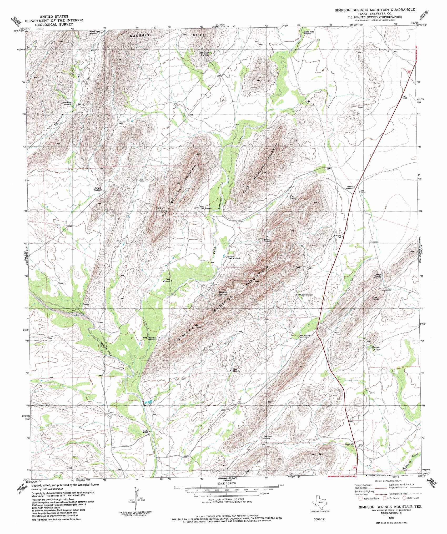
Simpson Springs Mountain Topo Map Texas
To zoom in, hover over the map of Simpson Springs Mountain
USGS Topo Quad 30103a3 - 1:24,000 scale
| Topo Map Name: | Simpson Springs Mountain |
| USGS Topo Quad ID: | 30103a3 |
| Print Size: | ca. 21 1/4" wide x 27" high |
| Southeast Coordinates: | 30° N latitude / 103.25° W longitude |
| Map Center Coordinates: | 30.0625° N latitude / 103.3125° W longitude |
| U.S. State: | TX |
| Filename: | o30103a3.jpg |
| Download Map JPG Image: | Simpson Springs Mountain topo map 1:24,000 scale |
| Map Type: | Topographic |
| Topo Series: | 7.5´ |
| Map Scale: | 1:24,000 |
| Source of Map Images: | United States Geological Survey (USGS) |
| Alternate Map Versions: |
Simpson Springs Mountain TX 1983, updated 1984 Download PDF Buy paper map Simpson Springs Mountain TX 2010 Download PDF Buy paper map Simpson Springs Mountain TX 2012 Download PDF Buy paper map Simpson Springs Mountain TX 2016 Download PDF Buy paper map |
1:24,000 Topo Quads surrounding Simpson Springs Mountain
Bird Mountain |
Altuda |
Gilliland Peak |
Leonard Mountain |
Wolf Camp Hills |
Mount Ord |
Dugout Mountain |
Beckwith Hills |
Marathon |
Lightening Hills |
Elephant Mountain |
Rock House Gap |
Simpson Springs Mountain |
Pena Blanca Mountains |
Horse Mountain |
Whirlwind Spring |
Paso Del Norte |
Maravillas Gap |
Heart Mountain |
Hood Spring |
Buck Hill |
Santiago Peak |
Ye Mesa |
Sosa Peak |
Hood Spring Se |
> Back to 30103a1 at 1:100,000 scale
> Back to 30102a1 at 1:250,000 scale
> Back to U.S. Topo Maps home
Simpson Springs Mountain topo map: Gazetteer
Simpson Springs Mountain: Springs
Garden Springs elevation 1120m 3674′Mud Spring elevation 1161m 3809′
Ridge Spring elevation 1168m 3832′
Simpson Springs elevation 1163m 3815′
Sunshine Springs elevation 1217m 3992′
Simpson Springs Mountain: Streams
Peña Colorado Creek elevation 1081m 3546′Simpson Springs Mountain: Summits
East Bourland Mountain elevation 1347m 4419′Simpson Springs Mountain elevation 1401m 4596′
West Bourland Mountain elevation 1282m 4206′
Simpson Springs Mountain digital topo map on disk
Buy this Simpson Springs Mountain topo map showing relief, roads, GPS coordinates and other geographical features, as a high-resolution digital map file on DVD: