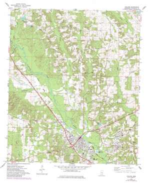
Collins Topo Map Mississippi
To zoom in, hover over the map of Collins
USGS Topo Quad 31089f5 - 1:24,000 scale
| Topo Map Name: | Collins |
| USGS Topo Quad ID: | 31089f5 |
| Print Size: | ca. 21 1/4" wide x 27" high |
| Southeast Coordinates: | 31.625° N latitude / 89.5° W longitude |
| Map Center Coordinates: | 31.6875° N latitude / 89.5625° W longitude |
| U.S. State: | MS |
| Filename: | o31089f5.jpg |
| Download Map JPG Image: | Collins topo map 1:24,000 scale |
| Map Type: | Topographic |
| Topo Series: | 7.5´ |
| Map Scale: | 1:24,000 |
| Source of Map Images: | United States Geological Survey (USGS) |
| Alternate Map Versions: |
Collins MS 1974, updated 1978 Download PDF Buy paper map Collins MS 1974, updated 1982 Download PDF Buy paper map Collins MS 1974, updated 1982 Download PDF Buy paper map Collins MS 2012 Download PDF Buy paper map Collins MS 2015 Download PDF Buy paper map |
1:24,000 Topo Quads surrounding Collins
> Back to 31089e1 at 1:100,000 scale
> Back to 31088a1 at 1:250,000 scale
> Back to U.S. Topo Maps home
Collins topo map: Gazetteer
Collins: Airports
Collins Jaycee Airport elevation 83m 272′Collins: Dams
Collins Sewage Lagoon Dam elevation 82m 269′Coulters Pond Dam elevation 90m 295′
Gibson Lake Dam elevation 95m 311′
Legion Lake Dam elevation 105m 344′
Collins: Parks
Robertson Park elevation 94m 308′Collins: Populated Places
Blakley Creek elevation 138m 452′Collins elevation 89m 291′
Kola elevation 80m 262′
Mish elevation 92m 301′
Ora elevation 91m 298′
Providence elevation 125m 410′
Salem elevation 128m 419′
Vennie Park elevation 93m 305′
Collins: Reservoirs
Chain Lake elevation 105m 344′Gibson Lake elevation 96m 314′
Legion Lake elevation 101m 331′
Collins: Streams
Blakely Creek elevation 87m 285′Burtons Creek elevation 87m 285′
Rogers Creek elevation 81m 265′
Shelby Creek elevation 91m 298′
Tanner Branch elevation 91m 298′
Collins: Swamps
Ora Swamp elevation 86m 282′Collins digital topo map on disk
Buy this Collins topo map showing relief, roads, GPS coordinates and other geographical features, as a high-resolution digital map file on DVD:
Gulf Coast (LA, MS, AL, FL) & Southwestern Georgia
Buy digital topo maps: Gulf Coast (LA, MS, AL, FL) & Southwestern Georgia


