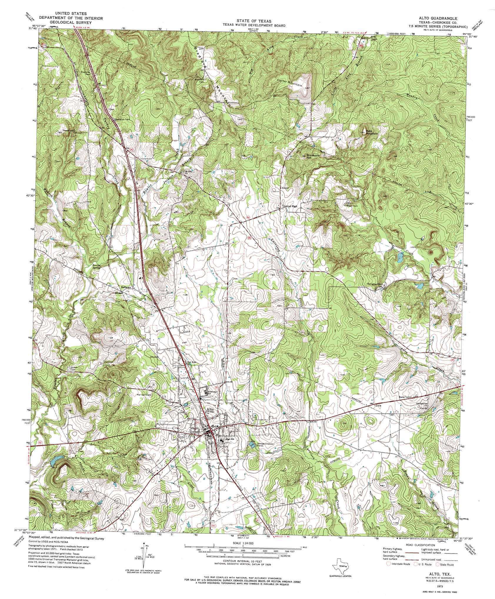
Alto Topo Map Texas
To zoom in, hover over the map of Alto
USGS Topo Quad 31095f1 - 1:24,000 scale
| Topo Map Name: | Alto |
| USGS Topo Quad ID: | 31095f1 |
| Print Size: | ca. 21 1/4" wide x 27" high |
| Southeast Coordinates: | 31.625° N latitude / 95° W longitude |
| Map Center Coordinates: | 31.6875° N latitude / 95.0625° W longitude |
| U.S. State: | TX |
| Filename: | o31095f1.jpg |
| Download Map JPG Image: | Alto topo map 1:24,000 scale |
| Map Type: | Topographic |
| Topo Series: | 7.5´ |
| Map Scale: | 1:24,000 |
| Source of Map Images: | United States Geological Survey (USGS) |
| Alternate Map Versions: |
Alto TX 1973, updated 1976 Download PDF Buy paper map Alto TX 2010 Download PDF Buy paper map Alto TX 2013 Download PDF Buy paper map Alto TX 2016 Download PDF Buy paper map |
1:24,000 Topo Quads surrounding Alto
Jacksonville West |
Jacksonville East |
New Summerfield |
New Salem |
Laneville |
Maydelle |
Rusk |
Atoy |
Reklaw |
Cushing |
Denson Springs |
Pryor Mountain |
Alto |
Douglas |
Lake Nacogdoches North |
Augusta |
Weches |
Forest |
Durst Lakes |
Lake Nacogdoches South |
Crockett Ne |
Ratcliff |
Kennard Ne |
Wells |
Clawson |
> Back to 31095e1 at 1:100,000 scale
> Back to 31094a1 at 1:250,000 scale
> Back to U.S. Topo Maps home
Alto topo map: Gazetteer
Alto: Populated Places
Alto elevation 133m 436′Central High elevation 163m 534′
Redlawn elevation 119m 390′
Alto: Springs
Bowles Spring elevation 104m 341′Alto: Streams
Alto Branch elevation 103m 337′Big Atoy Creek elevation 101m 331′
Jackson Branch elevation 109m 357′
Little Atoy Creek elevation 101m 331′
Turkey Creek elevation 97m 318′
Alto: Summits
Bald Mountain elevation 174m 570′Carter Mountain elevation 196m 643′
Graveyard Hill elevation 159m 521′
Alto digital topo map on disk
Buy this Alto topo map showing relief, roads, GPS coordinates and other geographical features, as a high-resolution digital map file on DVD: