Crockett Ne Topo Map Texas
To zoom in, hover over the map of Crockett Ne
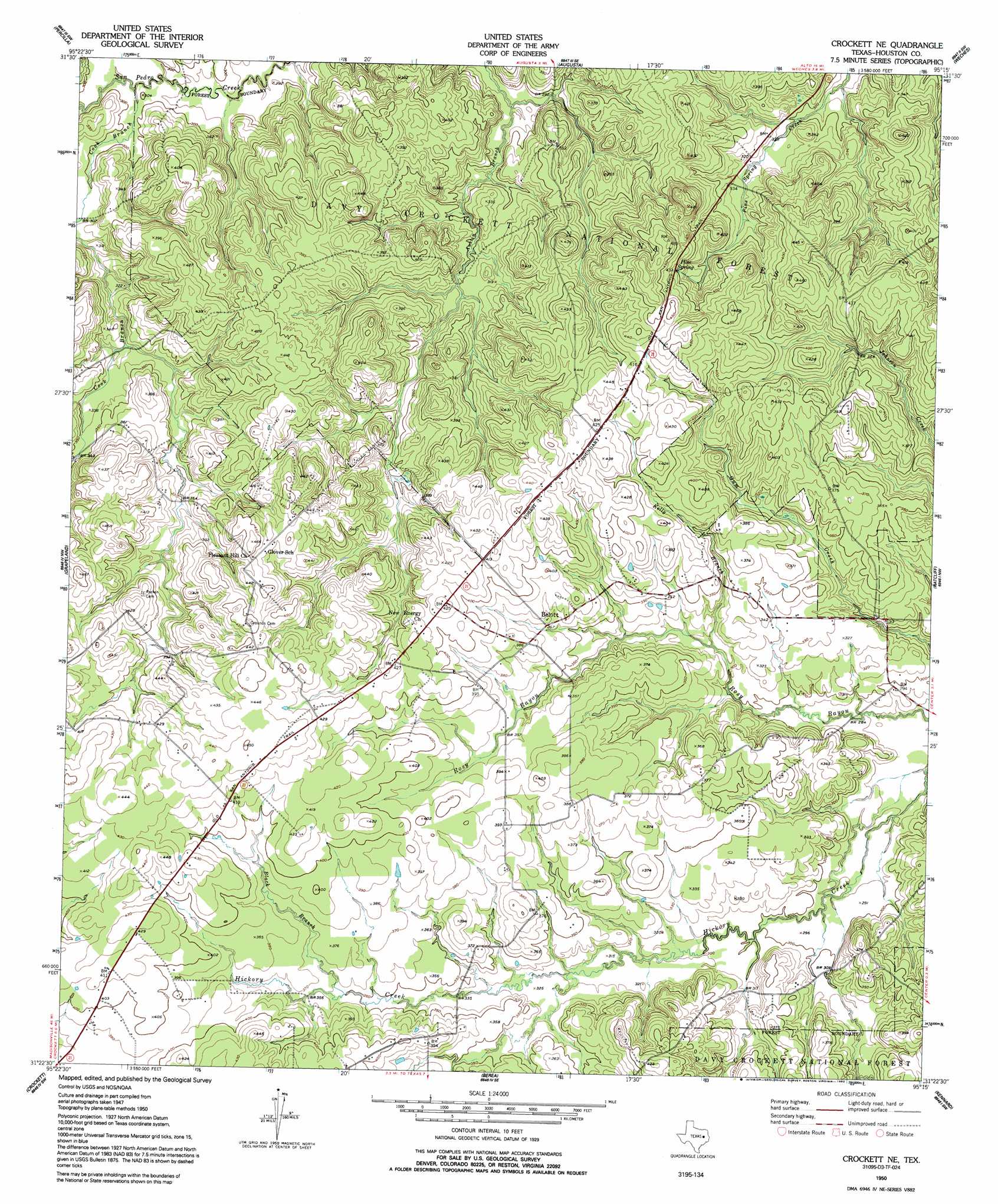
USGS Topo Quad 31095d3 - 1:24,000 scale
| Topo Map Name: | Crockett Ne |
| USGS Topo Quad ID: | 31095d3 |
| Print Size: | ca. 21 1/4" wide x 27" high |
| Southeast Coordinates: | 31.375° N latitude / 95.25° W longitude |
| Map Center Coordinates: | 31.4375° N latitude / 95.3125° W longitude |
| U.S. State: | TX |
| Filename: | o31095d3.jpg |
| Download Map JPG Image: | Crockett Ne topo map 1:24,000 scale |
| Map Type: | Topographic |
| Topo Series: | 7.5´ |
| Map Scale: | 1:24,000 |
| Source of Map Images: | United States Geological Survey (USGS) |
| Alternate Map Versions: |
Crockett NE TX 1950, updated 1967 Download PDF Buy paper map Crockett NE TX 1950, updated 1992 Download PDF Buy paper map Crockett NE TX 1951 Download PDF Buy paper map Crockett NE TX 2004, updated 2006 Download PDF Buy paper map Crockett NE TX 2010 Download PDF Buy paper map Crockett NE TX 2013 Download PDF Buy paper map Crockett NE TX 2016 Download PDF Buy paper map |
| FStopo: | US Forest Service topo Crockett NE is available: Download FStopo PDF Download FStopo TIF |
1:24,000 Topo Quads surrounding Crockett Ne
Southeast Palestine |
Slocum |
Denson Springs |
Pryor Mountain |
Alto |
Elkhart Creek |
Percilla |
Augusta |
Weches |
Forest |
Hays Spring |
Grapeland |
Crockett Ne |
Ratcliff |
Kennard Ne |
Porter Springs |
Crockett |
Berea |
Kennard |
Centralia |
Pearsons Chapel |
Lovelady North |
Fodice |
Pennington |
Crecy |
> Back to 31095a1 at 1:100,000 scale
> Back to 31094a1 at 1:250,000 scale
> Back to U.S. Topo Maps home
Crockett Ne topo map: Gazetteer
Crockett Ne: Airports
Dibrell Airport elevation 114m 374′Last Resort Airport elevation 129m 423′
Crockett Ne: Dams
Broxson Lake Dam elevation 124m 406′Crockett Ne: Populated Places
Belott elevation 111m 364′Germany elevation 133m 436′
Hickory Creek elevation 120m 393′
Crockett Ne: Post Offices
Belott Post Office elevation 122m 400′Crockett Ne: Reservoirs
Broxson Lake elevation 124m 406′Crockett Ne: Springs
Ferrell Branch Spring elevation 112m 367′Pine Spring elevation 125m 410′
Crockett Ne: Streams
Black Branch elevation 107m 351′Caney Creek elevation 88m 288′
Cook Branch elevation 88m 288′
Hayman Creek elevation 91m 298′
Kelly Branch elevation 88m 288′
Crockett Ne digital topo map on disk
Buy this Crockett Ne topo map showing relief, roads, GPS coordinates and other geographical features, as a high-resolution digital map file on DVD: