Denson Springs Topo Map Texas
To zoom in, hover over the map of Denson Springs
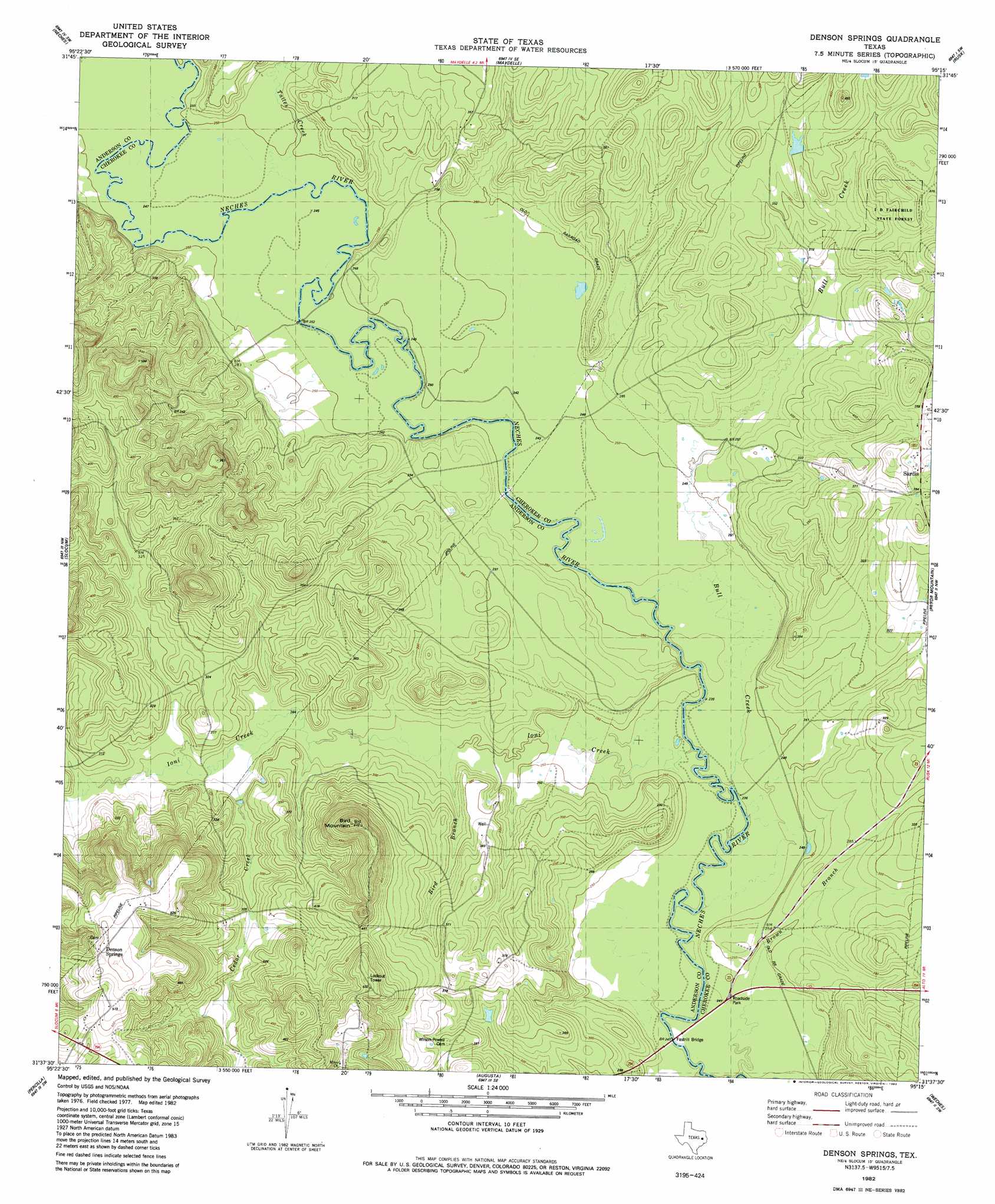
USGS Topo Quad 31095f3 - 1:24,000 scale
| Topo Map Name: | Denson Springs |
| USGS Topo Quad ID: | 31095f3 |
| Print Size: | ca. 21 1/4" wide x 27" high |
| Southeast Coordinates: | 31.625° N latitude / 95.25° W longitude |
| Map Center Coordinates: | 31.6875° N latitude / 95.3125° W longitude |
| U.S. State: | TX |
| Filename: | o31095f3.jpg |
| Download Map JPG Image: | Denson Springs topo map 1:24,000 scale |
| Map Type: | Topographic |
| Topo Series: | 7.5´ |
| Map Scale: | 1:24,000 |
| Source of Map Images: | United States Geological Survey (USGS) |
| Alternate Map Versions: |
Denson Springs TX 1982, updated 1982 Download PDF Buy paper map Denson Springs TX 2010 Download PDF Buy paper map Denson Springs TX 2013 Download PDF Buy paper map Denson Springs TX 2016 Download PDF Buy paper map |
1:24,000 Topo Quads surrounding Denson Springs
Pert |
Todd City |
Jacksonville West |
Jacksonville East |
New Summerfield |
Northeast Palestine |
Neches |
Maydelle |
Rusk |
Atoy |
Southeast Palestine |
Slocum |
Denson Springs |
Pryor Mountain |
Alto |
Elkhart Creek |
Percilla |
Augusta |
Weches |
Forest |
Hays Spring |
Grapeland |
Crockett Ne |
Ratcliff |
Kennard Ne |
> Back to 31095e1 at 1:100,000 scale
> Back to 31094a1 at 1:250,000 scale
> Back to U.S. Topo Maps home
Denson Springs topo map: Gazetteer
Denson Springs: Bridges
Fastrill Bridge elevation 71m 232′Denson Springs: Streams
Bird Branch elevation 76m 249′Bull Creek elevation 70m 229′
Caney Creek elevation 71m 232′
Cedar Creek elevation 80m 262′
Ioni Creek elevation 70m 229′
Tailes Creek elevation 75m 246′
Denson Springs digital topo map on disk
Buy this Denson Springs topo map showing relief, roads, GPS coordinates and other geographical features, as a high-resolution digital map file on DVD: