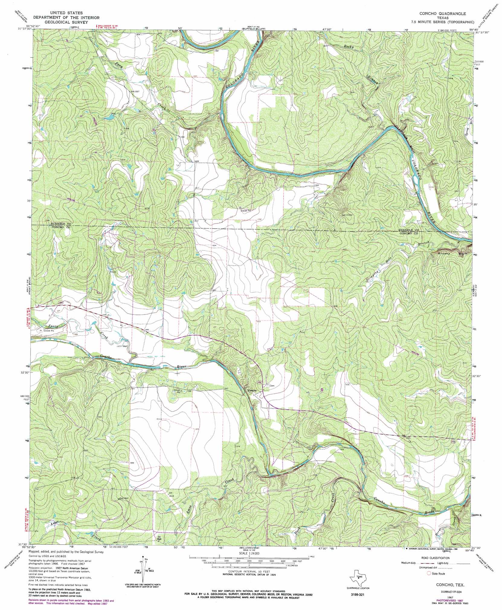
Concho Topo Map Texas
To zoom in, hover over the map of Concho
USGS Topo Quad 31099e7 - 1:24,000 scale
| Topo Map Name: | Concho |
| USGS Topo Quad ID: | 31099e7 |
| Print Size: | ca. 21 1/4" wide x 27" high |
| Southeast Coordinates: | 31.5° N latitude / 99.75° W longitude |
| Map Center Coordinates: | 31.5625° N latitude / 99.8125° W longitude |
| U.S. State: | TX |
| Filename: | o31099e7.jpg |
| Download Map JPG Image: | Concho topo map 1:24,000 scale |
| Map Type: | Topographic |
| Topo Series: | 7.5´ |
| Map Scale: | 1:24,000 |
| Source of Map Images: | United States Geological Survey (USGS) |
| Alternate Map Versions: |
Concho TX 1967, updated 1969 Download PDF Buy paper map Concho TX 1967, updated 1970 Download PDF Buy paper map Concho TX 1967, updated 1988 Download PDF Buy paper map Concho TX 2010 Download PDF Buy paper map Concho TX 2013 Download PDF Buy paper map Concho TX 2016 Download PDF Buy paper map |
1:24,000 Topo Quads surrounding Concho
Herring Ranch |
Hatchel |
Benoit |
Talpa |
Valera |
Rowena |
Ballinger |
Buffalo Bluff |
Little Grape Creek |
Bead Mountain |
Lowake |
Paint Rock |
Concho |
Leaday |
Voss |
Eola |
Millersview Nw |
Millersview |
Mustang Creek |
Doole |
Vick |
Millersview Sw |
Millersview Se |
Doole Sw |
Salt Gap |
> Back to 31099e1 at 1:100,000 scale
> Back to 31098a1 at 1:250,000 scale
> Back to U.S. Topo Maps home
Concho topo map: Gazetteer
Concho: Cliffs
Deadmans Bluff elevation 479m 1571′Concho: Populated Places
Concho elevation 486m 1594′Concho: Streams
Amos Creek elevation 464m 1522′Dripping Hole Branch elevation 457m 1499′
Duck Creek elevation 461m 1512′
Fuzzy Creek elevation 473m 1551′
Horse Creek elevation 458m 1502′
Pony Creek elevation 468m 1535′
Rocky Branch elevation 460m 1509′
Concho digital topo map on disk
Buy this Concho topo map showing relief, roads, GPS coordinates and other geographical features, as a high-resolution digital map file on DVD: