Dome Peak Topo Map Texas
To zoom in, hover over the map of Dome Peak
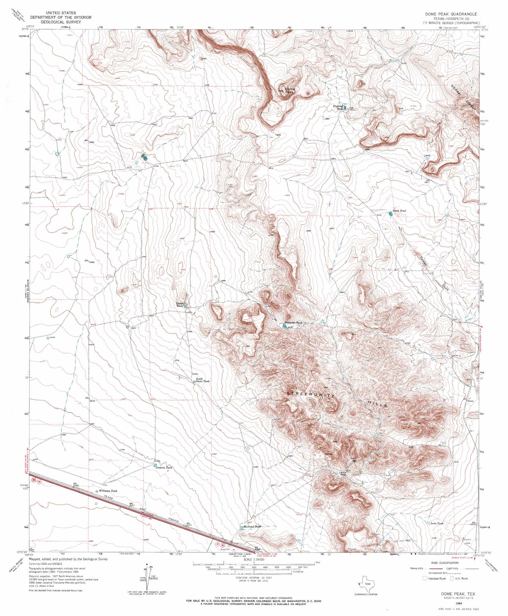
USGS Topo Quad 31105b2 - 1:24,000 scale
| Topo Map Name: | Dome Peak |
| USGS Topo Quad ID: | 31105b2 |
| Print Size: | ca. 21 1/4" wide x 27" high |
| Southeast Coordinates: | 31.125° N latitude / 105.125° W longitude |
| Map Center Coordinates: | 31.1875° N latitude / 105.1875° W longitude |
| U.S. State: | TX |
| Filename: | o31105b2.jpg |
| Download Map JPG Image: | Dome Peak topo map 1:24,000 scale |
| Map Type: | Topographic |
| Topo Series: | 7.5´ |
| Map Scale: | 1:24,000 |
| Source of Map Images: | United States Geological Survey (USGS) |
| Alternate Map Versions: |
Dome Peak TX 1964, updated 1967 Download PDF Buy paper map Dome Peak TX 2010 Download PDF Buy paper map Dome Peak TX 2013 Download PDF Buy paper map Dome Peak TX 2016 Download PDF Buy paper map |
1:24,000 Topo Quads surrounding Dome Peak
Gunsight Hills North |
Black Hills |
Norton Mesa |
Sneed Mountain Ne |
Apache Peak |
Gunsight Hills South |
Pierce Ranch |
Movie Mountain |
Sneed Mountain |
Collier Mesa |
Lasca |
Sierra Blanca |
Dome Peak |
Bean Hills |
Sheep Peak |
Sierra Blanca Sw |
Devil Ridge |
Grayton Lake |
Allamoore |
Hackett Peak |
Schroder Arroyo |
Cedar Arroyo |
Eagle Mountains Nw |
Eagle Mountains Ne |
Bass Canyon |
> Back to 31105a1 at 1:100,000 scale
> Back to 31104a1 at 1:250,000 scale
> Back to U.S. Topo Maps home
Dome Peak topo map: Gazetteer
Dome Peak: Reservoirs
Davis Tank elevation 1403m 4603′England Pond elevation 1497m 4911′
Jenkins Tank elevation 1340m 4396′
Lena Tank elevation 1397m 4583′
Railroad Tank elevation 1352m 4435′
South Davis Tank elevation 1373m 4504′
South Pond elevation 1455m 4773′
Williams Tank elevation 1461m 4793′
Williams Tank elevation 1329m 4360′
Dome Peak: Summits
Dome Peak elevation 1660m 5446′Streeruwitz Hills elevation 1517m 4977′
Dome Peak digital topo map on disk
Buy this Dome Peak topo map showing relief, roads, GPS coordinates and other geographical features, as a high-resolution digital map file on DVD: